Property Record
201 Miramar Dr, Augusta, GA 30907
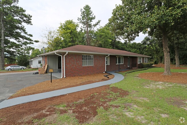

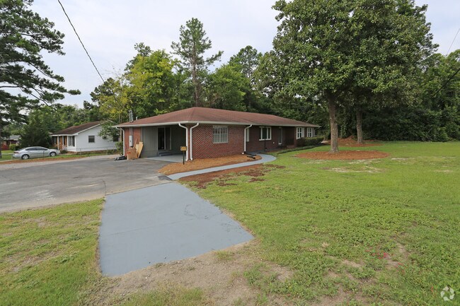

Property Detail
201 Miramar Dr
078C063
BLK A LOT 1; CASA LINDA
Officebuilding
COLUMBIA
P-1;PROFES
Georgia
B and X Area of moderate flood hazard, usually the area between the limits of the 100-year and 500-year floods.
1
2025
0.41 AC
2025
Evans/Martinez
030202
Augusta/Richmond County
1,761 SF
Augusta-Richmond County, GA-SC
NEARBY LISTINGS FOR SALE OR LEASE
DEMOGRAPHICS near 201 Miramar Dr
1 mile
3 mile
5 mile
2025 Total Population
6,761
62,928
137,079
2030 Population
7,075
64,463
140,348
Pop Growth 2025-2030
+ 4.64%
+ 2.44%
+ 2.38%
Average Age
40
41
40
2025 Total Households
2,712
26,625
56,592
HH Growth 2025-2030
+ 4.65%
+ 2.20%
+ 2.10%
Median Household Inc
$68,979
$73,141
$79,526
Avg Household Size
2.50
2.30
2.30
2025 Avg HH Vehicles
2.00
2.00
2.00
Median Home Value
$212,500
$255,853
$287,039
Median Year Built
1979
1988
1989
Nearby Places
Map Layers
Map Styles
 Street
 Aerial
Transit
 Traffic
 Biking
Places
Listings with unknown addresses are not visible on the map
- Restaurants
- Banks
- Shops
- Fitness
- Groceries
SALE & LEASE HISTORY
LISTING DATE
SALE/LEASE

Sep 23, 2016
For Sale
Oct 05, 2016
For Sale
Mar 16, 2017
For Sale
Aug 07, 2017
For Lease
Nearby Properties
Address
Land Use
TOTAL SIZE
Lot Size
Zoning
Address
Land Use
TOTAL SIZE
Lot Size
Zoning
371,617 SF
13.26 AC
B-2
Address
Land Use
TOTAL SIZE
Lot Size
Zoning
4,357 SF
34 AC
R-3B
Address
Land Use
TOTAL SIZE
Lot Size
Zoning
7,216 SF
53.27 AC
B-1 SPEX
Address
Land Use
TOTAL SIZE
Lot Size
Zoning
5,541 SF
14.81 AC
B-2
Address
Land Use
TOTAL SIZE
Lot Size
Zoning
4,077 SF
20.88 AC
C-2;GEN CO
Address
Land Use
TOTAL SIZE
Lot Size
Zoning
5,480 SF
19.05 AC
R-3B
Address
Land Use
TOTAL SIZE
Lot Size
Zoning
7,749 SF
17.02 AC
R2
Address
Land Use
TOTAL SIZE
Lot Size
Zoning
57,341 SF
54.33 AC
Address
Land Use
TOTAL SIZE
Lot Size
Zoning
3,680 SF
13.42 AC
B-2
Address
Land Use
TOTAL SIZE
Lot Size
Zoning
92,482 SF
14.77 AC
Address
Land Use
TOTAL SIZE
Lot Size
Zoning
3,498 SF
12.61 AC
B-2
Address
Land Use
TOTAL SIZE
Lot Size
Zoning
392 SF
19.66 AC
Address
Land Use
TOTAL SIZE
Lot Size
Zoning
4,800 SF
19.81 AC
B-2
Address
Land Use
TOTAL SIZE
Lot Size
Zoning
61,236 SF
8.09 AC
R-3B
Address
Land Use
TOTAL SIZE
Lot Size
Zoning
952 SF
29 AC
A
Address
Land Use
TOTAL SIZE
Lot Size
Zoning
53,653 SF
11.26 AC
Address
Land Use
TOTAL SIZE
Lot Size
Zoning
3,829 SF
35.30 AC
R-3B
Address
Land Use
TOTAL SIZE
Lot Size
Zoning
2,508 SF
14.61 AC
A-R;APARTM
Address
Land Use
TOTAL SIZE
Lot Size
Zoning
150,807 SF
16.91 AC
R-1A SPEX
Address
Land Use
TOTAL SIZE
Lot Size
Zoning
199,464 SF
45.19 AC
Address
Land Use
TOTAL SIZE
Lot Size
Zoning
61,473 SF
PUD
Address
Land Use
TOTAL SIZE
Lot Size
Zoning
997 SF
19.16 AC
Address
Land Use
TOTAL SIZE
Lot Size
Zoning
4,108 SF
14.12 AC
B-2
Address
Land Use
TOTAL SIZE
Lot Size
Zoning
6,000 SF
Address
Land Use
TOTAL SIZE
Lot Size
Zoning
640 SF
12.17 AC
B-1
Address
Land Use
TOTAL SIZE
Lot Size
Zoning
8,640 SF
13.15 AC
R-3B
Address
Land Use
TOTAL SIZE
Lot Size
Zoning
150,263 SF
18.75 AC
PUD
Address
Land Use
TOTAL SIZE
Lot Size
Zoning
112,947 SF
14.91 AC
Address
Land Use
TOTAL SIZE
Lot Size
Zoning
72,381 SF
0.95 AC
Address
Land Use
TOTAL SIZE
Lot Size
Zoning
42,617 SF
40.26 AC
R-1_B-1
The World's #1 Commercial Real Estate Marketplace
Connect with us
© 2026 CoStar Group
The information above has been obtained from sources believed reliable. While we do not doubt its accuracy we have not verified it and make no guarantee, warranty or representation about it. It is your responsibility to independently confirm its accuracy and completeness. Any projections, opinions, assumptions, or estimates used are for example only and do not represent the current or future performance of the property. The value of this transaction to you depends on tax and other factors which should be evaluated by your tax, financial, and legal advisors. You and your advisors should conduct a careful, independent investigation of the property to determine to your satisfaction the suitability of the property for your needs.