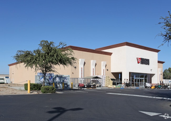
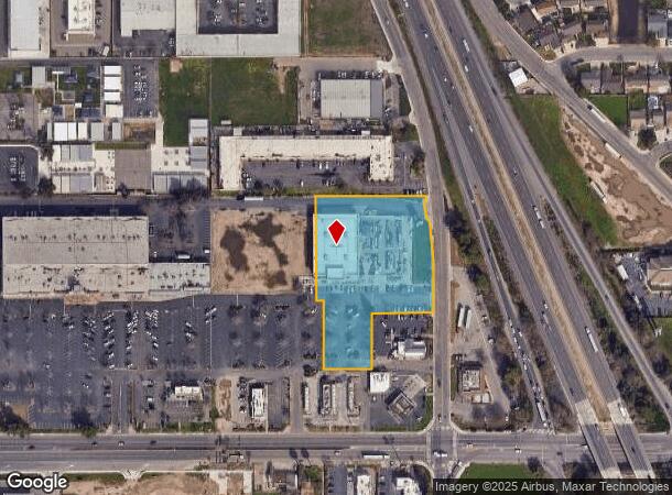
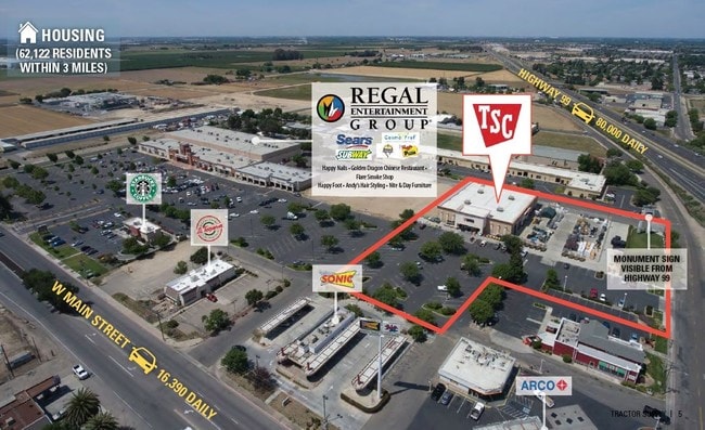
Property Record
201 N Walnut Rd, Turlock, CA 95380
NEARBY LISTINGS FOR SALE OR LEASE
Property Detail
201 N Walnut Rd
089-14-43
Stanislaus
Storemultistory
California
X
3
06047C0175G
2.97 AC
2025
Turlock/SW Stanislaus
2025
Stockton/Modesto
003603
Modesto, CA
21,679 SF
DEMOGRAPHICS near 201 N Walnut Rd
1 Mile
3 Mile
5 Mile
2024 Total Population
8,042
68,637
88,577
2029 Population
8,014
68,816
88,700
Pop Growth 2024-2029
(0.35%)
+ 0.26%
+ 0.14%
Average Age
36
37
37
2024 Total Households
2,509
22,919
29,216
HH Growth 2024-2029
(0.40%)
+ 0.33%
+ 0.20%
Median Household Inc
$58,933
$69,882
$73,538
Avg Household Size
3.10
2.90
2.90
2024 Avg HH Vehicles
2.00
2.00
2.00
Median Home Value
$291,666
$386,601
$417,780
Median Year Built
1982
1981
1982
Nearby Places
Map Layers
Map Styles
 Street
 Aerial
- Restaurants
- Banks
- Shops
- Fitness
- Groceries
PUBLIC TRANSPORTATION
COMMUTER RAIL
DRIVE
WALK
Distance
12 min
6.6 mi
AIRPORT
Stockton Metro
DRIVE
WALK
Distance
Stockton Metro
48 min
37.7 mi
SALE & LEASE HISTORY
LISTING DATE
SALE/LEASE

Jul 18, 2017
For Sale
Nearby Properties
Address
Land Use
TOTAL SIZE
Lot Size
Zoning
Address
Land Use
TOTAL SIZE
Lot Size
Zoning
147,933 SF
20.70 AC
TURI
Address
Land Use
TOTAL SIZE
Lot Size
Zoning
1,079,300 SF
68.99 AC
TURIBP
Address
Land Use
TOTAL SIZE
Lot Size
Zoning
199,306 SF
84.95 AC
TURI
Address
Land Use
TOTAL SIZE
Lot Size
Zoning
673,401 SF
39.91 AC
M2
Address
Land Use
TOTAL SIZE
Lot Size
Zoning
281,904 SF
17.84 AC
Address
Land Use
TOTAL SIZE
Lot Size
Zoning
335,582 SF
18.06 AC
Address
Land Use
TOTAL SIZE
Lot Size
Zoning
172,492 SF
14.98 AC
Address
Land Use
TOTAL SIZE
Lot Size
Zoning
99,146 SF
28.47 AC
TURI
Address
Land Use
TOTAL SIZE
Lot Size
Zoning
557,040 SF
22.54 AC
TURI
Address
Land Use
TOTAL SIZE
Lot Size
Zoning
224,984 SF
9.63 AC
R3
Address
Land Use
TOTAL SIZE
Lot Size
Zoning
349,309 SF
21.87 AC
Address
Land Use
TOTAL SIZE
Lot Size
Zoning
128,000 SF
6.48 AC
Address
Land Use
TOTAL SIZE
Lot Size
Zoning
144,172 SF
15.75 AC
TURCT
Address
Land Use
TOTAL SIZE
Lot Size
Zoning
264,573 SF
9.47 AC
TURPD
Address
Land Use
TOTAL SIZE
Lot Size
Zoning
75.21 AC
Address
Land Use
TOTAL SIZE
Lot Size
Zoning
144,510 SF
12.04 AC
Address
Land Use
TOTAL SIZE
Lot Size
Zoning
244,740 SF
18.90 AC
Address
Land Use
TOTAL SIZE
Lot Size
Zoning
70,569 SF
10 AC
Address
Land Use
TOTAL SIZE
Lot Size
Zoning
111,617 SF
10.10 AC
Address
Land Use
TOTAL SIZE
Lot Size
Zoning
67,176 SF
4.48 AC
Address
Land Use
TOTAL SIZE
Lot Size
Zoning
81,953 SF
5 AC
M2
Address
Land Use
TOTAL SIZE
Lot Size
Zoning
149,310 SF
8.45 AC
Address
Land Use
TOTAL SIZE
Lot Size
Zoning
185,088 SF
9.08 AC
PD21
Address
Land Use
TOTAL SIZE
Lot Size
Zoning
302,449 SF
17.57 AC
Address
Land Use
TOTAL SIZE
Lot Size
Zoning
103,011 SF
7.90 AC
Address
Land Use
TOTAL SIZE
Lot Size
Zoning
112,779 SF
7.35 AC
TURCC
Address
Land Use
TOTAL SIZE
Lot Size
Zoning
52,304 SF
5.10 AC
Address
Land Use
TOTAL SIZE
Lot Size
Zoning
88,787 SF
4.88 AC
TURCH
Address
Land Use
TOTAL SIZE
Lot Size
Zoning
68,015 SF
4.45 AC
CO
Address
Land Use
TOTAL SIZE
Lot Size
Zoning
55,955 SF
3.76 AC
TURRL
The World's #1 Commercial Real Estate Marketplace
Connect with us
© 2026 CoStar Group
The information above has been obtained from sources believed reliable. While we do not doubt its accuracy we have not verified it and make no guarantee, warranty or representation about it. It is your responsibility to independently confirm its accuracy and completeness. Any projections, opinions, assumptions, or estimates used are for example only and do not represent the current or future performance of the property. The value of this transaction to you depends on tax and other factors which should be evaluated by your tax, financial, and legal advisors. You and your advisors should conduct a careful, independent investigation of the property to determine to your satisfaction the suitability of the property for your needs.