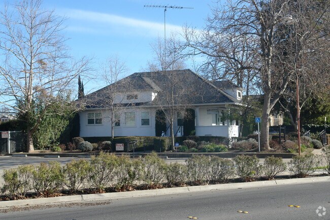
Property Record
201 Walnut St, Roseville, CA 95678


NEARBY LISTINGS FOR SALE OR LEASE
-
-
-
-
-
-
-
-
-
-
-
-
Freedom Point SEQ Washington Blvd & Blue Oaks Blvd
Roseville, CA 95678
$1,354,900 - $8,511,900
3,188 - 20,028 SF
Office
-
View all Roseville listings for sale on LoopNet.com
Property Detail
201 Walnut St
Sacramento--Roseville--Arden-Arcade, CA
Brookcliff Addn
013-074-015
FR LOTS 1 19 BROOKCLIFF ADDN
Officebuilding
Placer
X
California
06061C0944H
1
2024
0.33 AC
2025
Roseville/Rocklin
021003
Sacramento
1,198 SF
DEMOGRAPHICS near 201 Walnut St
1 Mile
3 Mile
5 Mile
2024 Total Population
11,787
108,301
293,141
2029 Population
12,575
114,930
307,754
Pop Growth 2024-2029
+ 6.69%
+ 6.12%
+ 4.98%
Average Age
40
40
41
2024 Total Households
4,831
41,825
108,920
HH Growth 2024-2029
+ 6.79%
+ 6.24%
+ 5.08%
Median Household Inc
$69,420
$90,881
$96,622
Avg Household Size
2.30
2.50
2.60
2024 Avg HH Vehicles
2.00
2.00
2.00
Median Home Value
$395,399
$512,126
$549,365
Median Year Built
1964
1986
1990
Nearby Places
Map Layers
Map Styles
 Street
 Aerial
- Restaurants
- Banks
- Shops
- Fitness
- Groceries
PUBLIC TRANSPORTATION
COMMUTER RAIL
DRIVE
WALK
Distance
3 min
9 min
0.4 mi
DRIVE
WALK
Distance
8 min
4.2 mi
AIRPORT
Sacramento International
DRIVE
WALK
Distance
Sacramento International
35 min
25.3 mi
SALE & LEASE HISTORY
LISTING DATE
SALE/LEASE

Mar 12, 2018
For Sale
Nearby Properties
Address
Land Use
TOTAL SIZE
Lot Size
Zoning
Address
Land Use
TOTAL SIZE
Lot Size
Zoning
1,444,630 SF
53.20 AC
Address
Land Use
TOTAL SIZE
Lot Size
Zoning
678,494 SF
15.80 AC
Address
Land Use
TOTAL SIZE
Lot Size
Zoning
350,573 SF
26.30 AC
Address
Land Use
TOTAL SIZE
Lot Size
Zoning
638,040 SF
38.70 AC
Address
Land Use
TOTAL SIZE
Lot Size
Zoning
277,602 SF
26.49 AC
Address
Land Use
TOTAL SIZE
Lot Size
Zoning
210,380 SF
14.26 AC
Address
Land Use
TOTAL SIZE
Lot Size
Zoning
280,129 SF
14.90 AC
Address
Land Use
TOTAL SIZE
Lot Size
Zoning
325,462 SF
29.50 AC
Address
Land Use
TOTAL SIZE
Lot Size
Zoning
328,416 SF
17.80 AC
Address
Land Use
TOTAL SIZE
Lot Size
Zoning
105,730 SF
7.20 AC
Address
Land Use
TOTAL SIZE
Lot Size
Zoning
174,840 SF
19.70 AC
Address
Land Use
TOTAL SIZE
Lot Size
Zoning
144,760 SF
26.70 AC
Address
Land Use
TOTAL SIZE
Lot Size
Zoning
222,702 SF
10.57 AC
Address
Land Use
TOTAL SIZE
Lot Size
Zoning
401,175 SF
19.80 AC
Address
Land Use
TOTAL SIZE
Lot Size
Zoning
223,623 SF
12.70 AC
Address
Land Use
TOTAL SIZE
Lot Size
Zoning
132,784 SF
9.80 AC
Address
Land Use
TOTAL SIZE
Lot Size
Zoning
233,228 SF
12.10 AC
Address
Land Use
TOTAL SIZE
Lot Size
Zoning
28,798 SF
12.52 AC
Address
Land Use
TOTAL SIZE
Lot Size
Zoning
288,628 SF
11.90 AC
Address
Land Use
TOTAL SIZE
Lot Size
Zoning
143,809 SF
14.40 AC
Address
Land Use
TOTAL SIZE
Lot Size
Zoning
263,682 SF
14.40 AC
Address
Land Use
TOTAL SIZE
Lot Size
Zoning
120,983 SF
17.60 AC
Address
Land Use
TOTAL SIZE
Lot Size
Zoning
718,131 SF
42 AC
Address
Land Use
TOTAL SIZE
Lot Size
Zoning
310,720 SF
16.90 AC
Address
Land Use
TOTAL SIZE
Lot Size
Zoning
121,000 SF
17.20 AC
Address
Land Use
TOTAL SIZE
Lot Size
Zoning
188,500 SF
20.30 AC
Address
Land Use
TOTAL SIZE
Lot Size
Zoning
222,453 SF
27.60 AC
Address
Land Use
TOTAL SIZE
Lot Size
Zoning
78,730 SF
8.03 AC
RD20 BP
Address
Land Use
TOTAL SIZE
Lot Size
Zoning
198,824 SF
29.66 AC
Address
Land Use
TOTAL SIZE
Lot Size
Zoning
82,661 SF
7.50 AC
The World's #1 Commercial Real Estate Marketplace
Connect with us
© 2026 CoStar Group
The information above has been obtained from sources believed reliable. While we do not doubt its accuracy we have not verified it and make no guarantee, warranty or representation about it. It is your responsibility to independently confirm its accuracy and completeness. Any projections, opinions, assumptions, or estimates used are for example only and do not represent the current or future performance of the property. The value of this transaction to you depends on tax and other factors which should be evaluated by your tax, financial, and legal advisors. You and your advisors should conduct a careful, independent investigation of the property to determine to your satisfaction the suitability of the property for your needs.