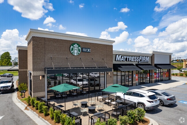
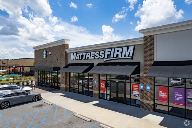
Property Record
2011 Pooler Pkwy, Pooler, GA 31322

Property Detail
2011 Pooler Pkwy
5100901100
OUTPARCEL 2 RECOMBINATION OF O UTPARCELS 2 & 3 SW QUADRANT OF
Stripcommercialcenter
CHATHAM
PUD
Georgia
B and X Area of moderate flood hazard, usually the area between the limits of the 100-year and 500-year floods.
1 AC
2024
Bloomingdale/Pooler
2025
Savannah
010811
Savannah, GA
7,904 SF
NEARBY LISTINGS FOR SALE OR LEASE
DEMOGRAPHICS near 2011 Pooler Pkwy
1 mile
3 mile
5 mile
2025 Total Population
5,237
21,817
47,487
2030 Population
5,607
23,082
50,092
Pop Growth 2025-2030
+ 7.07%
+ 5.80%
+ 5.49%
Average Age
39
40
40
2025 Total Households
2,240
8,530
18,829
HH Growth 2025-2030
+ 6.88%
+ 5.84%
+ 5.54%
Median Household Inc
$105,780
$94,452
$87,819
Avg Household Size
2.30
2.50
2.50
2025 Avg HH Vehicles
2.00
2.00
2.00
Median Home Value
$389,682
$341,563
$341,918
Median Year Built
2009
2006
2005
Nearby Places
Map Layers
Map Styles
 Street
 Aerial
Layers
 Traffic
 Biking
Places
Listings with unknown addresses are not visible on the map
- Restaurants
- Banks
- Shops
- Fitness
- Groceries
SALE & LEASE HISTORY
LISTING DATE
SALE/LEASE

Mar 06, 2018
For Lease
Feb 14, 2017
For Lease
Feb 14, 2017
For Sale
Nearby Properties
Address
Land Use
TOTAL SIZE
Lot Size
Zoning
Address
Land Use
TOTAL SIZE
Lot Size
Zoning
1,080,000 SF
71.17 AC
PUD
Address
Land Use
TOTAL SIZE
Lot Size
Zoning
1,460,340 SF
89.96 AC
RA-1
Address
Land Use
TOTAL SIZE
Lot Size
Zoning
1,193,920 SF
84.08 AC
PUD
Address
Land Use
TOTAL SIZE
Lot Size
Zoning
707,608 SF
78.02 AC
PUD
Address
Land Use
TOTAL SIZE
Lot Size
Zoning
68,464 SF
77 AC
PUD
Address
Land Use
TOTAL SIZE
Lot Size
Zoning
66.01 AC
Address
Land Use
TOTAL SIZE
Lot Size
Zoning
710,881 SF
44.98 AC
I-1
Address
Land Use
TOTAL SIZE
Lot Size
Zoning
4,656 SF
80.38 AC
PUD
Address
Land Use
TOTAL SIZE
Lot Size
Zoning
683,796 SF
57.50 AC
PUD
Address
Land Use
TOTAL SIZE
Lot Size
Zoning
25,358 SF
10.67 AC
PUD
Address
Land Use
TOTAL SIZE
Lot Size
Zoning
17,406 SF
18.27 AC
R-3C
Address
Land Use
TOTAL SIZE
Lot Size
Zoning
27,000 SF
15.11 AC
PUD
Address
Land Use
TOTAL SIZE
Lot Size
Zoning
499,500 SF
28.53 AC
Address
Land Use
TOTAL SIZE
Lot Size
Zoning
33.42 AC
PUD
Address
Land Use
TOTAL SIZE
Lot Size
Zoning
35,130 SF
21.45 AC
PUD
Address
Land Use
TOTAL SIZE
Lot Size
Zoning
39,720 SF
16.18 AC
PUD
Address
Land Use
TOTAL SIZE
Lot Size
Zoning
41,172 SF
29.69 AC
PUD
Address
Land Use
TOTAL SIZE
Lot Size
Zoning
290,524 SF
21.52 AC
Address
Land Use
TOTAL SIZE
Lot Size
Zoning
345,600 SF
22.22 AC
PUD
Address
Land Use
TOTAL SIZE
Lot Size
Zoning
324,815 SF
17.88 AC
I-1
Address
Land Use
TOTAL SIZE
Lot Size
Zoning
5,283 SF
19.55 AC
I-1
Address
Land Use
TOTAL SIZE
Lot Size
Zoning
97,500 SF
18.33 AC
C-2
Address
Land Use
TOTAL SIZE
Lot Size
Zoning
215,025 SF
12.90 AC
I1
Address
Land Use
TOTAL SIZE
Lot Size
Zoning
150,450 SF
172 AC
RA-1
Address
Land Use
TOTAL SIZE
Lot Size
Zoning
155,379 SF
18.50 AC
Address
Land Use
TOTAL SIZE
Lot Size
Zoning
110,279 SF
55.81 AC
R1B
Address
Land Use
TOTAL SIZE
Lot Size
Zoning
60,363 SF
10 AC
PUD
Address
Land Use
TOTAL SIZE
Lot Size
Zoning
17.96 AC
PUD
Address
Land Use
TOTAL SIZE
Lot Size
Zoning
139,488 SF
16.32 AC
C-2
Address
Land Use
TOTAL SIZE
Lot Size
Zoning
23,204 SF
3.54 AC
PUD
The World's #1 Commercial Real Estate Marketplace
Connect with us
© 2026 CoStar Group
The information above has been obtained from sources believed reliable. While we do not doubt its accuracy we have not verified it and make no guarantee, warranty or representation about it. It is your responsibility to independently confirm its accuracy and completeness. Any projections, opinions, assumptions, or estimates used are for example only and do not represent the current or future performance of the property. The value of this transaction to you depends on tax and other factors which should be evaluated by your tax, financial, and legal advisors. You and your advisors should conduct a careful, independent investigation of the property to determine to your satisfaction the suitability of the property for your needs.