Property Record
2014 High Falls Rd, Griffin, GA 30223
NEARBY LISTINGS FOR SALE OR LEASE
Property Detail
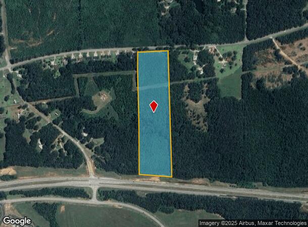
2014 High Falls Rd
220-02-004
HIGH FALLS RD
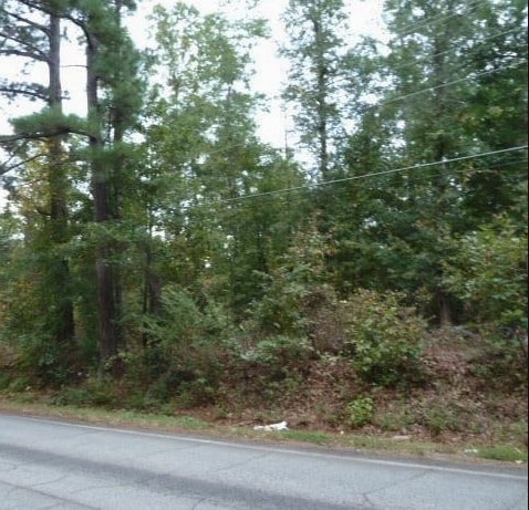
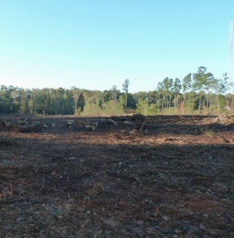
Agriculturalland
Spalding
X
Georgia
13255C0205E
17.05 AC
2024
Spalding County
2024
Atlanta
161000
Atlanta-Sandy Springs-Roswell, GA
DEMOGRAPHICS near 2014 High Falls Rd
1 Mile
3 Mile
5 Mile
2024 Total Population
626
9,897
37,573
2029 Population
660
10,458
39,940
Pop Growth 2024-2029
+ 5.43%
+ 5.67%
+ 6.30%
Average Age
40
39
39
2024 Total Households
236
3,740
14,453
HH Growth 2024-2029
+ 5.51%
+ 5.56%
+ 6.24%
Median Household Inc
$45,417
$50,779
$47,757
Avg Household Size
2.60
2.60
2.50
2024 Avg HH Vehicles
2.00
2.00
2.00
Median Home Value
$176,712
$171,334
$187,280
Median Year Built
1981
1977
1977
Nearby Places
Map Layers
Map Styles
 Street
 Aerial
- Restaurants
- Banks
- Shops
- Fitness
- Groceries
SALE & LEASE HISTORY
LISTING DATE
SALE/LEASE

Aug 27, 2018
For Sale
Nearby Properties
Address
Land Use
TOTAL SIZE
Lot Size
Zoning
Address
Land Use
TOTAL SIZE
Lot Size
Zoning
303,594 SF
58.69 AC
PDD
Address
Land Use
TOTAL SIZE
Lot Size
Zoning
367,793 SF
223.84 AC
C2
Address
Land Use
TOTAL SIZE
Lot Size
Zoning
13,392 SF
31.70 AC
Address
Land Use
TOTAL SIZE
Lot Size
Zoning
305,123 SF
37 AC
C2
Address
Land Use
TOTAL SIZE
Lot Size
Zoning
73.71 AC
AR1
Address
Land Use
TOTAL SIZE
Lot Size
Zoning
216,242 SF
15.21 AC
C2
Address
Land Use
TOTAL SIZE
Lot Size
Zoning
92,331 SF
29.84 AC
C2
Address
Land Use
TOTAL SIZE
Lot Size
Zoning
39,105 SF
33.98 AC
PDD
Address
Land Use
TOTAL SIZE
Lot Size
Zoning
84,105 SF
17 AC
AR1
Address
Land Use
TOTAL SIZE
Lot Size
Zoning
293,260 SF
23.27 AC
C-2
Address
Land Use
TOTAL SIZE
Lot Size
Zoning
48,856 SF
35.46 AC
PDD
Address
Land Use
TOTAL SIZE
Lot Size
Zoning
99,469 SF
28.98 AC
R-2
Address
Land Use
TOTAL SIZE
Lot Size
Zoning
72,876 SF
16.23 AC
PDD
Address
Land Use
TOTAL SIZE
Lot Size
Zoning
39,105 SF
33.98 AC
PDD
Address
Land Use
TOTAL SIZE
Lot Size
Zoning
48,856 SF
33.47 AC
PDD
Address
Land Use
TOTAL SIZE
Lot Size
Zoning
62,748 SF
22 AC
PDD
Address
Land Use
TOTAL SIZE
Lot Size
Zoning
205,953 SF
17.81 AC
PID
Address
Land Use
TOTAL SIZE
Lot Size
Zoning
203,804 SF
10.76 AC
C2
Address
Land Use
TOTAL SIZE
Lot Size
Zoning
61,517 SF
12.96 AC
PCD
Address
Land Use
TOTAL SIZE
Lot Size
Zoning
72,056 SF
11.89 AC
C2
Address
Land Use
TOTAL SIZE
Lot Size
Zoning
303,594 SF
58.69 AC
PDD
Address
Land Use
TOTAL SIZE
Lot Size
Zoning
203,291 SF
19.83 AC
PID
Address
Land Use
TOTAL SIZE
Lot Size
Zoning
142,875 SF
20 AC
PID
Address
Land Use
TOTAL SIZE
Lot Size
Zoning
123,401 SF
26.43 AC
PID
Address
Land Use
TOTAL SIZE
Lot Size
Zoning
108,086 SF
29.23 AC
C-2
Address
Land Use
TOTAL SIZE
Lot Size
Zoning
46,310 SF
24.68 AC
R3
Address
Land Use
TOTAL SIZE
Lot Size
Zoning
137,279 SF
10.84 AC
PID
Address
Land Use
TOTAL SIZE
Lot Size
Zoning
37,681 SF
8.40 AC
C-1C
Address
Land Use
TOTAL SIZE
Lot Size
Zoning
55,202 SF
15.95 AC
C2
Address
Land Use
TOTAL SIZE
Lot Size
Zoning
72,000 SF
10 AC
PID
The World's #1 Commercial Real Estate Marketplace
Connect with us
© 2025 CoStar Group
The information above has been obtained from sources believed reliable. While we do not doubt its accuracy we have not verified it and make no guarantee, warranty or representation about it. It is your responsibility to independently confirm its accuracy and completeness. Any projections, opinions, assumptions, or estimates used are for example only and do not represent the current or future performance of the property. The value of this transaction to you depends on tax and other factors which should be evaluated by your tax, financial, and legal advisors. You and your advisors should conduct a careful, independent investigation of the property to determine to your satisfaction the suitability of the property for your needs.