Property Record
2016 Riverside Dr, Los Angeles, CA 90039


NEARBY LISTINGS FOR SALE OR LEASE
Property Detail
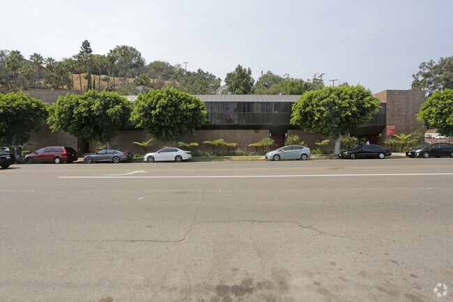
2016 Riverside Dr
Los Angeles-Long Beach-Glendale, CA
Hunter J D & Asa Prop
5443-035-011
MB 13-34-35 FOR DESC SEE ASSESSORS MAPS POR OF LOT E
Lightindustrial
Los Angeles
X
California
06037C1626F
e
2024
0.45 AC
2025
East Hollywood/Silver Lake
197410
Los Angeles
30,748 SF
DEMOGRAPHICS near 2016 Riverside Dr
1 mile
3 mile
5 mile
2024 Total Population
19,778
331,886
999,988
2029 Population
19,135
321,115
974,254
Pop Growth 2024-2029
(3.25%)
(3.25%)
(2.57%)
Average Age
41
40
40
2024 Total Households
7,776
130,655
401,520
HH Growth 2024-2029
(3.60%)
(3.48%)
(2.60%)
Median Household Inc
$93,936
$69,661
$60,828
Avg Household Size
2.50
2.40
2.30
2024 Avg HH Vehicles
2.00
1.00
1.00
Median Home Value
$990,989
$944,053
$900,179
Median Year Built
1949
1957
1962
Nearby Places
Map Layers
Map Styles
 Street
 Aerial
Transit
 Traffic
 Biking
Places
Listings with unknown addresses are not visible on the map
- Restaurants
- Banks
- Shops
- Fitness
- Groceries
PUBLIC TRANSPORTATION
COMMUTER RAIL
Glendale (Antelope Valley Line - Southern California Regional Rail Authority (Metrolink), Ventura County Line - Southern California Regional Rail Authority (Metrolink))
Drive
Walk
Distance
Glendale (Antelope Valley Line - Southern California Regional Rail Authority (Metrolink), Ventura County Line - Southern California Regional Rail Authority (Metrolink))
6 min
2.9 mi
Union Station (91 Line - Southern California Regional Rail Authority (Metrolink), Antelope Valley Line - Southern California Regional Rail Authority (Metrolink), Orange County Line - Southern California Regional Rail Authority (Metrolink), Riverside Line - Southern California Regional Rail Authority (Metrolink), San Bernardino Line - Southern California Regional Rail Authority (Metrolink), Ventura County Line - Southern California Regional Rail Authority (Metrolink))
Drive
Walk
Distance
Union Station (91 Line - Southern California Regional Rail Authority (Metrolink), Antelope Valley Line - Southern California Regional Rail Authority (Metrolink), Orange County Line - Southern California Regional Rail Authority (Metrolink), Riverside Line - Southern California Regional Rail Authority (Metrolink), San Bernardino Line - Southern California Regional Rail Authority (Metrolink), Ventura County Line - Southern California Regional Rail Authority (Metrolink))
11 min
4.3 mi
AIRPORT
Bob Hope
Drive
Walk
Distance
Bob Hope
19 min
12.7 mi
Los Angeles International
Drive
Walk
Distance
Los Angeles International
31 min
18.4 mi
Long Beach (Daugherty Field)
Drive
Walk
Distance
Long Beach (Daugherty Field)
37 min
25.0 mi
Nearby Properties
Address
Land Use
TOTAL SIZE
Lot Size
Zoning
Address
Land Use
TOTAL SIZE
Lot Size
Zoning
930,249 SF
7.39 AC
LAC2
Address
Land Use
TOTAL SIZE
Lot Size
Zoning
709,584 SF
1.80 AC
LAPB
Address
Land Use
TOTAL SIZE
Lot Size
Zoning
816,046 SF
15.37 AC
LAA1
Address
Land Use
TOTAL SIZE
Lot Size
Zoning
465,722 SF
5.84 AC
LAC4
Address
Land Use
TOTAL SIZE
Lot Size
Zoning
406,948 SF
8.04 AC
LAC2
Address
Land Use
TOTAL SIZE
Lot Size
Zoning
251,317 SF
114.56 AC
LAR1
Address
Land Use
TOTAL SIZE
Lot Size
Zoning
1,059,650 SF
1.07 AC
LAC2
Address
Land Use
TOTAL SIZE
Lot Size
Zoning
985,517 SF
4.08 AC
GLC3
Address
Land Use
TOTAL SIZE
Lot Size
Zoning
349,519 SF
2.16 AC
GLM1*
Address
Land Use
TOTAL SIZE
Lot Size
Zoning
244,071 SF
1.64 AC
LARAS4
Address
Land Use
TOTAL SIZE
Lot Size
Zoning
175.69 AC
LAA1
Address
Land Use
TOTAL SIZE
Lot Size
Zoning
642,160 SF
8.26 AC
LAADP
Address
Land Use
TOTAL SIZE
Lot Size
Zoning
251,159 SF
2.84 AC
LAPB
Address
Land Use
TOTAL SIZE
Lot Size
Zoning
368,058 SF
2.65 AC
LAUC (CA)
Address
Land Use
TOTAL SIZE
Lot Size
Zoning
245,031 SF
2.21 AC
GLM2
Address
Land Use
TOTAL SIZE
Lot Size
Zoning
529,791 SF
8.43 AC
LAR4
Address
Land Use
TOTAL SIZE
Lot Size
Zoning
354,707 SF
1.14 AC
LACW
Address
Land Use
TOTAL SIZE
Lot Size
Zoning
342,600 SF
2.55 AC
LAC4
Address
Land Use
TOTAL SIZE
Lot Size
Zoning
Address
Land Use
TOTAL SIZE
Lot Size
Zoning
5,770 SF
2.64 AC
LAC2
Address
Land Use
TOTAL SIZE
Lot Size
Zoning
86,522 SF
21.02 AC
LAM1
Address
Land Use
TOTAL SIZE
Lot Size
Zoning
225,923 SF
1.31 AC
LAR5
Address
Land Use
TOTAL SIZE
Lot Size
Zoning
224,969 SF
1.87 AC
LACW
Address
Land Use
TOTAL SIZE
Lot Size
Zoning
43,526 SF
2.80 AC
LAC2
Address
Land Use
TOTAL SIZE
Lot Size
Zoning
131,790 SF
1.31 AC
LARD1.5
Address
Land Use
TOTAL SIZE
Lot Size
Zoning
266,548 SF
4.59 AC
LAC4
Address
Land Use
TOTAL SIZE
Lot Size
Zoning
148,284 SF
1.96 AC
LAC2
Address
Land Use
TOTAL SIZE
Lot Size
Zoning
119,455 SF
5.04 AC
LACM
Address
Land Use
TOTAL SIZE
Lot Size
Zoning
492,128 SF
5.27 AC
LAC2
Address
Land Use
TOTAL SIZE
Lot Size
Zoning
53,760 SF
4.60 AC
LAM1
The World's #1 Commercial Real Estate Marketplace
Connect with us
© 2026 CoStar Group
The information above has been obtained from sources believed reliable. While we do not doubt its accuracy we have not verified it and make no guarantee, warranty or representation about it. It is your responsibility to independently confirm its accuracy and completeness. Any projections, opinions, assumptions, or estimates used are for example only and do not represent the current or future performance of the property. The value of this transaction to you depends on tax and other factors which should be evaluated by your tax, financial, and legal advisors. You and your advisors should conduct a careful, independent investigation of the property to determine to your satisfaction the suitability of the property for your needs.