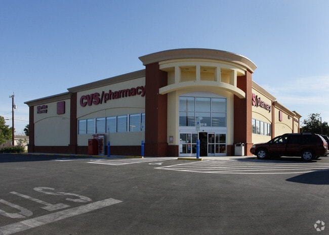
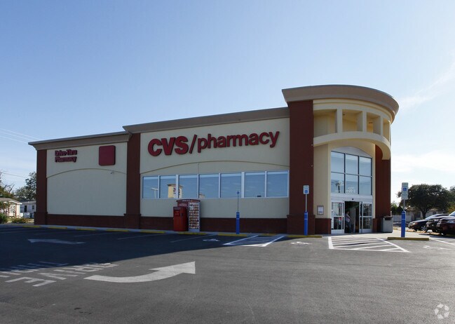
Property Record
2018 Culebra Rd, San Antonio, TX 78201

Property Detail
2018 Culebra Rd
San Antonio-New Braunfels, TX
NCB 6586 (CVS-CULEBRA AND 24TH), BLOCK 3 LOT 16 2012 NEW ACCT PER PLAT 9630/32-11 FILED 06/17/2011.
06586-003-0160
BEXAR
Storebuilding
Texas
B and X Area of moderate flood hazard, usually the area between the limits of the 100-year and 500-year floods.
16
2024
1.57 AC
2025
Northwest
170401
San Antonio
13,565 SF
NEARBY LISTINGS FOR SALE OR LEASE
DEMOGRAPHICS near 2018 Culebra Rd
1 mile
3 mile
5 mile
2025 Total Population
18,463
166,096
367,807
2030 Population
19,293
173,791
386,808
Pop Growth 2025-2030
+ 4.50%
+ 4.63%
+ 5.17%
Average Age
38
39
39
2025 Total Households
6,309
58,061
137,769
HH Growth 2025-2030
+ 4.60%
+ 4.88%
+ 5.55%
Median Household Inc
$47,972
$42,755
$47,236
Avg Household Size
2.80
2.70
2.50
2025 Avg HH Vehicles
2.00
2.00
2.00
Median Home Value
$139,773
$156,687
$183,683
Median Year Built
1954
1957
1963
Nearby Places
Map Layers
Map Styles
 Street
 Aerial
Layers
 Traffic
 Biking
Places
Listings with unknown addresses are not visible on the map
- Restaurants
- Banks
- Shops
- Fitness
- Groceries
PUBLIC TRANSPORTATION
COMMUTER RAIL
San Antonio Amtrak Station (Sunset Limited - Amtrak, Texas Eagle - Amtrak)
Drive
Walk
Distance
San Antonio Amtrak Station (Sunset Limited - Amtrak, Texas Eagle - Amtrak)
10 min
5.0 mi
AIRPORT
San Antonio International
Drive
Walk
Distance
San Antonio International
15 min
9.7 mi
Freight Ports
Calhoun Port
Drive
Walk
Distance
Calhoun Port
186 min
152.4 mi
Nearby Properties
Address
Land Use
TOTAL SIZE
Lot Size
Zoning
Address
Land Use
TOTAL SIZE
Lot Size
Zoning
443,560 SF
2.77 AC
Address
Land Use
TOTAL SIZE
Lot Size
Zoning
31,334 SF
14.11 AC
Address
Land Use
TOTAL SIZE
Lot Size
Zoning
50.69 AC
Address
Land Use
TOTAL SIZE
Lot Size
Zoning
7,542 SF
1.30 AC
Address
Land Use
TOTAL SIZE
Lot Size
Zoning
122,292 SF
12.83 AC
Address
Land Use
TOTAL SIZE
Lot Size
Zoning
12.06 AC
Address
Land Use
TOTAL SIZE
Lot Size
Zoning
245,371 SF
20.50 AC
Address
Land Use
TOTAL SIZE
Lot Size
Zoning
Address
Land Use
TOTAL SIZE
Lot Size
Zoning
98,208 SF
0.94 AC
Address
Land Use
TOTAL SIZE
Lot Size
Zoning
317,878 SF
3.14 AC
Address
Land Use
TOTAL SIZE
Lot Size
Zoning
Address
Land Use
TOTAL SIZE
Lot Size
Zoning
27,517 SF
27.66 AC
Address
Land Use
TOTAL SIZE
Lot Size
Zoning
Address
Land Use
TOTAL SIZE
Lot Size
Zoning
223,148 SF
19.15 AC
Address
Land Use
TOTAL SIZE
Lot Size
Zoning
99,538 SF
11.89 AC
Address
Land Use
TOTAL SIZE
Lot Size
Zoning
102,456 SF
7.35 AC
Address
Land Use
TOTAL SIZE
Lot Size
Zoning
173,363 SF
10.29 AC
Address
Land Use
TOTAL SIZE
Lot Size
Zoning
315,630 SF
10.19 AC
Address
Land Use
TOTAL SIZE
Lot Size
Zoning
369,600 SF
1.71 AC
Address
Land Use
TOTAL SIZE
Lot Size
Zoning
153,244 SF
2.04 AC
Address
Land Use
TOTAL SIZE
Lot Size
Zoning
75,670 SF
2.48 AC
Address
Land Use
TOTAL SIZE
Lot Size
Zoning
125,776 SF
6.98 AC
Address
Land Use
TOTAL SIZE
Lot Size
Zoning
148,206 SF
7.69 AC
Address
Land Use
TOTAL SIZE
Lot Size
Zoning
179,276 SF
20.19 AC
Address
Land Use
TOTAL SIZE
Lot Size
Zoning
143,212 SF
14.85 AC
Address
Land Use
TOTAL SIZE
Lot Size
Zoning
104,146 SF
4.20 AC
Address
Land Use
TOTAL SIZE
Lot Size
Zoning
70,685 SF
1.64 AC
Address
Land Use
TOTAL SIZE
Lot Size
Zoning
245,574 SF
19.65 AC
Address
Land Use
TOTAL SIZE
Lot Size
Zoning
133,892 SF
7.41 AC
Address
Land Use
TOTAL SIZE
Lot Size
Zoning
155,130 SF
13.89 AC
The World's #1 Commercial Real Estate Marketplace
Connect with us
© 2026 CoStar Group
The information above has been obtained from sources believed reliable. While we do not doubt its accuracy we have not verified it and make no guarantee, warranty or representation about it. It is your responsibility to independently confirm its accuracy and completeness. Any projections, opinions, assumptions, or estimates used are for example only and do not represent the current or future performance of the property. The value of this transaction to you depends on tax and other factors which should be evaluated by your tax, financial, and legal advisors. You and your advisors should conduct a careful, independent investigation of the property to determine to your satisfaction the suitability of the property for your needs.