Property Record
2022 Miamisburg Centerville Rd, Minneapolis, OH 55403
NEARBY LISTINGS FOR SALE OR LEASE
Property Detail
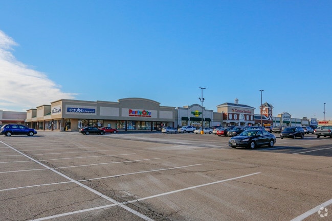
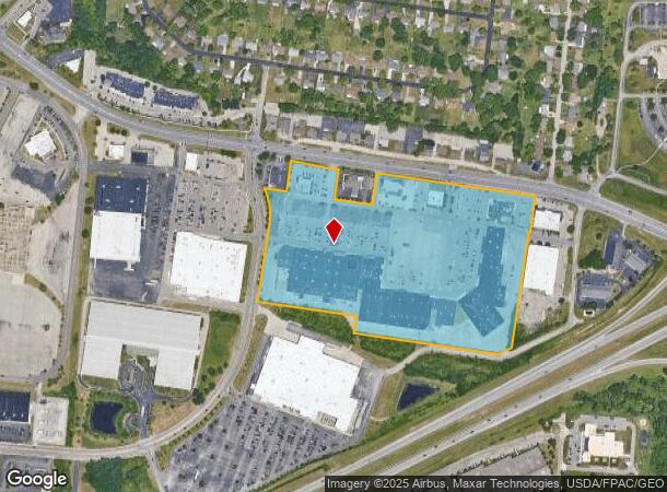
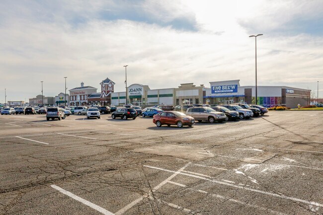
2022 Miamisburg Centerville Rd
Dayton, OH
Mrs
K45-02604-0071
26-4-73,76,98,120 5-2-12, TIF100%30YRS2006-2035 FD 2036 TIFLOCK17956340
Regionalshoppingcenterormallwithanchorstore
Montgomery
X
Ohio
39113C0265E
71
2023
26.75 AC
2024
South Dayton
105204
Cincinnati/Dayton
318,633 SF
DEMOGRAPHICS near 2022 Miamisburg Centerville Rd
1 Mile
3 Mile
5 Mile
2024 Total Population
4,543
61,215
151,593
2029 Population
4,428
59,956
150,895
Pop Growth 2024-2029
(2.53%)
(2.06%)
(0.46%)
Average Age
43
43
42
2024 Total Households
2,339
27,470
64,833
HH Growth 2024-2029
(2.61%)
(2.15%)
(0.68%)
Median Household Inc
$68,666
$72,023
$77,977
Avg Household Size
1.90
2.20
2.30
2024 Avg HH Vehicles
2.00
2.00
2.00
Median Home Value
$204,060
$218,105
$228,684
Median Year Built
1985
1980
1977
Nearby Places
- Restaurants
- Banks
- Shops
- Fitness
- Groceries
PUBLIC TRANSPORTATION
AIRPORT
James M Cox Dayton International
DRIVE
WALK
Distance
James M Cox Dayton International
33 min
22.9 mi
Freight Ports
Port of Toledo
DRIVE
WALK
Distance
Port of Toledo
190 min
163.1 mi
SALE & LEASE HISTORY
LISTING DATE
SALE/LEASE

Sep 25, 2016
For Lease
May 09, 2017
For Lease
Jan 24, 2018
For Lease
Nearby Properties
Address
Land Use
TOTAL SIZE
Lot Size
Zoning
Address
Land Use
TOTAL SIZE
Lot Size
Zoning
25,715 SF
23.28 AC
Address
Land Use
TOTAL SIZE
Lot Size
Zoning
1,042,121 SF
51.37 AC
Address
Land Use
TOTAL SIZE
Lot Size
Zoning
Address
Land Use
TOTAL SIZE
Lot Size
Zoning
446,592 SF
4.33 AC
Address
Land Use
TOTAL SIZE
Lot Size
Zoning
47,552 SF
47.55 AC
Address
Land Use
TOTAL SIZE
Lot Size
Zoning
39,404 SF
55.59 AC
Address
Land Use
TOTAL SIZE
Lot Size
Zoning
64,121 SF
21.21 AC
Address
Land Use
TOTAL SIZE
Lot Size
Zoning
203,556 SF
10.69 AC
Address
Land Use
TOTAL SIZE
Lot Size
Zoning
209,894 SF
5.41 AC
Address
Land Use
TOTAL SIZE
Lot Size
Zoning
145,322 SF
22.31 AC
Address
Land Use
TOTAL SIZE
Lot Size
Zoning
71,204 SF
5.15 AC
Address
Land Use
TOTAL SIZE
Lot Size
Zoning
131,742 SF
7.75 AC
Address
Land Use
TOTAL SIZE
Lot Size
Zoning
66.56 AC
Address
Land Use
TOTAL SIZE
Lot Size
Zoning
1,042,121 SF
51.37 AC
Address
Land Use
TOTAL SIZE
Lot Size
Zoning
272,855 SF
29.01 AC
Address
Land Use
TOTAL SIZE
Lot Size
Zoning
138,484 SF
23.04 AC
Address
Land Use
TOTAL SIZE
Lot Size
Zoning
89,683 SF
33.45 AC
Address
Land Use
TOTAL SIZE
Lot Size
Zoning
24,928 SF
13.67 AC
Address
Land Use
TOTAL SIZE
Lot Size
Zoning
64,364 SF
26.01 AC
Address
Land Use
TOTAL SIZE
Lot Size
Zoning
318,361 SF
23.90 AC
Address
Land Use
TOTAL SIZE
Lot Size
Zoning
122,344 SF
2.17 AC
Address
Land Use
TOTAL SIZE
Lot Size
Zoning
155,702 SF
5.95 AC
Address
Land Use
TOTAL SIZE
Lot Size
Zoning
31.95 AC
Address
Land Use
TOTAL SIZE
Lot Size
Zoning
Address
Land Use
TOTAL SIZE
Lot Size
Zoning
10,912 SF
15.28 AC
Address
Land Use
TOTAL SIZE
Lot Size
Zoning
90,769 SF
1.05 AC
Address
Land Use
TOTAL SIZE
Lot Size
Zoning
206,027 SF
28.63 AC
Address
Land Use
TOTAL SIZE
Lot Size
Zoning
70,234 SF
11.22 AC
Address
Land Use
TOTAL SIZE
Lot Size
Zoning
88,556 SF
23.94 AC
The World's #1 Commercial Real Estate Marketplace
Connect with us
© 2025 CoStar Group
The information above has been obtained from sources believed reliable. While we do not doubt its accuracy we have not verified it and make no guarantee, warranty or representation about it. It is your responsibility to independently confirm its accuracy and completeness. Any projections, opinions, assumptions, or estimates used are for example only and do not represent the current or future performance of the property. The value of this transaction to you depends on tax and other factors which should be evaluated by your tax, financial, and legal advisors. You and your advisors should conduct a careful, independent investigation of the property to determine to your satisfaction the suitability of the property for your needs.