Property Record
203 Ferry St, Newark, NJ 07105


Save to a Folder
{{folder.Name}}
{{folder.ListingIds.length}} Properties
{{folder.ListingIds.length}} Property
Create a New Folder
Property Detail
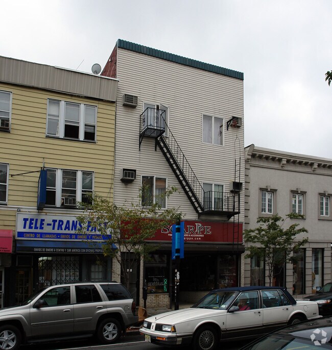
203 Ferry St
Newark, NJ
25X100
14-01982-0000-00002
Essex
Commercialnec
New Jersey
B and X Area of moderate flood hazard, usually the area between the limits of the 100-year and 500-year floods.
2
2025
0.06 AC
2026
Newark
007700
Northern New Jersey
NEARBY LISTINGS FOR SALE OR LEASE
DEMOGRAPHICS near 203 Ferry St
1 mile
3 mile
5 mile
2025 Total Population
57,856
255,609
830,114
2030 Population
59,998
263,666
860,835
Pop Growth 2025-2030
+ 3.70%
+ 3.15%
+ 3.70%
Average Age
37
37
38
2025 Total Households
22,078
92,440
306,629
HH Growth 2025-2030
+ 4.27%
+ 3.69%
+ 4.06%
Median Household Inc
$62,641
$54,835
$64,687
Avg Household Size
2.50
2.60
2.60
2025 Avg HH Vehicles
1.00
1.00
1.00
Median Home Value
$467,991
$399,553
$404,958
Median Year Built
1976
1971
1959
Nearby Places
Map Layers
Map Styles
 Street
 Aerial
Layers
 Traffic
 Biking
Places
Listings with unknown addresses are not visible on the map
- Restaurants
- Banks
- Shops
- Fitness
- Groceries
PUBLIC TRANSPORTATION
COMMUTER RAIL
Newark Penn Station (North Jersey Coast Line - NJ TRANSIT RAIL, Northeast Corridor - NJ TRANSIT RAIL, Raritan Valley Line - NJ TRANSIT RAIL)
Drive
Walk
Distance
Newark Penn Station (North Jersey Coast Line - NJ TRANSIT RAIL, Northeast Corridor - NJ TRANSIT RAIL, Raritan Valley Line - NJ TRANSIT RAIL)
1 min
12 min
0.6 mi
Newark (Acela - Amtrak, Crescent - Amtrak, Keystone Service - Amtrak, Newark - Harrison Shuttle Train - Amtrak, Newark - World Trade Center - Amtrak, Palmetto - Amtrak, Silver Meteor - Amtrak)
Drive
Walk
Distance
Newark (Acela - Amtrak, Crescent - Amtrak, Keystone Service - Amtrak, Newark - Harrison Shuttle Train - Amtrak, Newark - World Trade Center - Amtrak, Palmetto - Amtrak, Silver Meteor - Amtrak)
2 min
13 min
0.7 mi
AIRPORT
Newark Liberty International
Drive
Walk
Distance
Newark Liberty International
7 min
4.1 mi
LaGuardia
Drive
Walk
Distance
LaGuardia
39 min
19.3 mi
John F Kennedy International
Drive
Walk
Distance
John F Kennedy International
48 min
27.5 mi
Freight Ports
Port Newark Container Terminal
Drive
Walk
Distance
Port Newark Container Terminal
9 min
4.4 mi
Nearby Properties
Address
Land Use
TOTAL SIZE
Lot Size
Zoning
Address
Land Use
TOTAL SIZE
Lot Size
Zoning
0.57 AC
Address
Land Use
TOTAL SIZE
Lot Size
Zoning
0.45 AC
Address
Land Use
TOTAL SIZE
Lot Size
Zoning
Address
Land Use
TOTAL SIZE
Lot Size
Zoning
31.86 AC
Address
Land Use
TOTAL SIZE
Lot Size
Zoning
25.69 AC
Address
Land Use
TOTAL SIZE
Lot Size
Zoning
Address
Land Use
TOTAL SIZE
Lot Size
Zoning
98.48 AC
Address
Land Use
TOTAL SIZE
Lot Size
Zoning
877 SF
7.25 AC
Address
Land Use
TOTAL SIZE
Lot Size
Zoning
4.51 AC
Address
Land Use
TOTAL SIZE
Lot Size
Zoning
683 SF
9.59 AC
Address
Land Use
TOTAL SIZE
Lot Size
Zoning
2.01 AC
Address
Land Use
TOTAL SIZE
Lot Size
Zoning
3.42 AC
Address
Land Use
TOTAL SIZE
Lot Size
Zoning
320 SF
1.25 AC
Address
Land Use
TOTAL SIZE
Lot Size
Zoning
710 SF
39.32 AC
Address
Land Use
TOTAL SIZE
Lot Size
Zoning
9.77 AC
Address
Land Use
TOTAL SIZE
Lot Size
Zoning
877 SF
0.91 AC
Address
Land Use
TOTAL SIZE
Lot Size
Zoning
1.64 AC
Address
Land Use
TOTAL SIZE
Lot Size
Zoning
Address
Land Use
TOTAL SIZE
Lot Size
Zoning
1.63 AC
Address
Land Use
TOTAL SIZE
Lot Size
Zoning
Address
Land Use
TOTAL SIZE
Lot Size
Zoning
2.79 AC
Address
Land Use
TOTAL SIZE
Lot Size
Zoning
4.82 AC
Address
Land Use
TOTAL SIZE
Lot Size
Zoning
0.13 AC
Address
Land Use
TOTAL SIZE
Lot Size
Zoning
1,264 SF
3.20 AC
Address
Land Use
TOTAL SIZE
Lot Size
Zoning
Address
Land Use
TOTAL SIZE
Lot Size
Zoning
0.06 AC
Address
Land Use
TOTAL SIZE
Lot Size
Zoning
0.09 AC
Address
Land Use
TOTAL SIZE
Lot Size
Zoning
877 SF
1.95 AC
Address
Land Use
TOTAL SIZE
Lot Size
Zoning
877 SF
1.35 AC
Address
Land Use
TOTAL SIZE
Lot Size
Zoning
683 SF
0.79 AC
The World's #1 Commercial Real Estate Marketplace
Connect with us
© 2026 CoStar Group
The information above has been obtained from sources believed reliable. While we do not doubt its accuracy we have not verified it and make no guarantee, warranty or representation about it. It is your responsibility to independently confirm its accuracy and completeness. Any projections, opinions, assumptions, or estimates used are for example only and do not represent the current or future performance of the property. The value of this transaction to you depends on tax and other factors which should be evaluated by your tax, financial, and legal advisors. You and your advisors should conduct a careful, independent investigation of the property to determine to your satisfaction the suitability of the property for your needs.