Property Record
2031 29Th St Sw, Allentown, PA 18103


NEARBY LISTINGS FOR SALE OR LEASE
Property Detail
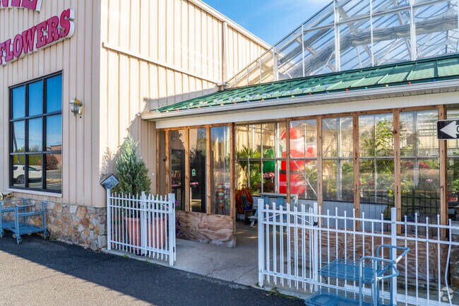
2031 29Th St Sw
Allentown-Bethlehem-Easton, PA-NJ
Minor Subdivision
549575852267-1
LOTS: 001
Storebuilding
Lehigh
X
Pennsylvania
42077C0261F
1
2025
2.16 AC
2025
Lehigh Valley
001402
Philadelphia
5,250 SF
DEMOGRAPHICS near 2031 29Th St Sw
1 Mile
3 Mile
5 Mile
2024 Total Population
9,282
88,937
213,026
2029 Population
9,458
89,716
214,746
Pop Growth 2024-2029
+ 1.90%
+ 0.88%
+ 0.81%
Average Age
39
39
39
2024 Total Households
3,849
34,357
80,572
HH Growth 2024-2029
+ 1.79%
+ 0.95%
+ 0.85%
Median Household Inc
$58,134
$57,306
$61,519
Avg Household Size
2.40
2.40
2.50
2024 Avg HH Vehicles
2.00
2.00
2.00
Median Home Value
$205,671
$201,757
$235,947
Median Year Built
1971
1959
1963
Nearby Places
Map Layers
Map Styles
 Street
 Aerial
- Restaurants
- Banks
- Shops
- Fitness
- Groceries
PUBLIC TRANSPORTATION
AIRPORT
Lehigh Valley International
DRIVE
WALK
Distance
Lehigh Valley International
19 min
9.5 mi
Freight Ports
Port of Philadelphia
DRIVE
WALK
Distance
Port of Philadelphia
82 min
51.0 mi
SALE & LEASE HISTORY
LISTING DATE
SALE/LEASE

Oct 09, 2023
For Sale
Nearby Properties
Address
Land Use
TOTAL SIZE
Lot Size
Zoning
Address
Land Use
TOTAL SIZE
Lot Size
Zoning
504,141 SF
44.47 AC
R2
Address
Land Use
TOTAL SIZE
Lot Size
Zoning
302,304 SF
5.15 AC
B-2
Address
Land Use
TOTAL SIZE
Lot Size
Zoning
353,441 SF
4.34 AC
I-G
Address
Land Use
TOTAL SIZE
Lot Size
Zoning
413,834 SF
40 AC
R-L
Address
Land Use
TOTAL SIZE
Lot Size
Zoning
356,283 SF
2 AC
I-G
Address
Land Use
TOTAL SIZE
Lot Size
Zoning
300,783 SF
0.64 AC
B-2
Address
Land Use
TOTAL SIZE
Lot Size
Zoning
295,502 SF
0.77 AC
B-2
Address
Land Use
TOTAL SIZE
Lot Size
Zoning
135,668 SF
5 AC
R3
Address
Land Use
TOTAL SIZE
Lot Size
Zoning
112,456 SF
5 AC
R3
Address
Land Use
TOTAL SIZE
Lot Size
Zoning
1,250 SF
80.20 AC
CR
Address
Land Use
TOTAL SIZE
Lot Size
Zoning
113,608 SF
6.43 AC
I-G
Address
Land Use
TOTAL SIZE
Lot Size
Zoning
124,954 SF
1.23 AC
B-2
Address
Land Use
TOTAL SIZE
Lot Size
Zoning
155,344 SF
B-2
Address
Land Use
TOTAL SIZE
Lot Size
Zoning
266,354 SF
2.56 AC
R-H
Address
Land Use
TOTAL SIZE
Lot Size
Zoning
139,462 SF
1.30 AC
B-2
Address
Land Use
TOTAL SIZE
Lot Size
Zoning
139,812 SF
0.14 AC
B-2
Address
Land Use
TOTAL SIZE
Lot Size
Zoning
42,250 SF
3.33 AC
I-G
Address
Land Use
TOTAL SIZE
Lot Size
Zoning
48,816 SF
197.98 AC
I-2
Address
Land Use
TOTAL SIZE
Lot Size
Zoning
71,838 SF
0.48 AC
I-G
Address
Land Use
TOTAL SIZE
Lot Size
Zoning
19,850 SF
15.01 AC
R3
Address
Land Use
TOTAL SIZE
Lot Size
Zoning
219,048 SF
1.48 AC
B-2
Address
Land Use
TOTAL SIZE
Lot Size
Zoning
128,106 SF
10.14 AC
C1
Address
Land Use
TOTAL SIZE
Lot Size
Zoning
139,782 SF
27.47 AC
R4
Address
Land Use
TOTAL SIZE
Lot Size
Zoning
7,200 SF
22.31 AC
I-3
Address
Land Use
TOTAL SIZE
Lot Size
Zoning
44,302 SF
17.25 AC
I-L
Address
Land Use
TOTAL SIZE
Lot Size
Zoning
88,600 SF
3.97 AC
R-H
Address
Land Use
TOTAL SIZE
Lot Size
Zoning
118,272 SF
1.17 AC
B-2
Address
Land Use
TOTAL SIZE
Lot Size
Zoning
266,179 SF
1.29 AC
B-2
Address
Land Use
TOTAL SIZE
Lot Size
Zoning
38,650 SF
11.05 AC
R-H
Address
Land Use
TOTAL SIZE
Lot Size
Zoning
1,154,183 SF
83.21 AC
I-3
The World's #1 Commercial Real Estate Marketplace
Connect with us
© 2026 CoStar Group
The information above has been obtained from sources believed reliable. While we do not doubt its accuracy we have not verified it and make no guarantee, warranty or representation about it. It is your responsibility to independently confirm its accuracy and completeness. Any projections, opinions, assumptions, or estimates used are for example only and do not represent the current or future performance of the property. The value of this transaction to you depends on tax and other factors which should be evaluated by your tax, financial, and legal advisors. You and your advisors should conduct a careful, independent investigation of the property to determine to your satisfaction the suitability of the property for your needs.