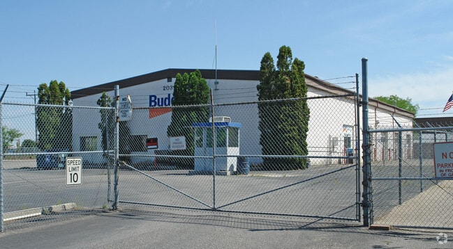
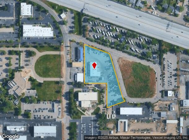
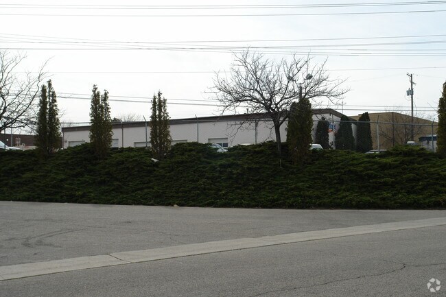
Property Record
2039 W Airport Way, Boise, ID 83705

NEARBY LISTINGS FOR SALE OR LEASE
Property Detail
2039 W Airport Way
Boise City, ID
Stout Sub Amd
R8184740200
LOT 03 BLK 01 STOUT SUB REPLAT
Commercialnec
Ada
X
Idaho
16001C0280G
03
2024
2.49 AC
2025
Airport
002100
Boise City/Nampa
11,112 SF
DEMOGRAPHICS near 2039 W Airport Way
1 Mile
3 Mile
5 Mile
2024 Total Population
4,556
68,102
154,613
2029 Population
5,164
77,456
175,515
Pop Growth 2024-2029
+ 13.35%
+ 13.74%
+ 13.52%
Average Age
39
38
39
2024 Total Households
1,956
30,269
66,191
HH Growth 2024-2029
+ 13.60%
+ 14.22%
+ 13.94%
Median Household Inc
$65,232
$60,781
$70,396
Avg Household Size
2.20
2.10
2.20
2024 Avg HH Vehicles
2.00
2.00
2.00
Median Home Value
$342,840
$453,518
$472,055
Median Year Built
1976
1983
1984
Nearby Places
Map Layers
Map Styles
 Street
 Aerial
- Restaurants
- Banks
- Shops
- Fitness
- Groceries
PUBLIC TRANSPORTATION
AIRPORT
Boise Air Trml/Gowen Field
DRIVE
WALK
Distance
Boise Air Trml/Gowen Field
12 min
5.2 mi
Nearby Properties
Address
Land Use
TOTAL SIZE
Lot Size
Zoning
Address
Land Use
TOTAL SIZE
Lot Size
Zoning
635,403 SF
23.42 AC
ZC-243
Address
Land Use
TOTAL SIZE
Lot Size
Zoning
900,981 SF
86.35 AC
ZC-263
Address
Land Use
TOTAL SIZE
Lot Size
Zoning
240,481 SF
1.79 AC
ZC-264
Address
Land Use
TOTAL SIZE
Lot Size
Zoning
251,614 SF
12.62 AC
ZC-245
Address
Land Use
TOTAL SIZE
Lot Size
Zoning
279,694 SF
2.09 AC
ZC-264
Address
Land Use
TOTAL SIZE
Lot Size
Zoning
258,747 SF
3.30 AC
ZC-266
Address
Land Use
TOTAL SIZE
Lot Size
Zoning
413,253 SF
3.33 AC
ZC-260
Address
Land Use
TOTAL SIZE
Lot Size
Zoning
356,969 SF
49.72 AC
ZC-269
Address
Land Use
TOTAL SIZE
Lot Size
Zoning
334,334 SF
3.21 AC
ZC-259
Address
Land Use
TOTAL SIZE
Lot Size
Zoning
197,268 SF
10.95 AC
R-3
Address
Land Use
TOTAL SIZE
Lot Size
Zoning
203,503 SF
7.93 AC
ZC-243
Address
Land Use
TOTAL SIZE
Lot Size
Zoning
223,171 SF
0.85 AC
ZC-264
Address
Land Use
TOTAL SIZE
Lot Size
Zoning
214,318 SF
13.77 AC
R-2
Address
Land Use
TOTAL SIZE
Lot Size
Zoning
159,859 SF
0.80 AC
ZC-264
Address
Land Use
TOTAL SIZE
Lot Size
Zoning
259,565 SF
4.07 AC
SP-02
Address
Land Use
TOTAL SIZE
Lot Size
Zoning
364,998 SF
40.53 AC
ZC-269
Address
Land Use
TOTAL SIZE
Lot Size
Zoning
10.03 AC
R-3
Address
Land Use
TOTAL SIZE
Lot Size
Zoning
157,347 SF
7.97 AC
R-3
Address
Land Use
TOTAL SIZE
Lot Size
Zoning
237,251 SF
20.90 AC
ZC-269
Address
Land Use
TOTAL SIZE
Lot Size
Zoning
144,785 SF
2.89 AC
ZC-243
Address
Land Use
TOTAL SIZE
Lot Size
Zoning
220,160 SF
12.70 AC
ZC-269
Address
Land Use
TOTAL SIZE
Lot Size
Zoning
247,435 SF
2.90 AC
ZC-261
Address
Land Use
TOTAL SIZE
Lot Size
Zoning
79,425 SF
2.88 AC
ZC-245
Address
Land Use
TOTAL SIZE
Lot Size
Zoning
190,180 SF
14.43 AC
R-2
Address
Land Use
TOTAL SIZE
Lot Size
Zoning
246,944 SF
2.29 AC
ZC-259
Address
Land Use
TOTAL SIZE
Lot Size
Zoning
237,299 SF
20.32 AC
ZC-269
Address
Land Use
TOTAL SIZE
Lot Size
Zoning
125,305 SF
1.08 AC
ZC-248
Address
Land Use
TOTAL SIZE
Lot Size
Zoning
127,351 SF
4.42 AC
ZC-243
Address
Land Use
TOTAL SIZE
Lot Size
Zoning
140,088 SF
8.46 AC
R-2
Address
Land Use
TOTAL SIZE
Lot Size
Zoning
161,421 SF
10.05 AC
R-3
The World's #1 Commercial Real Estate Marketplace
Connect with us
© 2026 CoStar Group
The information above has been obtained from sources believed reliable. While we do not doubt its accuracy we have not verified it and make no guarantee, warranty or representation about it. It is your responsibility to independently confirm its accuracy and completeness. Any projections, opinions, assumptions, or estimates used are for example only and do not represent the current or future performance of the property. The value of this transaction to you depends on tax and other factors which should be evaluated by your tax, financial, and legal advisors. You and your advisors should conduct a careful, independent investigation of the property to determine to your satisfaction the suitability of the property for your needs.