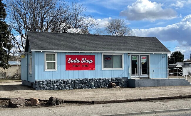
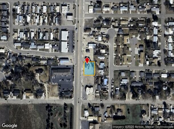
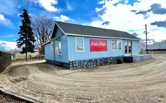
Property Record
204 N Whitley Dr, Fruitland, ID 83619
NEARBY LISTINGS FOR SALE OR LEASE
Property Detail
204 N Whitley Dr
Other Market Areas
Less Hwy Tussing
Ontario, OR-ID
LOT 4 & LOT 6 LESS HWY TUSSING SUB
F3920000004A
Payette
Storebuilding
Idaho
2025
4,6
2025
0.32 AC
960302
Idaho South Area
1,344 SF
DEMOGRAPHICS near 204 N Whitley Dr
1 Mile
3 Mile
5 Mile
2024 Total Population
4,446
16,857
31,474
2029 Population
5,205
18,667
34,985
Pop Growth 2024-2029
+ 17.07%
+ 10.74%
+ 11.16%
Average Age
39
37
39
2024 Total Households
1,611
6,092
11,691
HH Growth 2024-2029
+ 17.44%
+ 11.03%
+ 11.47%
Median Household Inc
$74,792
$56,453
$53,455
Avg Household Size
2.70
2.70
2.60
2024 Avg HH Vehicles
2.00
2.00
2.00
Median Home Value
$308,355
$217,909
$232,973
Median Year Built
1987
1977
1976
Nearby Places
Map Layers
Map Styles
 Street
 Aerial
- Restaurants
- Banks
- Shops
- Fitness
- Groceries
SALE & LEASE HISTORY
LISTING DATE
SALE/LEASE

Apr 06, 2022
For Sale
Nearby Properties
Address
Land Use
TOTAL SIZE
Lot Size
Zoning
Address
Land Use
TOTAL SIZE
Lot Size
Zoning
50.97 AC
O-I2
Address
Land Use
TOTAL SIZE
Lot Size
Zoning
260,313 SF
5.15 AC
O-C1
Address
Land Use
TOTAL SIZE
Lot Size
Zoning
10 SF
89.11 AC
O-CD
Address
Land Use
TOTAL SIZE
Lot Size
Zoning
10 SF
6.75 AC
O-PF
Address
Land Use
TOTAL SIZE
Lot Size
Zoning
35.92 AC
Address
Land Use
TOTAL SIZE
Lot Size
Zoning
88,574 SF
18.39 AC
O-PF
Address
Land Use
TOTAL SIZE
Lot Size
Zoning
4.74 AC
O-PF
Address
Land Use
TOTAL SIZE
Lot Size
Zoning
50.97 AC
O-I2
Address
Land Use
TOTAL SIZE
Lot Size
Zoning
10 SF
6.57 AC
O-CD
Address
Land Use
TOTAL SIZE
Lot Size
Zoning
36,732 SF
7.14 AC
O-CD
Address
Land Use
TOTAL SIZE
Lot Size
Zoning
4.96 AC
O-C2
Address
Land Use
TOTAL SIZE
Lot Size
Zoning
197,522 SF
19.72 AC
O-C2
Address
Land Use
TOTAL SIZE
Lot Size
Zoning
71,504 SF
5.94 AC
Address
Land Use
TOTAL SIZE
Lot Size
Zoning
10.89 AC
INDUSTRIAL
Address
Land Use
TOTAL SIZE
Lot Size
Zoning
104,456 SF
8.71 AC
O-C2H
Address
Land Use
TOTAL SIZE
Lot Size
Zoning
42,807 SF
11.02 AC
Address
Land Use
TOTAL SIZE
Lot Size
Zoning
21,715 SF
4.94 AC
Address
Land Use
TOTAL SIZE
Lot Size
Zoning
39,162 SF
3.95 AC
Address
Land Use
TOTAL SIZE
Lot Size
Zoning
9.69 AC
INDUSTRIAL
Address
Land Use
TOTAL SIZE
Lot Size
Zoning
141.70 AC
O-I2
Address
Land Use
TOTAL SIZE
Lot Size
Zoning
1 SF
9.63 AC
O-PF
Address
Land Use
TOTAL SIZE
Lot Size
Zoning
65,953 SF
4.77 AC
COMMERCIAL
Address
Land Use
TOTAL SIZE
Lot Size
Zoning
Address
Land Use
TOTAL SIZE
Lot Size
Zoning
62,348 SF
2.24 AC
O-C2
Address
Land Use
TOTAL SIZE
Lot Size
Zoning
47,605 SF
9.07 AC
O-PF
Address
Land Use
TOTAL SIZE
Lot Size
Zoning
26,855 SF
1.85 AC
Address
Land Use
TOTAL SIZE
Lot Size
Zoning
48,892 SF
5.76 AC
O-C2H
Address
Land Use
TOTAL SIZE
Lot Size
Zoning
20,361 SF
2.58 AC
O-RS
Address
Land Use
TOTAL SIZE
Lot Size
Zoning
18.67 AC
Address
Land Use
TOTAL SIZE
Lot Size
Zoning
10.83 AC
COMMERCIAL
The World's #1 Commercial Real Estate Marketplace
Connect with us
© 2025 CoStar Group
The information above has been obtained from sources believed reliable. While we do not doubt its accuracy we have not verified it and make no guarantee, warranty or representation about it. It is your responsibility to independently confirm its accuracy and completeness. Any projections, opinions, assumptions, or estimates used are for example only and do not represent the current or future performance of the property. The value of this transaction to you depends on tax and other factors which should be evaluated by your tax, financial, and legal advisors. You and your advisors should conduct a careful, independent investigation of the property to determine to your satisfaction the suitability of the property for your needs.