Property Record
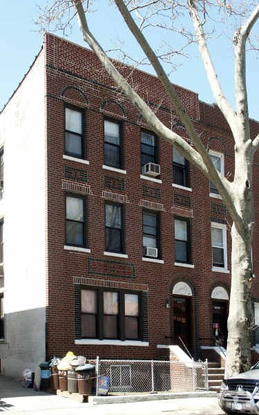
2044 73Rd St, Brooklyn, NY 11204


NEARBY LISTINGS FOR SALE OR LEASE
Property Detail
2044 73Rd St
06207-0023
DOCID-2015061000671001
Multifamilydwelling
Kings
X
New York
3604970351F
23
2024
0.07 AC
2025
Bensonhurst
026800
Long Island (New York)
5,305 SF
New York-Jersey City-White Plains, NY-NJ
DEMOGRAPHICS near 2044 73Rd St
1 mile
3 mile
5 mile
2024 Total Population
144,966
972,267
1,599,550
2029 Population
132,472
903,615
1,493,115
Pop Growth 2024-2029
(8.62%)
(7.06%)
(6.65%)
Average Age
40
40
40
2024 Total Households
47,059
333,156
572,160
HH Growth 2024-2029
(9.22%)
(7.34%)
(6.93%)
Median Household Inc
$60,506
$62,215
$69,352
Avg Household Size
3.00
2.80
2.70
2024 Avg HH Vehicles
1.00
1.00
1.00
Median Home Value
$942,096
$828,965
$808,215
Median Year Built
1946
1948
1948
Nearby Places
Map Layers
Map Styles
 Street
 Aerial
Transit
 Traffic
 Biking
Places
Listings with unknown addresses are not visible on the map
- Restaurants
- Banks
- Shops
- Fitness
- Groceries
PUBLIC TRANSPORTATION
TRANSIT/SUBWAY
20 Avenue (N Line) (N - New York MTA Subway (The Subway))
Drive
Walk
Distance
20 Avenue (N Line) (N - New York MTA Subway (The Subway))
3 min
11 min
0.6 mi
Bay Parkway (N Line) (N - New York MTA Subway (The Subway))
Drive
Walk
Distance
Bay Parkway (N Line) (N - New York MTA Subway (The Subway))
2 min
12 min
0.6 mi
20 Avenue (D,M Line) (D - New York MTA Subway (The Subway), M - New York MTA Subway (The Subway))
Drive
Walk
Distance
20 Avenue (D,M Line) (D - New York MTA Subway (The Subway), M - New York MTA Subway (The Subway))
3 min
14 min
0.7 mi
79 Street (D,M Line) (D - New York MTA Subway (The Subway), M - New York MTA Subway (The Subway))
Drive
Walk
Distance
79 Street (D,M Line) (D - New York MTA Subway (The Subway), M - New York MTA Subway (The Subway))
3 min
15 min
0.8 mi
Kings Highway (N Line) (N - New York MTA Subway (The Subway))
Drive
Walk
Distance
Kings Highway (N Line) (N - New York MTA Subway (The Subway))
3 min
15 min
0.8 mi
COMMUTER RAIL
Grasmere (Staten Island Railway - New York MTA Subway (The Subway))
Drive
Walk
Distance
Grasmere (Staten Island Railway - New York MTA Subway (The Subway))
14 min
6.7 mi
Clifton (Staten Island Railway - New York MTA Subway (The Subway))
Drive
Walk
Distance
Clifton (Staten Island Railway - New York MTA Subway (The Subway))
15 min
7.2 mi
AIRPORT
John F Kennedy International
Drive
Walk
Distance
John F Kennedy International
28 min
14.7 mi
LaGuardia
Drive
Walk
Distance
LaGuardia
32 min
17.6 mi
Newark Liberty International
Drive
Walk
Distance
Newark Liberty International
36 min
21.9 mi
Freight Ports
NY - Red Hook Container Terminal
Drive
Walk
Distance
NY - Red Hook Container Terminal
12 min
6.5 mi
Nearby Properties
Address
Land Use
TOTAL SIZE
Lot Size
Zoning
Address
Land Use
TOTAL SIZE
Lot Size
Zoning
1,524,659 SF
170.96 AC
R4
Address
Land Use
TOTAL SIZE
Lot Size
Zoning
1,078,317 SF
10.45 AC
R4
Address
Land Use
TOTAL SIZE
Lot Size
Zoning
5,800 SF
20.10 AC
R6
Address
Land Use
TOTAL SIZE
Lot Size
Zoning
5,800 SF
20.10 AC
R6
Address
Land Use
TOTAL SIZE
Lot Size
Zoning
5,800 SF
20.10 AC
R6
Address
Land Use
TOTAL SIZE
Lot Size
Zoning
5,800 SF
20.10 AC
R6
Address
Land Use
TOTAL SIZE
Lot Size
Zoning
5,800 SF
20.10 AC
R6
Address
Land Use
TOTAL SIZE
Lot Size
Zoning
5,800 SF
20.10 AC
R6
Address
Land Use
TOTAL SIZE
Lot Size
Zoning
5,800 SF
20.10 AC
R6
Address
Land Use
TOTAL SIZE
Lot Size
Zoning
5,800 SF
20.10 AC
R6
Address
Land Use
TOTAL SIZE
Lot Size
Zoning
5,800 SF
20.10 AC
R6
Address
Land Use
TOTAL SIZE
Lot Size
Zoning
12.39 AC
R6
Address
Land Use
TOTAL SIZE
Lot Size
Zoning
965,600 SF
6.65 AC
R5
Address
Land Use
TOTAL SIZE
Lot Size
Zoning
460,000 SF
3.21 AC
R6
Address
Land Use
TOTAL SIZE
Lot Size
Zoning
1,073,920 SF
16.53 AC
R6
Address
Land Use
TOTAL SIZE
Lot Size
Zoning
305,093 SF
0.60 AC
C1-9
Address
Land Use
TOTAL SIZE
Lot Size
Zoning
335,800 SF
1.51 AC
R6
Address
Land Use
TOTAL SIZE
Lot Size
Zoning
54.78 AC
PARK
Address
Land Use
TOTAL SIZE
Lot Size
Zoning
340,837 SF
0.61 AC
C1-9
Address
Land Use
TOTAL SIZE
Lot Size
Zoning
785,450 SF
14.22 AC
R6
Address
Land Use
TOTAL SIZE
Lot Size
Zoning
397,354 SF
0.61 AC
C5-2
Address
Land Use
TOTAL SIZE
Lot Size
Zoning
340,068 SF
0.58 AC
C2-8
Address
Land Use
TOTAL SIZE
Lot Size
Zoning
340,068 SF
0.58 AC
C2-8
Address
Land Use
TOTAL SIZE
Lot Size
Zoning
1,800,000 SF
12.39 AC
R6
Address
Land Use
TOTAL SIZE
Lot Size
Zoning
1,736,700 SF
20.10 AC
R6
Address
Land Use
TOTAL SIZE
Lot Size
Zoning
753,367 SF
5.11 AC
R6
Address
Land Use
TOTAL SIZE
Lot Size
Zoning
623,806 SF
4.68 AC
R6
Address
Land Use
TOTAL SIZE
Lot Size
Zoning
623,806 SF
4.68 AC
R6
Address
Land Use
TOTAL SIZE
Lot Size
Zoning
623,806 SF
4.68 AC
R6
Address
Land Use
TOTAL SIZE
Lot Size
Zoning
623,806 SF
4.68 AC
R6
The World's #1 Commercial Real Estate Marketplace
Connect with us
© 2026 CoStar Group
The information above has been obtained from sources believed reliable. While we do not doubt its accuracy we have not verified it and make no guarantee, warranty or representation about it. It is your responsibility to independently confirm its accuracy and completeness. Any projections, opinions, assumptions, or estimates used are for example only and do not represent the current or future performance of the property. The value of this transaction to you depends on tax and other factors which should be evaluated by your tax, financial, and legal advisors. You and your advisors should conduct a careful, independent investigation of the property to determine to your satisfaction the suitability of the property for your needs.