Property Record
2045 S 14Th Ave, Broadview, IL 60155
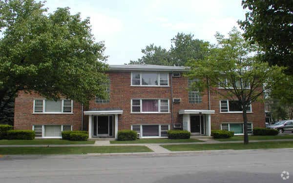

Property Detail
2045 S 14Th Ave
Chicago-Naperville-Elgin, IL-IN
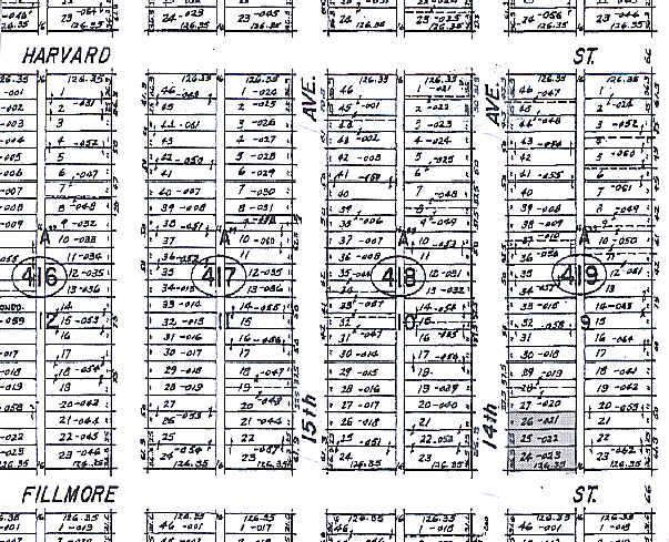
(WESTERN) ADD SUB OF WH SE SEC 15-39-12
15-15-419-023-0000
Cook
Apartment
Illinois
B and X Area of moderate flood hazard, usually the area between the limits of the 100-year and 500-year floods.
24
2023
0.11 AC
2025
West Cook
817900
Chicago
NEARBY LISTINGS FOR SALE OR LEASE
DEMOGRAPHICS near 2045 S 14Th Ave
1 mile
3 mile
5 mile
2025 Total Population
19,395
171,497
508,486
2030 Population
19,506
172,011
506,274
Pop Growth 2025-2030
+ 0.57%
+ 0.30%
(0.44%)
Average Age
41
41
40
2025 Total Households
6,782
65,044
184,866
HH Growth 2025-2030
+ 0.38%
+ 0.24%
(0.49%)
Median Household Inc
$61,066
$83,558
$84,540
Avg Household Size
2.80
2.50
2.60
2025 Avg HH Vehicles
2.00
2.00
2.00
Median Home Value
$225,665
$291,925
$317,022
Median Year Built
1949
1953
1951
Nearby Places
Map Layers
Map Styles
 Street
 Aerial
Layers
 Traffic
 Biking
Places
Listings with unknown addresses are not visible on the map
- Restaurants
- Banks
- Shops
- Fitness
- Groceries
PUBLIC TRANSPORTATION
COMMUTER RAIL
Melrose Park Station (Union Pacific West Line - Northeast Illinois Regional Commuter Railroad (Metra))
Drive
Walk
Distance
Melrose Park Station (Union Pacific West Line - Northeast Illinois Regional Commuter Railroad (Metra))
7 min
2.0 mi
Maywood Station (Union Pacific West Line - Northeast Illinois Regional Commuter Railroad (Metra))
Drive
Walk
Distance
Maywood Station (Union Pacific West Line - Northeast Illinois Regional Commuter Railroad (Metra))
6 min
2.2 mi
AIRPORT
Chicago Midway International
Drive
Walk
Distance
Chicago Midway International
20 min
10.1 mi
Chicago O'Hare International
Drive
Walk
Distance
Chicago O'Hare International
23 min
11.8 mi
Nearby Properties
Address
Land Use
TOTAL SIZE
Lot Size
Zoning
Address
Land Use
TOTAL SIZE
Lot Size
Zoning
646,763 SF
17.54 AC
Address
Land Use
TOTAL SIZE
Lot Size
Zoning
377,265 SF
25.73 AC
Address
Land Use
TOTAL SIZE
Lot Size
Zoning
Address
Land Use
TOTAL SIZE
Lot Size
Zoning
516,605 SF
16.29 AC
Address
Land Use
TOTAL SIZE
Lot Size
Zoning
233,538 SF
0.68 AC
Address
Land Use
TOTAL SIZE
Lot Size
Zoning
389,155 SF
17.69 AC
Address
Land Use
TOTAL SIZE
Lot Size
Zoning
459,659 SF
Address
Land Use
TOTAL SIZE
Lot Size
Zoning
189,908 SF
23.82 AC
Address
Land Use
TOTAL SIZE
Lot Size
Zoning
3.26 AC
Address
Land Use
TOTAL SIZE
Lot Size
Zoning
184,970 SF
11.64 AC
Address
Land Use
TOTAL SIZE
Lot Size
Zoning
479,130 SF
15.80 AC
Address
Land Use
TOTAL SIZE
Lot Size
Zoning
108,276 SF
3.80 AC
Address
Land Use
TOTAL SIZE
Lot Size
Zoning
220,137 SF
13.24 AC
Address
Land Use
TOTAL SIZE
Lot Size
Zoning
141,800 SF
3.77 AC
Address
Land Use
TOTAL SIZE
Lot Size
Zoning
225,000 SF
5.82 AC
Address
Land Use
TOTAL SIZE
Lot Size
Zoning
1.65 AC
Address
Land Use
TOTAL SIZE
Lot Size
Zoning
153,954 SF
14.36 AC
Address
Land Use
TOTAL SIZE
Lot Size
Zoning
101,146 SF
2.24 AC
Address
Land Use
TOTAL SIZE
Lot Size
Zoning
89,919 SF
2.87 AC
Address
Land Use
TOTAL SIZE
Lot Size
Zoning
193,511 SF
17.89 AC
Address
Land Use
TOTAL SIZE
Lot Size
Zoning
53,800 SF
0.88 AC
Address
Land Use
TOTAL SIZE
Lot Size
Zoning
318,305 SF
12.71 AC
Address
Land Use
TOTAL SIZE
Lot Size
Zoning
62,844 SF
3.24 AC
Address
Land Use
TOTAL SIZE
Lot Size
Zoning
120,929 SF
9 AC
Address
Land Use
TOTAL SIZE
Lot Size
Zoning
150,893 SF
Address
Land Use
TOTAL SIZE
Lot Size
Zoning
103,050 SF
7.49 AC
Address
Land Use
TOTAL SIZE
Lot Size
Zoning
42,720 SF
0.98 AC
Address
Land Use
TOTAL SIZE
Lot Size
Zoning
242,662 SF
21.02 AC
Address
Land Use
TOTAL SIZE
Lot Size
Zoning
Address
Land Use
TOTAL SIZE
Lot Size
Zoning
274,375 SF
9.35 AC
The World's #1 Commercial Real Estate Marketplace
Connect with us
© 2026 CoStar Group
The information above has been obtained from sources believed reliable. While we do not doubt its accuracy we have not verified it and make no guarantee, warranty or representation about it. It is your responsibility to independently confirm its accuracy and completeness. Any projections, opinions, assumptions, or estimates used are for example only and do not represent the current or future performance of the property. The value of this transaction to you depends on tax and other factors which should be evaluated by your tax, financial, and legal advisors. You and your advisors should conduct a careful, independent investigation of the property to determine to your satisfaction the suitability of the property for your needs.