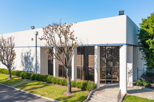
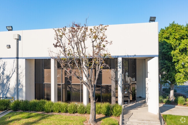
Property Record
20455 S Reeves Ave, Long Beach, CA 90810

NEARBY LISTINGS FOR SALE OR LEASE
Property Detail
20455 S Reeves Ave
Los Angeles-Long Beach-Glendale, CA
City Of Carson
7318-014-018
*TR=PARCEL MAP AS PER BK 121 P 34-35 OF P M*(EX OF R/W) LOT 2
Warehouse
Los Angeles
X
California
06037C1955F
2
2024
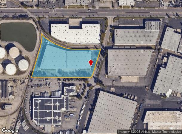
5.16 AC
2025
Carson
980025
Los Angeles
110,190 SF
DEMOGRAPHICS near 20455 S Reeves Ave
1 Mile
3 Mile
5 Mile
2024 Total Population
9,424
158,311
584,323
2029 Population
9,031
152,456
562,525
Pop Growth 2024-2029
(4.17%)
(3.70%)
(3.73%)
Average Age
41
40
38
2024 Total Households
2,732
46,233
169,635
HH Growth 2024-2029
(4.50%)
(3.98%)
(3.96%)
Median Household Inc
$85,951
$74,992
$69,830
Avg Household Size
3.40
3.20
3.30
2024 Avg HH Vehicles
2.00
2.00
2.00
Median Home Value
$604,332
$625,844
$632,790
Median Year Built
1963
1961
1960
Nearby Places
Map Layers
Map Styles
 Street
 Aerial
- Restaurants
- Banks
- Shops
- Fitness
- Groceries
PUBLIC TRANSPORTATION
AIRPORT
Long Beach (Daugherty Field)
DRIVE
WALK
Distance
Long Beach (Daugherty Field)
12 min
6.4 mi
Los Angeles International
DRIVE
WALK
Distance
Los Angeles International
24 min
16.4 mi
John Wayne/Orange County
DRIVE
WALK
Distance
John Wayne/Orange County
34 min
26.6 mi
Freight Ports
Port of Long Beach
DRIVE
WALK
Distance
Port of Long Beach
13 min
8.2 mi
Nearby Properties
Address
Land Use
TOTAL SIZE
Lot Size
Zoning
Address
Land Use
TOTAL SIZE
Lot Size
Zoning
236,582 SF
425.41 AC
CAMH*
Address
Land Use
TOTAL SIZE
Lot Size
Zoning
64,456 SF
11.71 AC
CASP-10*
Address
Land Use
TOTAL SIZE
Lot Size
Zoning
18,791 SF
54.78 AC
LCM2
Address
Land Use
TOTAL SIZE
Lot Size
Zoning
206,715 SF
19.23 AC
CAMH*
Address
Land Use
TOTAL SIZE
Lot Size
Zoning
108,891 SF
224.14 AC
CAMH*
Address
Land Use
TOTAL SIZE
Lot Size
Zoning
285,314 SF
14.28 AC
CAMH*
Address
Land Use
TOTAL SIZE
Lot Size
Zoning
513,520 SF
19.09 AC
LBPD26
Address
Land Use
TOTAL SIZE
Lot Size
Zoning
383,109 SF
17 AC
LCM2
Address
Land Use
TOTAL SIZE
Lot Size
Zoning
169,400 SF
8.11 AC
COMH*
Address
Land Use
TOTAL SIZE
Lot Size
Zoning
402,197 SF
27.29 AC
COMH*
Address
Land Use
TOTAL SIZE
Lot Size
Zoning
194,230 SF
2.58 AC
LBR4N
Address
Land Use
TOTAL SIZE
Lot Size
Zoning
1,800 SF
124.45 AC
CAMH*
Address
Land Use
TOTAL SIZE
Lot Size
Zoning
213,408 SF
13.81 AC
LBR4R
Address
Land Use
TOTAL SIZE
Lot Size
Zoning
350,896 SF
13.43 AC
LBML*
Address
Land Use
TOTAL SIZE
Lot Size
Zoning
14.80 AC
CAMH*
Address
Land Use
TOTAL SIZE
Lot Size
Zoning
340,121 SF
13 AC
LCM2
Address
Land Use
TOTAL SIZE
Lot Size
Zoning
1.27 AC
CACR&D*
Address
Land Use
TOTAL SIZE
Lot Size
Zoning
430,706 SF
18.95 AC
CASP-4*
Address
Land Use
TOTAL SIZE
Lot Size
Zoning
178,323 SF
12.23 AC
CACR&D&MUR
Address
Land Use
TOTAL SIZE
Lot Size
Zoning
169,056 SF
10.04 AC
LBR4R
Address
Land Use
TOTAL SIZE
Lot Size
Zoning
130,977 SF
5.55 AC
LCM2*
Address
Land Use
TOTAL SIZE
Lot Size
Zoning
157,320 SF
7.18 AC
COMH*
Address
Land Use
TOTAL SIZE
Lot Size
Zoning
496,472 SF
21.57 AC
CAMH*
Address
Land Use
TOTAL SIZE
Lot Size
Zoning
146,820 SF
7.83 AC
LCM2*
Address
Land Use
TOTAL SIZE
Lot Size
Zoning
622,175 SF
14.25 AC
LCM11/2*
Address
Land Use
TOTAL SIZE
Lot Size
Zoning
71,479 SF
3.11 AC
CAML*
Address
Land Use
TOTAL SIZE
Lot Size
Zoning
87,211 SF
3.67 AC
CAMH*
Address
Land Use
TOTAL SIZE
Lot Size
Zoning
105,853 SF
9.98 AC
CACA*
Address
Land Use
TOTAL SIZE
Lot Size
Zoning
291,508 SF
15.21 AC
LBR4R
The World's #1 Commercial Real Estate Marketplace
Connect with us
© 2026 CoStar Group
The information above has been obtained from sources believed reliable. While we do not doubt its accuracy we have not verified it and make no guarantee, warranty or representation about it. It is your responsibility to independently confirm its accuracy and completeness. Any projections, opinions, assumptions, or estimates used are for example only and do not represent the current or future performance of the property. The value of this transaction to you depends on tax and other factors which should be evaluated by your tax, financial, and legal advisors. You and your advisors should conduct a careful, independent investigation of the property to determine to your satisfaction the suitability of the property for your needs.