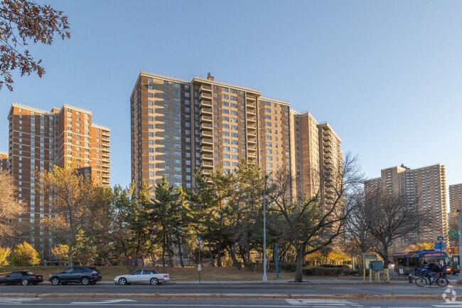
Property Record
2049 Bartow Ave, Bronx, NY 10475


NEARBY LISTINGS FOR SALE OR LEASE
Property Detail
2049 Bartow Ave
05141-0120
Adelphi Hms Co Inc 26Th Ward P
Cooperative
Bronx
AE
New York
36119C0339F
120
2024
115.90 AC
2025
Co-Op City
046205
Westchester/So Connecticut
1,324,339 SF
New York-Jersey City-White Plains, NY-NJ
DEMOGRAPHICS near 2049 Bartow Ave
1 mile
3 mile
5 mile
2024 Total Population
47,862
440,445
1,266,376
2029 Population
43,111
403,304
1,179,127
Pop Growth 2024-2029
(9.93%)
(8.43%)
(6.89%)
Average Age
45
40
39
2024 Total Households
19,286
162,247
456,391
HH Growth 2024-2029
(10.37%)
(8.93%)
(7.40%)
Median Household Inc
$58,756
$59,312
$53,752
Avg Household Size
2.30
2.60
2.60
2024 Avg HH Vehicles
1.00
1.00
1.00
Median Home Value
$105,556
$512,075
$526,879
Median Year Built
1964
1951
1951
Nearby Places
Map Layers
Map Styles
 Street
 Aerial
Transit
 Traffic
 Biking
Places
Listings with unknown addresses are not visible on the map
- Restaurants
- Banks
- Shops
- Fitness
- Groceries
PUBLIC TRANSPORTATION
TRANSIT/SUBWAY
Baychester Avenue (5 - New York MTA Subway (The Subway))
Drive
Walk
Distance
Baychester Avenue (5 - New York MTA Subway (The Subway))
3 min
15 min
0.8 mi
Eastchester-Dyre Ave (5 - New York MTA Subway (The Subway))
Drive
Walk
Distance
Eastchester-Dyre Ave (5 - New York MTA Subway (The Subway))
2 min
16 min
0.9 mi
COMMUTER RAIL
Woodlawn Station (Harlem Line - Metro-North Commuter Railroad Company (Metro-North))
Drive
Walk
Distance
Woodlawn Station (Harlem Line - Metro-North Commuter Railroad Company (Metro-North))
7 min
3.4 mi
Williams Bridge Station (Harlem Line - Metro-North Commuter Railroad Company (Metro-North))
Drive
Walk
Distance
Williams Bridge Station (Harlem Line - Metro-North Commuter Railroad Company (Metro-North))
7 min
3.5 mi
AIRPORT
LaGuardia
Drive
Walk
Distance
LaGuardia
22 min
11.9 mi
Westchester County
Drive
Walk
Distance
Westchester County
29 min
19.1 mi
John F Kennedy International
Drive
Walk
Distance
John F Kennedy International
29 min
19.5 mi
Freight Ports
NY - Red Hook Container Terminal
Drive
Walk
Distance
NY - Red Hook Container Terminal
37 min
22.4 mi
SALE & LEASE HISTORY
LISTING DATE
SALE/LEASE

Mar 17, 2017
For Lease
Nearby Properties
Address
Land Use
TOTAL SIZE
Lot Size
Zoning
Address
Land Use
TOTAL SIZE
Lot Size
Zoning
115.90 AC
R6
Address
Land Use
TOTAL SIZE
Lot Size
Zoning
115.90 AC
R6
Address
Land Use
TOTAL SIZE
Lot Size
Zoning
115.90 AC
R6
Address
Land Use
TOTAL SIZE
Lot Size
Zoning
115.90 AC
R6
Address
Land Use
TOTAL SIZE
Lot Size
Zoning
115.90 AC
R6
Address
Land Use
TOTAL SIZE
Lot Size
Zoning
115.90 AC
R6
Address
Land Use
TOTAL SIZE
Lot Size
Zoning
115.90 AC
R6
Address
Land Use
TOTAL SIZE
Lot Size
Zoning
115.90 AC
R6
Address
Land Use
TOTAL SIZE
Lot Size
Zoning
115.90 AC
R6
Address
Land Use
TOTAL SIZE
Lot Size
Zoning
115.90 AC
R6
Address
Land Use
TOTAL SIZE
Lot Size
Zoning
115.90 AC
R6
Address
Land Use
TOTAL SIZE
Lot Size
Zoning
115.90 AC
R6
Address
Land Use
TOTAL SIZE
Lot Size
Zoning
115.90 AC
R6
Address
Land Use
TOTAL SIZE
Lot Size
Zoning
115.90 AC
R6
Address
Land Use
TOTAL SIZE
Lot Size
Zoning
115.90 AC
R6
Address
Land Use
TOTAL SIZE
Lot Size
Zoning
115.90 AC
R6
Address
Land Use
TOTAL SIZE
Lot Size
Zoning
115.90 AC
R6
Address
Land Use
TOTAL SIZE
Lot Size
Zoning
115.90 AC
R6
Address
Land Use
TOTAL SIZE
Lot Size
Zoning
115.90 AC
R6
Address
Land Use
TOTAL SIZE
Lot Size
Zoning
115.90 AC
R6
Address
Land Use
TOTAL SIZE
Lot Size
Zoning
115.90 AC
R6
Address
Land Use
TOTAL SIZE
Lot Size
Zoning
115.90 AC
R6
Address
Land Use
TOTAL SIZE
Lot Size
Zoning
115.90 AC
R6
Address
Land Use
TOTAL SIZE
Lot Size
Zoning
115.90 AC
R6
Address
Land Use
TOTAL SIZE
Lot Size
Zoning
115.90 AC
R6
Address
Land Use
TOTAL SIZE
Lot Size
Zoning
550,000 SF
8.75 AC
M1-1
Address
Land Use
TOTAL SIZE
Lot Size
Zoning
44.83 AC
R6
Address
Land Use
TOTAL SIZE
Lot Size
Zoning
44.83 AC
R6
Address
Land Use
TOTAL SIZE
Lot Size
Zoning
1,427,393 SF
39.94 AC
R4
The World's #1 Commercial Real Estate Marketplace
Connect with us
© 2026 CoStar Group
The information above has been obtained from sources believed reliable. While we do not doubt its accuracy we have not verified it and make no guarantee, warranty or representation about it. It is your responsibility to independently confirm its accuracy and completeness. Any projections, opinions, assumptions, or estimates used are for example only and do not represent the current or future performance of the property. The value of this transaction to you depends on tax and other factors which should be evaluated by your tax, financial, and legal advisors. You and your advisors should conduct a careful, independent investigation of the property to determine to your satisfaction the suitability of the property for your needs.