Property Record
205 Willow St, South Hamilton, MA 01982
NEARBY LISTINGS FOR SALE OR LEASE
Property Detail
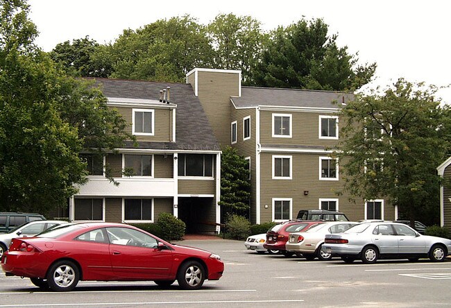
205 Willow St
HAMI-000055-000004-000225
Essex
Officecondo
Massachusetts
X
225
25009C0407G
1.47 AC
2025
Essex/Gloucester
2025
Boston
215102
Boston-Cambridge-Newton, MA-NH
1,024 SF
DEMOGRAPHICS near 205 Willow St
1 mile
3 mile
5 mile
2024 Total Population
4,797
22,169
87,905
2029 Population
4,806
22,216
87,710
Pop Growth 2024-2029
+ 0.19%
+ 0.21%
(0.22%)
Average Age
40
41
42
2024 Total Households
1,594
7,835
33,798
HH Growth 2024-2029
+ 0.25%
+ 0.22%
(0.33%)
Median Household Inc
$136,921
$116,526
$104,884
Avg Household Size
2.70
2.60
2.40
2024 Avg HH Vehicles
2.00
2.00
2.00
Median Home Value
$668,831
$688,048
$638,048
Median Year Built
1954
1963
1961
Nearby Places
Map Layers
Map Styles
 Street
 Aerial
Transit
 Traffic
 Biking
Places
Listings with unknown addresses are not visible on the map
- Restaurants
- Banks
- Shops
- Fitness
- Groceries
PUBLIC TRANSPORTATION
TRANSIT/SUBWAY
Hamilton/Wenham (Newburyport/Rockport Line - Massachusetts Bay Transportation Authority Commuter Rail (Purple Line))
Drive
Walk
Distance
Hamilton/Wenham (Newburyport/Rockport Line - Massachusetts Bay Transportation Authority Commuter Rail (Purple Line))
3 min
8 min
0.4 mi
COMMUTER RAIL
Hamilton/Wenham (Newburyport/Rockport Line - Massachusetts Bay Transportation Authority Commuter Rail (Purple Line))
Drive
Walk
Distance
Hamilton/Wenham (Newburyport/Rockport Line - Massachusetts Bay Transportation Authority Commuter Rail (Purple Line))
3 min
8 min
0.4 mi
North Beverly (Newburyport/Rockport Line - Massachusetts Bay Transportation Authority Commuter Rail (Purple Line))
Drive
Walk
Distance
North Beverly (Newburyport/Rockport Line - Massachusetts Bay Transportation Authority Commuter Rail (Purple Line))
7 min
2.6 mi
AIRPORT
General Edward Lawrence Logan International
Drive
Walk
Distance
General Edward Lawrence Logan International
42 min
22.0 mi
Portsmouth International at Pease
Drive
Walk
Distance
Portsmouth International at Pease
59 min
40.6 mi
Manchester Boston Regional
Drive
Walk
Distance
Manchester Boston Regional
81 min
46.6 mi
Freight Ports
Port of Boston
Drive
Walk
Distance
Port of Boston
46 min
27.7 mi
Nearby Properties
Address
Land Use
TOTAL SIZE
Lot Size
Zoning
Address
Land Use
TOTAL SIZE
Lot Size
Zoning
228,295 SF
12.50 AC
RMD
Address
Land Use
TOTAL SIZE
Lot Size
Zoning
172.50 AC
R3
Address
Land Use
TOTAL SIZE
Lot Size
Zoning
64,451 SF
102.50 AC
R1A
Address
Land Use
TOTAL SIZE
Lot Size
Zoning
212,956 SF
44.90 AC
R1B
Address
Land Use
TOTAL SIZE
Lot Size
Zoning
207,237 SF
16.73 AC
RMD
Address
Land Use
TOTAL SIZE
Lot Size
Zoning
195,527 SF
16.60 AC
CG
Address
Land Use
TOTAL SIZE
Lot Size
Zoning
358,662 SF
36.98 AC
IR
Address
Land Use
TOTAL SIZE
Lot Size
Zoning
46,504 SF
48 AC
RA
Address
Land Use
TOTAL SIZE
Lot Size
Zoning
37,553 SF
238.29 AC
IR
Address
Land Use
TOTAL SIZE
Lot Size
Zoning
123,171 SF
9.09 AC
R10
Address
Land Use
TOTAL SIZE
Lot Size
Zoning
207,095 SF
IR
Address
Land Use
TOTAL SIZE
Lot Size
Zoning
150,183 SF
38.84 AC
IR
Address
Land Use
TOTAL SIZE
Lot Size
Zoning
328.40 AC
R1A
Address
Land Use
TOTAL SIZE
Lot Size
Zoning
79,964 SF
7.78 AC
R15
Address
Land Use
TOTAL SIZE
Lot Size
Zoning
68,740 SF
6.50 AC
IR
Address
Land Use
TOTAL SIZE
Lot Size
Zoning
156,675 SF
IR
Address
Land Use
TOTAL SIZE
Lot Size
Zoning
57,157 SF
7.80 AC
Address
Land Use
TOTAL SIZE
Lot Size
Zoning
97,396 SF
IR
Address
Land Use
TOTAL SIZE
Lot Size
Zoning
80,154 SF
5.85 AC
IR
Address
Land Use
TOTAL SIZE
Lot Size
Zoning
2,176 SF
548.70 AC
RA
Address
Land Use
TOTAL SIZE
Lot Size
Zoning
2,705 SF
24.60 AC
Address
Land Use
TOTAL SIZE
Lot Size
Zoning
142,596 SF
10.93 AC
IR
Address
Land Use
TOTAL SIZE
Lot Size
Zoning
127,674 SF
14.04 AC
IR
Address
Land Use
TOTAL SIZE
Lot Size
Zoning
43.68 AC
Address
Land Use
TOTAL SIZE
Lot Size
Zoning
475 AC
RRA
Address
Land Use
TOTAL SIZE
Lot Size
Zoning
104,501 SF
IR
Address
Land Use
TOTAL SIZE
Lot Size
Zoning
65,211 SF
4.90 AC
CG
Address
Land Use
TOTAL SIZE
Lot Size
Zoning
126,838 SF
4.01 AC
IR
Address
Land Use
TOTAL SIZE
Lot Size
Zoning
55,911 SF
6.10 AC
IR
Address
Land Use
TOTAL SIZE
Lot Size
Zoning
38,975 SF
4.40 AC
R1A
The World's #1 Commercial Real Estate Marketplace
Connect with us
© 2026 CoStar Group
The information above has been obtained from sources believed reliable. While we do not doubt its accuracy we have not verified it and make no guarantee, warranty or representation about it. It is your responsibility to independently confirm its accuracy and completeness. Any projections, opinions, assumptions, or estimates used are for example only and do not represent the current or future performance of the property. The value of this transaction to you depends on tax and other factors which should be evaluated by your tax, financial, and legal advisors. You and your advisors should conduct a careful, independent investigation of the property to determine to your satisfaction the suitability of the property for your needs.