Property Record
2050 Trumble Rd, Perris, CA 92571


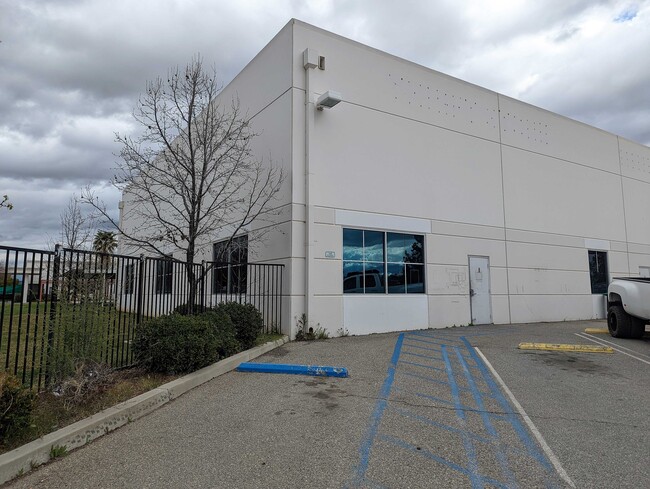

Property Detail
2050 Trumble Rd
329-020-038
3.87 ACRES M/L IN POR LOT 509 MB 014/063 ROMOLA FARMS 6A
Lightindustrial
RIVERSIDE
MSC
California
C and X Area of minimal flood hazard, usually depicted on FIRMs as above the 500-year flood level.
509
2024
3.87 AC
2025
South Riverside
042730
Inland Empire (California)
54,282 SF
Riverside-San Bernardino-Ontario, CA
NEARBY LISTINGS FOR SALE OR LEASE
DEMOGRAPHICS near 2050 Trumble Rd
1 mile
3 mile
5 mile
2025 Total Population
2,408
38,363
141,576
2030 Population
2,472
39,986
146,246
Pop Growth 2025-2030
+ 2.66%
+ 4.23%
+ 3.30%
Average Age
36
40
38
2025 Total Households
641
12,295
42,301
HH Growth 2025-2030
+ 2.50%
+ 3.86%
+ 2.95%
Median Household Inc
$88,549
$77,465
$76,376
Avg Household Size
3.50
3.00
3.20
2025 Avg HH Vehicles
3.00
2.00
2.00
Median Home Value
$484,693
$455,547
$468,589
Median Year Built
1994
1993
1991
Nearby Places
Map Layers
Map Styles
 Street
 Aerial
Layers
 Traffic
 Biking
Places
Listings with unknown addresses are not visible on the map
- Restaurants
- Banks
- Shops
- Fitness
- Groceries
PUBLIC TRANSPORTATION
COMMUTER RAIL
Drive
Walk
Distance
4 min
1.8 mi
Drive
Walk
Distance
8 min
4.6 mi
AIRPORT
Ontario International
Drive
Walk
Distance
Ontario International
47 min
37.7 mi
SALE & LEASE HISTORY
LISTING DATE
SALE/LEASE

Mar 23, 2022
For Lease
Mar 06, 2020
For Sale
Nearby Properties
Address
Land Use
TOTAL SIZE
Lot Size
Zoning
Address
Land Use
TOTAL SIZE
Lot Size
Zoning
123,058 SF
17.09 AC
R3
Address
Land Use
TOTAL SIZE
Lot Size
Zoning
28.13 AC
RR
Address
Land Use
TOTAL SIZE
Lot Size
Zoning
34.84 AC
Address
Land Use
TOTAL SIZE
Lot Size
Zoning
57,600 SF
51.69 AC
Address
Land Use
TOTAL SIZE
Lot Size
Zoning
9.22 AC
CBOOK
Address
Land Use
TOTAL SIZE
Lot Size
Zoning
40,349 SF
9.89 AC
R3
Address
Land Use
TOTAL SIZE
Lot Size
Zoning
104,208 SF
10.96 AC
Address
Land Use
TOTAL SIZE
Lot Size
Zoning
75,109 SF
9.39 AC
Address
Land Use
TOTAL SIZE
Lot Size
Zoning
1,080 SF
9.53 AC
A02
Address
Land Use
TOTAL SIZE
Lot Size
Zoning
122,824 SF
5.18 AC
CC
Address
Land Use
TOTAL SIZE
Lot Size
Zoning
13.95 AC
Address
Land Use
TOTAL SIZE
Lot Size
Zoning
50,000 SF
5.36 AC
CC
Address
Land Use
TOTAL SIZE
Lot Size
Zoning
1,018,178 SF
57.91 AC
Address
Land Use
TOTAL SIZE
Lot Size
Zoning
3,750 SF
37.79 AC
GI
Address
Land Use
TOTAL SIZE
Lot Size
Zoning
97,942 SF
11 AC
Address
Land Use
TOTAL SIZE
Lot Size
Zoning
86,590 SF
10.97 AC
MM
Address
Land Use
TOTAL SIZE
Lot Size
Zoning
35,600 SF
3.19 AC
Address
Land Use
TOTAL SIZE
Lot Size
Zoning
41,840 SF
8.92 AC
Address
Land Use
TOTAL SIZE
Lot Size
Zoning
24,889 SF
42.36 AC
Address
Land Use
TOTAL SIZE
Lot Size
Zoning
13,489 SF
6.18 AC
R3
Address
Land Use
TOTAL SIZE
Lot Size
Zoning
29,598 SF
3.26 AC
The World's #1 Commercial Real Estate Marketplace
Connect with us
© 2026 CoStar Group
The information above has been obtained from sources believed reliable. While we do not doubt its accuracy we have not verified it and make no guarantee, warranty or representation about it. It is your responsibility to independently confirm its accuracy and completeness. Any projections, opinions, assumptions, or estimates used are for example only and do not represent the current or future performance of the property. The value of this transaction to you depends on tax and other factors which should be evaluated by your tax, financial, and legal advisors. You and your advisors should conduct a careful, independent investigation of the property to determine to your satisfaction the suitability of the property for your needs.