Property Record
20602 E 81St St S, Broken Arrow, OK 74014
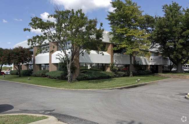

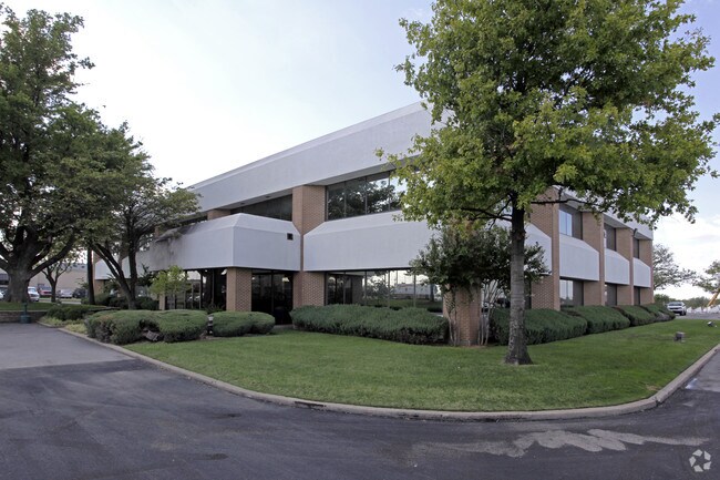
Property Detail
20602 E 81St St S
730007437
07-18-15 A TR OF LAND IN S2 SE DESC AS FOLLOWS: BEG PT ON SERLY LN OF SEC 7 SD PT BEING 1680' WSTRLY OF SE COR OF SEC 7 -ESTE
Privateutilityelectricwatergasnuclearsolarwindetc
WAGONER
B and X Area of moderate flood hazard, usually the area between the limits of the 100-year and 500-year floods.
Oklahoma
2025
24.37 AC
2025
Wagoner County
030502
Tulsa
7,200 SF
Tulsa, OK
NEARBY LISTINGS FOR SALE OR LEASE
DEMOGRAPHICS near 20602 E 81St St S
1 mile
3 mile
5 mile
2025 Total Population
2,280
36,191
118,818
2030 Population
2,498
38,541
125,096
Pop Growth 2025-2030
+ 9.56%
+ 6.49%
+ 5.28%
Average Age
40
39
39
2025 Total Households
838
14,031
44,339
HH Growth 2025-2030
+ 9.19%
+ 6.31%
+ 5.16%
Median Household Inc
$84,375
$79,461
$86,597
Avg Household Size
2.70
2.50
2.60
2025 Avg HH Vehicles
2.00
2.00
2.00
Median Home Value
$221,601
$251,619
$254,769
Median Year Built
1984
1991
1995
Nearby Places
Map Layers
Map Styles
 Street
 Aerial
Layers
 Traffic
 Biking
Places
Listings with unknown addresses are not visible on the map
- Restaurants
- Banks
- Shops
- Fitness
- Groceries
PUBLIC TRANSPORTATION
AIRPORT
Tulsa International
Drive
Walk
Distance
Tulsa International
27 min
18.4 mi
Nearby Properties
Address
Land Use
TOTAL SIZE
Lot Size
Zoning
Address
Land Use
TOTAL SIZE
Lot Size
Zoning
125,902 SF
19.15 AC
CH
Address
Land Use
TOTAL SIZE
Lot Size
Zoning
75,444 SF
23.92 AC
R1
Address
Land Use
TOTAL SIZE
Lot Size
Zoning
58,695 SF
5.34 AC
RM
Address
Land Use
TOTAL SIZE
Lot Size
Zoning
77,260 SF
0.58 AC
R3
Address
Land Use
TOTAL SIZE
Lot Size
Zoning
67,149 SF
28.56 AC
R2
Address
Land Use
TOTAL SIZE
Lot Size
Zoning
58,627 SF
6.07 AC
CG
Address
Land Use
TOTAL SIZE
Lot Size
Zoning
363,154 SF
23.09 AC
IL
Address
Land Use
TOTAL SIZE
Lot Size
Zoning
39,733 SF
9.36 AC
A1
Address
Land Use
TOTAL SIZE
Lot Size
Zoning
11,601 SF
38.18 AC
RS1
Address
Land Use
TOTAL SIZE
Lot Size
Zoning
13,691 SF
2.04 AC
CH
Address
Land Use
TOTAL SIZE
Lot Size
Zoning
28,071 SF
19 AC
Address
Land Use
TOTAL SIZE
Lot Size
Zoning
28,348 SF
0.90 AC
DM
Address
Land Use
TOTAL SIZE
Lot Size
Zoning
51,741 SF
2.41 AC
R3
Address
Land Use
TOTAL SIZE
Lot Size
Zoning
60,460 SF
2.28 AC
NCU
Address
Land Use
TOTAL SIZE
Lot Size
Zoning
10,140 SF
18.57 AC
R1
Address
Land Use
TOTAL SIZE
Lot Size
Zoning
23,283 SF
3.94 AC
A1
Address
Land Use
TOTAL SIZE
Lot Size
Zoning
20,633 SF
5.53 AC
Address
Land Use
TOTAL SIZE
Lot Size
Zoning
314,047 SF
12.60 AC
RM
Address
Land Use
TOTAL SIZE
Lot Size
Zoning
12,497 SF
3.31 AC
R1
Address
Land Use
TOTAL SIZE
Lot Size
Zoning
279,184 SF
14.50 AC
RM
Address
Land Use
TOTAL SIZE
Lot Size
Zoning
30,482 SF
4.43 AC
R1
Address
Land Use
TOTAL SIZE
Lot Size
Zoning
27,477 SF
5.79 AC
R1
Address
Land Use
TOTAL SIZE
Lot Size
Zoning
33,004 SF
3.23 AC
R2
Address
Land Use
TOTAL SIZE
Lot Size
Zoning
255,328 SF
27.50 AC
IL
Address
Land Use
TOTAL SIZE
Lot Size
Zoning
11,100 SF
5.30 AC
R1
Address
Land Use
TOTAL SIZE
Lot Size
Zoning
Address
Land Use
TOTAL SIZE
Lot Size
Zoning
21,960 SF
0.24 AC
CH
Address
Land Use
TOTAL SIZE
Lot Size
Zoning
38,842 SF
0.96 AC
DM
Address
Land Use
TOTAL SIZE
Lot Size
Zoning
10,700 SF
5.99 AC
RM
The World's #1 Commercial Real Estate Marketplace
Connect with us
© 2026 CoStar Group
The information above has been obtained from sources believed reliable. While we do not doubt its accuracy we have not verified it and make no guarantee, warranty or representation about it. It is your responsibility to independently confirm its accuracy and completeness. Any projections, opinions, assumptions, or estimates used are for example only and do not represent the current or future performance of the property. The value of this transaction to you depends on tax and other factors which should be evaluated by your tax, financial, and legal advisors. You and your advisors should conduct a careful, independent investigation of the property to determine to your satisfaction the suitability of the property for your needs.