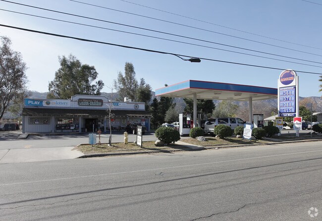
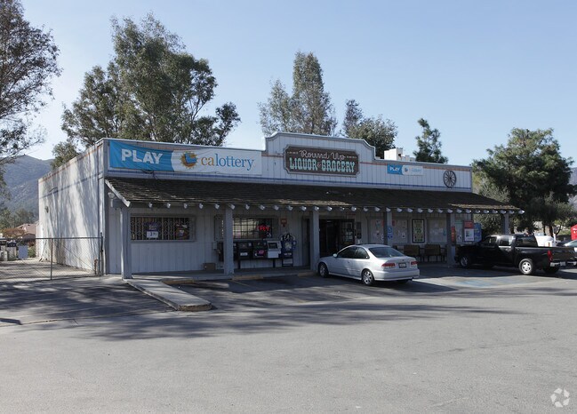
Property Record
20651 Palomar St, Wildomar, CA 92595


Property Detail
20651 Palomar St
368-060-019
2.07 ACRES M/L IN POR LOT 14 BLK L MB 004/174 SD BLOCKS K,L & M ELSINORE
Supermarket
Riverside
C1CP
California
B and X Area of moderate flood hazard, usually the area between the limits of the 100-year and 500-year floods.
14
2024
2.07 AC
2025
South Riverside
043271
Inland Empire (California)
9,621 SF
Riverside-San Bernardino-Ontario, CA
NEARBY LISTINGS FOR SALE OR LEASE
DEMOGRAPHICS near 20651 Palomar St
1 mile
3 mile
5 mile
2025 Total Population
6,134
38,181
105,884
2030 Population
6,260
39,069
108,404
Pop Growth 2025-2030
+ 2.05%
+ 2.33%
+ 2.38%
Average Age
39
38
38
2025 Total Households
1,863
11,730
32,050
HH Growth 2025-2030
+ 1.66%
+ 1.94%
+ 1.98%
Median Household Inc
$102,783
$106,141
$109,927
Avg Household Size
3.20
3.20
3.20
2025 Avg HH Vehicles
2.00
2.00
2.00
Median Home Value
$579,078
$640,488
$673,655
Median Year Built
1986
1996
1998
Nearby Places
Map Layers
Map Styles
 Street
 Aerial
Layers
 Traffic
 Biking
Places
Listings with unknown addresses are not visible on the map
- Restaurants
- Banks
- Shops
- Fitness
- Groceries
PUBLIC TRANSPORTATION
AIRPORT
Ontario International
Drive
Walk
Distance
Ontario International
51 min
41.5 mi
Nearby Properties
Address
Land Use
TOTAL SIZE
Lot Size
Zoning
Address
Land Use
TOTAL SIZE
Lot Size
Zoning
83,279 SF
7.20 AC
Address
Land Use
TOTAL SIZE
Lot Size
Zoning
13,834 SF
18.97 AC
Address
Land Use
TOTAL SIZE
Lot Size
Zoning
37,073 SF
4.91 AC
Address
Land Use
TOTAL SIZE
Lot Size
Zoning
49,031 SF
7.18 AC
RR
Address
Land Use
TOTAL SIZE
Lot Size
Zoning
69,299 SF
9.88 AC
RR
Address
Land Use
TOTAL SIZE
Lot Size
Zoning
60,949 SF
1.37 AC
Address
Land Use
TOTAL SIZE
Lot Size
Zoning
65,742 SF
4.97 AC
Address
Land Use
TOTAL SIZE
Lot Size
Zoning
115,825 SF
9.46 AC
R3
Address
Land Use
TOTAL SIZE
Lot Size
Zoning
36,140 SF
2.33 AC
C1CP
Address
Land Use
TOTAL SIZE
Lot Size
Zoning
33,667 SF
3.73 AC
CPS
Address
Land Use
TOTAL SIZE
Lot Size
Zoning
57,687 SF
6.08 AC
CPS
Address
Land Use
TOTAL SIZE
Lot Size
Zoning
22,316 SF
2.49 AC
CPS
Address
Land Use
TOTAL SIZE
Lot Size
Zoning
76,319 SF
5.77 AC
Address
Land Use
TOTAL SIZE
Lot Size
Zoning
17,272 SF
1.51 AC
C1CP
Address
Land Use
TOTAL SIZE
Lot Size
Zoning
20.66 AC
Address
Land Use
TOTAL SIZE
Lot Size
Zoning
12.79 AC
CPS
Address
Land Use
TOTAL SIZE
Lot Size
Zoning
42,856 SF
3.85 AC
Address
Land Use
TOTAL SIZE
Lot Size
Zoning
33,412 SF
7.75 AC
C1CP
Address
Land Use
TOTAL SIZE
Lot Size
Zoning
87,510 SF
4.75 AC
CPS
Address
Land Use
TOTAL SIZE
Lot Size
Zoning
20,650 SF
2.19 AC
R1
Address
Land Use
TOTAL SIZE
Lot Size
Zoning
2,911 SF
1.06 AC
CPS
Address
Land Use
TOTAL SIZE
Lot Size
Zoning
31,390 SF
2.19 AC
M1
Address
Land Use
TOTAL SIZE
Lot Size
Zoning
58,244 SF
1.90 AC
C-1
Address
Land Use
TOTAL SIZE
Lot Size
Zoning
91,279 SF
9.07 AC
Address
Land Use
TOTAL SIZE
Lot Size
Zoning
30,492 SF
3.13 AC
Address
Land Use
TOTAL SIZE
Lot Size
Zoning
25,360 SF
4.91 AC
Address
Land Use
TOTAL SIZE
Lot Size
Zoning
30,600 SF
1.48 AC
CPS
Address
Land Use
TOTAL SIZE
Lot Size
Zoning
161,396 SF
7.12 AC
C1CP
Address
Land Use
TOTAL SIZE
Lot Size
Zoning
9,168 SF
1.18 AC
CPS
The World's #1 Commercial Real Estate Marketplace
Connect with us
© 2026 CoStar Group
The information above has been obtained from sources believed reliable. While we do not doubt its accuracy we have not verified it and make no guarantee, warranty or representation about it. It is your responsibility to independently confirm its accuracy and completeness. Any projections, opinions, assumptions, or estimates used are for example only and do not represent the current or future performance of the property. The value of this transaction to you depends on tax and other factors which should be evaluated by your tax, financial, and legal advisors. You and your advisors should conduct a careful, independent investigation of the property to determine to your satisfaction the suitability of the property for your needs.