Property Record
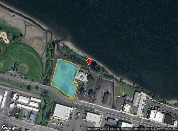
209 W A St, Rainier, OR 97048
NEARBY LISTINGS FOR SALE OR LEASE
Property Detail
209 W A St
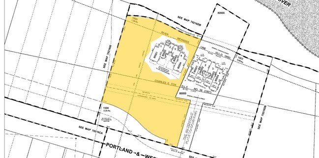
0391072160420150000
Waterfront Place Condominiums
Residentialacreage
Columbia
AE
Oregon
53015C0683G
1.39 AC
2025
Columbia County
2025
Portland
970300
Portland-Vancouver-Hillsboro, OR-WA
1,990 SF
DEMOGRAPHICS near 209 W A St
1 Mile
3 Mile
5 Mile
2024 Total Population
1,873
14,303
49,444
2029 Population
1,945
14,872
51,185
Pop Growth 2024-2029
+ 3.84%
+ 3.98%
+ 3.52%
Average Age
45
39
41
2024 Total Households
756
5,588
19,988
HH Growth 2024-2029
+ 3.57%
+ 4.01%
+ 3.62%
Median Household Inc
$69,221
$47,135
$57,914
Avg Household Size
2.40
2.50
2.40
2024 Avg HH Vehicles
2.00
2.00
2.00
Median Home Value
$390,908
$286,347
$320,137
Median Year Built
1966
1958
1961
Nearby Places
Map Layers
Map Styles
 Street
 Aerial
- Restaurants
- Banks
- Shops
- Fitness
- Groceries
PUBLIC TRANSPORTATION
COMMUTER RAIL
Kelso-Longview (Amtrak Cascades - Amtrak, Coast Starlight - Amtrak)
DRIVE
WALK
Distance
Kelso-Longview (Amtrak Cascades - Amtrak, Coast Starlight - Amtrak)
16 min
7.0 mi
Freight Ports
Port of Long View, WA
DRIVE
WALK
Distance
Port of Long View, WA
9 min
3.9 mi
SALE & LEASE HISTORY
LISTING DATE
SALE/LEASE

Jul 23, 2018
For Sale
Jan 28, 2019
For Sale
Nearby Properties
Address
Land Use
TOTAL SIZE
Lot Size
Zoning
Address
Land Use
TOTAL SIZE
Lot Size
Zoning
93.25 AC
MH0
Address
Land Use
TOTAL SIZE
Lot Size
Zoning
40.70 AC
MH0
Address
Land Use
TOTAL SIZE
Lot Size
Zoning
Address
Land Use
TOTAL SIZE
Lot Size
Zoning
9,600 SF
26.83 AC
MH0
Address
Land Use
TOTAL SIZE
Lot Size
Zoning
92.77 AC
I02
Address
Land Use
TOTAL SIZE
Lot Size
Zoning
179.05 AC
Address
Land Use
TOTAL SIZE
Lot Size
Zoning
81.40 AC
RN:M-1
Address
Land Use
TOTAL SIZE
Lot Size
Zoning
139,660 SF
2.76 AC
Address
Land Use
TOTAL SIZE
Lot Size
Zoning
206,926 SF
4.80 AC
C02
Address
Land Use
TOTAL SIZE
Lot Size
Zoning
1 SF
76.14 AC
MH0
Address
Land Use
TOTAL SIZE
Lot Size
Zoning
28.39 AC
M02
Address
Land Use
TOTAL SIZE
Lot Size
Zoning
1 SF
88.15 AC
M01
Address
Land Use
TOTAL SIZE
Lot Size
Zoning
160,069 SF
20.68 AC
M01
Address
Land Use
TOTAL SIZE
Lot Size
Zoning
106.19 AC
M01
Address
Land Use
TOTAL SIZE
Lot Size
Zoning
1 SF
34.61 AC
Address
Land Use
TOTAL SIZE
Lot Size
Zoning
1 SF
43.48 AC
MH0
Address
Land Use
TOTAL SIZE
Lot Size
Zoning
50.37 AC
MH0
Address
Land Use
TOTAL SIZE
Lot Size
Zoning
18.59 AC
MH0
Address
Land Use
TOTAL SIZE
Lot Size
Zoning
20.90 AC
MH0
Address
Land Use
TOTAL SIZE
Lot Size
Zoning
9,020 SF
114.62 AC
I01
Address
Land Use
TOTAL SIZE
Lot Size
Zoning
117,064 SF
14.52 AC
M01
Address
Land Use
TOTAL SIZE
Lot Size
Zoning
3.93 AC
C02
Address
Land Use
TOTAL SIZE
Lot Size
Zoning
14,547 SF
1.52 AC
M1A
Address
Land Use
TOTAL SIZE
Lot Size
Zoning
45,579 SF
3.87 AC
R01
Address
Land Use
TOTAL SIZE
Lot Size
Zoning
13,076 SF
17.67 AC
RPD
Address
Land Use
TOTAL SIZE
Lot Size
Zoning
38,880 SF
1.83 AC
M1A
Address
Land Use
TOTAL SIZE
Lot Size
Zoning
49,620 SF
10.42 AC
R01
Address
Land Use
TOTAL SIZE
Lot Size
Zoning
48,628 SF
3.50 AC
M1A
Address
Land Use
TOTAL SIZE
Lot Size
Zoning
41.57 AC
MH0
The World's #1 Commercial Real Estate Marketplace
Connect with us
© 2026 CoStar Group
The information above has been obtained from sources believed reliable. While we do not doubt its accuracy we have not verified it and make no guarantee, warranty or representation about it. It is your responsibility to independently confirm its accuracy and completeness. Any projections, opinions, assumptions, or estimates used are for example only and do not represent the current or future performance of the property. The value of this transaction to you depends on tax and other factors which should be evaluated by your tax, financial, and legal advisors. You and your advisors should conduct a careful, independent investigation of the property to determine to your satisfaction the suitability of the property for your needs.