Property Record
2090 E Main St, Ventura, CA 93001
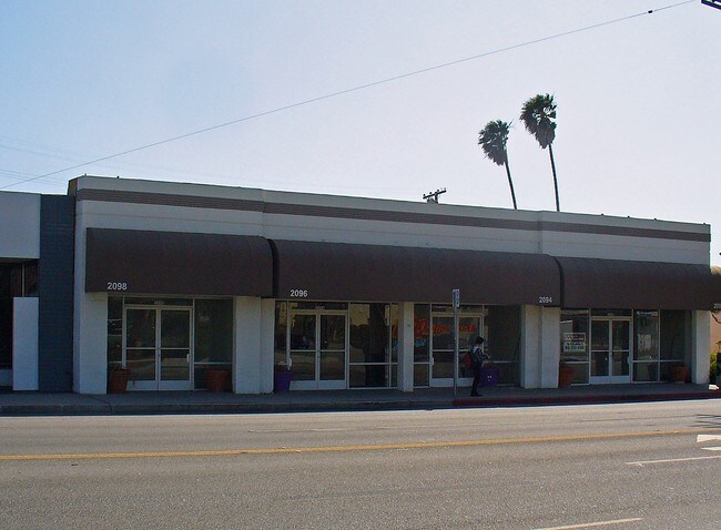

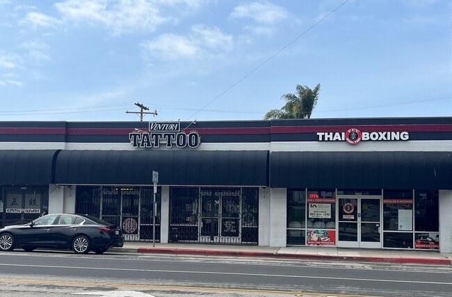

This Property Is For Sale
Current Lease Availabilities
Property Detail
2090 E Main St
075-0-011-020
MAP 17 PG 3 LOT 11,12
Storebuilding
Ventura
C1
California
B and X Area of moderate flood hazard, usually the area between the limits of the 100-year and 500-year floods.
0.15 AC
2024
Ventura
2025
Los Angeles
002600
Oxnard-Thousand Oaks-Ventura, CA
80 SF
NEARBY LISTINGS FOR SALE OR LEASE
DEMOGRAPHICS near 2090 E Main St
1 mile
3 mile
5 mile
2025 Total Population
13,254
58,889
91,787
2030 Population
13,260
59,317
92,002
Pop Growth 2025-2030
+ 0.05%
+ 0.73%
+ 0.23%
Average Age
44
43
43
2025 Total Households
5,849
23,302
35,336
HH Growth 2025-2030
(0.05%)
+ 0.76%
+ 0.23%
Median Household Inc
$102,636
$97,470
$100,351
Avg Household Size
2.20
2.40
2.50
2025 Avg HH Vehicles
2.00
2.00
2.00
Median Home Value
$1,033,636
$864,269
$828,193
Median Year Built
1952
1965
1970
Nearby Places
Map Layers
Map Styles
 Street
 Aerial
Transit
 Traffic
 Biking
Places
Listings with unknown addresses are not visible on the map
- Restaurants
- Banks
- Shops
- Fitness
- Groceries
PUBLIC TRANSPORTATION
COMMUTER RAIL
Drive
Walk
Distance
7 min
2.4 mi
Drive
Walk
Distance
9 min
4.5 mi
AIRPORT
Santa Barbara Municipal
Drive
Walk
Distance
Santa Barbara Municipal
63 min
40.9 mi
Nearby Properties
Address
Land Use
TOTAL SIZE
Lot Size
Zoning
Address
Land Use
TOTAL SIZE
Lot Size
Zoning
1.99 AC
Address
Land Use
TOTAL SIZE
Lot Size
Zoning
4.19 AC
H
Address
Land Use
TOTAL SIZE
Lot Size
Zoning
176,598 SF
9.22 AC
Address
Land Use
TOTAL SIZE
Lot Size
Zoning
Address
Land Use
TOTAL SIZE
Lot Size
Zoning
49,296 SF
11.08 AC
Address
Land Use
TOTAL SIZE
Lot Size
Zoning
7,280 SF
5.38 AC
C-T-O
Address
Land Use
TOTAL SIZE
Lot Size
Zoning
3.01 AC
Address
Land Use
TOTAL SIZE
Lot Size
Zoning
6.81 AC
C-T-O
Address
Land Use
TOTAL SIZE
Lot Size
Zoning
2.89 AC
C-T-O
Address
Land Use
TOTAL SIZE
Lot Size
Zoning
13,530 SF
10.85 AC
Address
Land Use
TOTAL SIZE
Lot Size
Zoning
25,401 SF
2.74 AC
C1AD
Address
Land Use
TOTAL SIZE
Lot Size
Zoning
639.79 AC
Address
Land Use
TOTAL SIZE
Lot Size
Zoning
107,360 SF
5.96 AC
RPD15
Address
Land Use
TOTAL SIZE
Lot Size
Zoning
58,841 SF
6.74 AC
CPD
Address
Land Use
TOTAL SIZE
Lot Size
Zoning
76,449 SF
6.88 AC
CPD
Address
Land Use
TOTAL SIZE
Lot Size
Zoning
65,192 SF
3.20 AC
RPD-
Address
Land Use
TOTAL SIZE
Lot Size
Zoning
96,277 SF
7.72 AC
Address
Land Use
TOTAL SIZE
Lot Size
Zoning
7,993 SF
3.71 AC
C-T-O
Address
Land Use
TOTAL SIZE
Lot Size
Zoning
7,233 SF
7.39 AC
C1
Address
Land Use
TOTAL SIZE
Lot Size
Zoning
Address
Land Use
TOTAL SIZE
Lot Size
Zoning
13,996 SF
1.09 AC
Address
Land Use
TOTAL SIZE
Lot Size
Zoning
62,306 SF
1.33 AC
Address
Land Use
TOTAL SIZE
Lot Size
Zoning
48,388 SF
2.39 AC
RPD-
Address
Land Use
TOTAL SIZE
Lot Size
Zoning
19,523 SF
10.50 AC
Address
Land Use
TOTAL SIZE
Lot Size
Zoning
11,444 SF
6.57 AC
Address
Land Use
TOTAL SIZE
Lot Size
Zoning
74,872 SF
4.50 AC
MPD
Address
Land Use
TOTAL SIZE
Lot Size
Zoning
42,655 SF
0.94 AC
Address
Land Use
TOTAL SIZE
Lot Size
Zoning
732 SF
0.51 AC
DR
The World's #1 Commercial Real Estate Marketplace
Connect with us
© 2026 CoStar Group
The information above has been obtained from sources believed reliable. While we do not doubt its accuracy we have not verified it and make no guarantee, warranty or representation about it. It is your responsibility to independently confirm its accuracy and completeness. Any projections, opinions, assumptions, or estimates used are for example only and do not represent the current or future performance of the property. The value of this transaction to you depends on tax and other factors which should be evaluated by your tax, financial, and legal advisors. You and your advisors should conduct a careful, independent investigation of the property to determine to your satisfaction the suitability of the property for your needs.