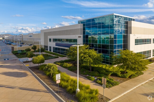
Property Record
20901 Krameria Ave, March Air Reserve Base, CA 92518


NEARBY LISTINGS FOR SALE OR LEASE
Property Detail
20901 Krameria Ave
294-110-011
44.53 ACRES IN POR LOT 11 AND LOT 10 MB 452/054 TR 30857-7
Lightindustrial
Riverside
D
California
06065C0745G
11
2024
44.53 AC
2025
Moreno Valley/Perris
046700
Inland Empire (California)
1,001,789 SF
Riverside-San Bernardino-Ontario, CA
DEMOGRAPHICS near 20901 Krameria Ave
1 Mile
3 Mile
5 Mile
2024 Total Population
5,358
44,891
157,935
2029 Population
5,656
47,028
165,755
Pop Growth 2024-2029
+ 5.56%
+ 4.76%
+ 4.95%
Average Age
40
37
36
2024 Total Households
1,711
12,223
43,195
HH Growth 2024-2029
+ 6.37%
+ 4.43%
+ 4.59%
Median Household Inc
$123,309
$112,853
$87,118
Avg Household Size
3.10
3.50
3.50
2024 Avg HH Vehicles
2.00
3.00
3.00
Median Home Value
$613,194
$636,925
$490,589
Median Year Built
1989
1993
1987
Nearby Places
Map Layers
Map Styles
 Street
 Aerial
- Restaurants
- Banks
- Shops
- Fitness
- Groceries
PUBLIC TRANSPORTATION
COMMUTER RAIL
Moreno Valley/March Field (Metrolink 91-Perris Valley Line - Metrolink Trains)
DRIVE
WALK
Distance
Moreno Valley/March Field (Metrolink 91-Perris Valley Line - Metrolink Trains)
10 min
3.7 mi
AIRPORT
Ontario International
DRIVE
WALK
Distance
Ontario International
41 min
29.3 mi
Freight Ports
Port of Long Beach
DRIVE
WALK
Distance
Port of Long Beach
83 min
60.0 mi
SALE & LEASE HISTORY
LISTING DATE
SALE/LEASE

Sep 25, 2016
For Lease
Mar 30, 2017
For Lease
Nearby Properties
Address
Land Use
TOTAL SIZE
Lot Size
Zoning
Address
Land Use
TOTAL SIZE
Lot Size
Zoning
1,851,898 SF
128.07 AC
Address
Land Use
TOTAL SIZE
Lot Size
Zoning
1,101,504 SF
59.45 AC
Address
Land Use
TOTAL SIZE
Lot Size
Zoning
782,209 SF
35.98 AC
Address
Land Use
TOTAL SIZE
Lot Size
Zoning
709,081 SF
33.17 AC
Address
Land Use
TOTAL SIZE
Lot Size
Zoning
617,000 SF
23.91 AC
W2
Address
Land Use
TOTAL SIZE
Lot Size
Zoning
929,918 SF
52.44 AC
Address
Land Use
TOTAL SIZE
Lot Size
Zoning
692,465 SF
34.46 AC
Address
Land Use
TOTAL SIZE
Lot Size
Zoning
596,090 SF
29.17 AC
IP
Address
Land Use
TOTAL SIZE
Lot Size
Zoning
1,007,387 SF
48.02 AC
RR
Address
Land Use
TOTAL SIZE
Lot Size
Zoning
348,375 SF
21.80 AC
Address
Land Use
TOTAL SIZE
Lot Size
Zoning
332,377 SF
21.12 AC
Address
Land Use
TOTAL SIZE
Lot Size
Zoning
481,636 SF
45 AC
Address
Land Use
TOTAL SIZE
Lot Size
Zoning
26.96 AC
R3
Address
Land Use
TOTAL SIZE
Lot Size
Zoning
620,533 SF
32.50 AC
Address
Land Use
TOTAL SIZE
Lot Size
Zoning
753,895 SF
36.38 AC
Address
Land Use
TOTAL SIZE
Lot Size
Zoning
38,560 SF
12.04 AC
R3
Address
Land Use
TOTAL SIZE
Lot Size
Zoning
579,807 SF
30.23 AC
MP
Address
Land Use
TOTAL SIZE
Lot Size
Zoning
399,615 SF
24.31 AC
Address
Land Use
TOTAL SIZE
Lot Size
Zoning
410,350 SF
21.38 AC
Address
Land Use
TOTAL SIZE
Lot Size
Zoning
486,000 SF
24.62 AC
Address
Land Use
TOTAL SIZE
Lot Size
Zoning
262,260 SF
13.35 AC
RR
Address
Land Use
TOTAL SIZE
Lot Size
Zoning
676,690 SF
30.87 AC
Address
Land Use
TOTAL SIZE
Lot Size
Zoning
500,174 SF
22.96 AC
Address
Land Use
TOTAL SIZE
Lot Size
Zoning
347,672 SF
18.82 AC
Address
Land Use
TOTAL SIZE
Lot Size
Zoning
503,592 SF
26.92 AC
Address
Land Use
TOTAL SIZE
Lot Size
Zoning
4,439 SF
78.46 AC
Address
Land Use
TOTAL SIZE
Lot Size
Zoning
140,030 SF
9.45 AC
Address
Land Use
TOTAL SIZE
Lot Size
Zoning
600,000 SF
26.89 AC
W-2
The World's #1 Commercial Real Estate Marketplace
Connect with us
© 2026 CoStar Group
The information above has been obtained from sources believed reliable. While we do not doubt its accuracy we have not verified it and make no guarantee, warranty or representation about it. It is your responsibility to independently confirm its accuracy and completeness. Any projections, opinions, assumptions, or estimates used are for example only and do not represent the current or future performance of the property. The value of this transaction to you depends on tax and other factors which should be evaluated by your tax, financial, and legal advisors. You and your advisors should conduct a careful, independent investigation of the property to determine to your satisfaction the suitability of the property for your needs.