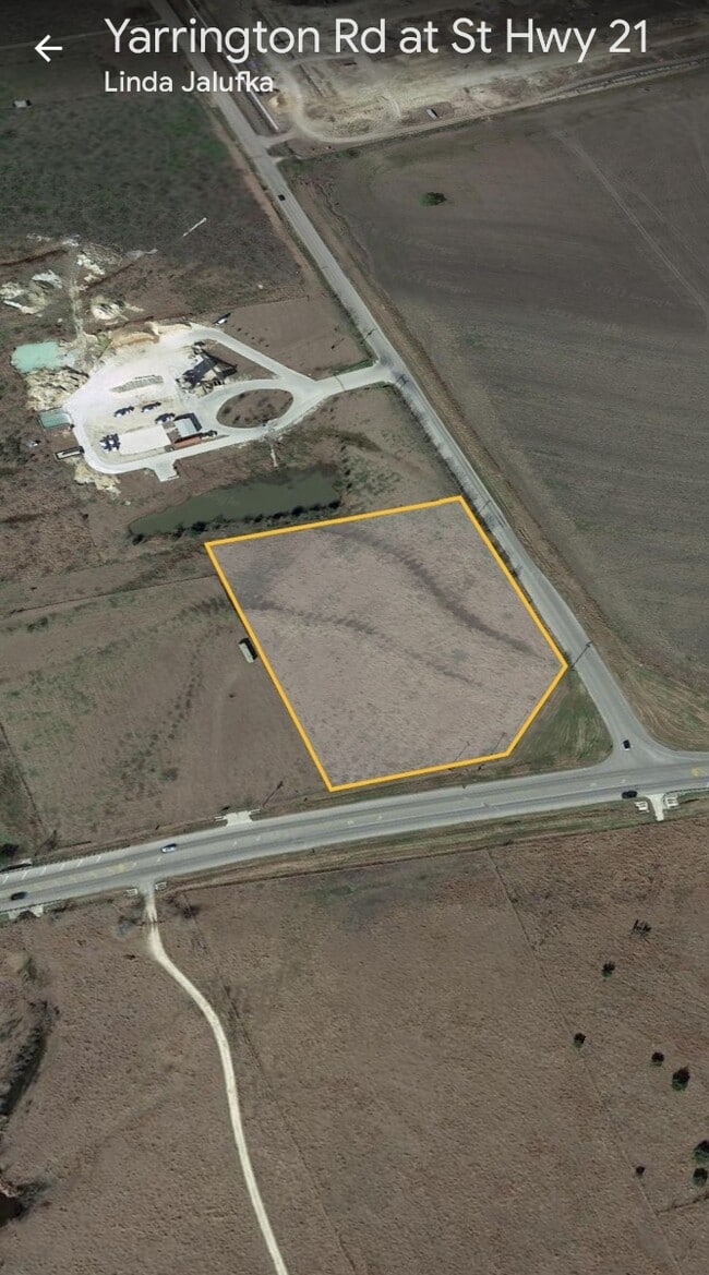
Property Record
21 State Highway 21, San Marcos, TX 78666

Property Detail
21 State Highway 21
Austin-Round Rock-San Marcos, TX
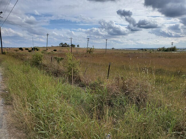
COUNTY LINE STRIP TRACT 3 1.916 AC
R25115
HAYS
Residentialacreage
Texas
B and X Area of moderate flood hazard, usually the area between the limits of the 100-year and 500-year floods.
1.81 AC
2024
Hays County
2025
Austin
010100
NEARBY LISTINGS FOR SALE OR LEASE
DEMOGRAPHICS near 21 State Highway 21
1 mile
3 mile
5 mile
2025 Total Population
3,017
13,218
60,557
2030 Population
3,755
15,751
70,389
Pop Growth 2025-2030
+ 24.46%
+ 19.16%
+ 16.24%
Average Age
38
34
33
2025 Total Households
987
4,302
22,247
HH Growth 2025-2030
+ 24.82%
+ 20.22%
+ 16.88%
Median Household Inc
$155,612
$79,124
$68,042
Avg Household Size
3.10
2.90
2.60
2025 Avg HH Vehicles
3.00
3.00
2.00
Median Home Value
$298,759
$275,932
$330,051
Median Year Built
2011
2010
2009
Nearby Places
Map Layers
Map Styles
 Street
 Aerial
Transit
 Traffic
 Biking
Places
Listings with unknown addresses are not visible on the map
- Restaurants
- Banks
- Shops
- Fitness
- Groceries
PUBLIC TRANSPORTATION
COMMUTER RAIL
Drive
Walk
Distance
12 min
7.2 mi
AIRPORT
Austin-Bergstrom International
Drive
Walk
Distance
Austin-Bergstrom International
37 min
26.3 mi
SALE & LEASE HISTORY
LISTING DATE
SALE/LEASE

Nov 22, 2021
For Sale
Nearby Properties
Address
Land Use
TOTAL SIZE
Lot Size
Zoning
Address
Land Use
TOTAL SIZE
Lot Size
Zoning
1,647,300 SF
96.81 AC
Address
Land Use
TOTAL SIZE
Lot Size
Zoning
13,158 SF
457.48 AC
Address
Land Use
TOTAL SIZE
Lot Size
Zoning
40.48 AC
Address
Land Use
TOTAL SIZE
Lot Size
Zoning
354,670 SF
13 AC
Address
Land Use
TOTAL SIZE
Lot Size
Zoning
300,779 SF
10.84 AC
Address
Land Use
TOTAL SIZE
Lot Size
Zoning
4,173 SF
128.50 AC
Address
Land Use
TOTAL SIZE
Lot Size
Zoning
132,825 SF
52.74 AC
Address
Land Use
TOTAL SIZE
Lot Size
Zoning
203,840 SF
16.70 AC
Address
Land Use
TOTAL SIZE
Lot Size
Zoning
229,600 SF
16.50 AC
Address
Land Use
TOTAL SIZE
Lot Size
Zoning
36,219 SF
18.14 AC
Address
Land Use
TOTAL SIZE
Lot Size
Zoning
162,768 SF
13.52 AC
Address
Land Use
TOTAL SIZE
Lot Size
Zoning
303.50 AC
Address
Land Use
TOTAL SIZE
Lot Size
Zoning
169,025 SF
17.45 AC
Address
Land Use
TOTAL SIZE
Lot Size
Zoning
27,012 SF
19.50 AC
Address
Land Use
TOTAL SIZE
Lot Size
Zoning
279,434 SF
14.18 AC
Address
Land Use
TOTAL SIZE
Lot Size
Zoning
118,080 SF
9.69 AC
Address
Land Use
TOTAL SIZE
Lot Size
Zoning
115,080 SF
10.63 AC
Address
Land Use
TOTAL SIZE
Lot Size
Zoning
89,700 SF
7.84 AC
Address
Land Use
TOTAL SIZE
Lot Size
Zoning
96,000 SF
10 AC
Address
Land Use
TOTAL SIZE
Lot Size
Zoning
82,180 SF
6.68 AC
Address
Land Use
TOTAL SIZE
Lot Size
Zoning
58,600 SF
1.35 AC
Address
Land Use
TOTAL SIZE
Lot Size
Zoning
3,000 SF
138.74 AC
Address
Land Use
TOTAL SIZE
Lot Size
Zoning
31,224 SF
7.27 AC
Address
Land Use
TOTAL SIZE
Lot Size
Zoning
29.61 AC
Address
Land Use
TOTAL SIZE
Lot Size
Zoning
76.94 AC
Address
Land Use
TOTAL SIZE
Lot Size
Zoning
32.08 AC
Address
Land Use
TOTAL SIZE
Lot Size
Zoning
9,000 SF
12.88 AC
Address
Land Use
TOTAL SIZE
Lot Size
Zoning
39,600 SF
3.95 AC
Address
Land Use
TOTAL SIZE
Lot Size
Zoning
35.67 AC
Address
Land Use
TOTAL SIZE
Lot Size
Zoning
29,570 SF
0.57 AC
The World's #1 Commercial Real Estate Marketplace
Connect with us
© 2026 CoStar Group
The information above has been obtained from sources believed reliable. While we do not doubt its accuracy we have not verified it and make no guarantee, warranty or representation about it. It is your responsibility to independently confirm its accuracy and completeness. Any projections, opinions, assumptions, or estimates used are for example only and do not represent the current or future performance of the property. The value of this transaction to you depends on tax and other factors which should be evaluated by your tax, financial, and legal advisors. You and your advisors should conduct a careful, independent investigation of the property to determine to your satisfaction the suitability of the property for your needs.