Property Record
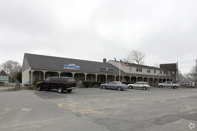
210 Main St, Orleans, MA 02653

Property Detail
210 Main St
Commercialcondominium
BARNSTABLE
C
Massachusetts
B and X Area of moderate flood hazard, usually the area between the limits of the 100-year and 500-year floods.
1.0
2025
Other Market Areas
2025
Barnstable Town, MA
010500
ORLE-000350-000068-000030
2,790 SF
NEARBY LISTINGS FOR SALE OR LEASE
DEMOGRAPHICS near 210 Main St
1 mile
3 mile
5 mile
2025 Total Population
1,551
7,562
14,585
2030 Population
1,509
7,426
14,533
Pop Growth 2025-2030
(2.71%)
(1.80%)
(0.36%)
Average Age
57
56
54
2025 Total Households
770
3,651
6,896
HH Growth 2025-2030
(3.12%)
(2.36%)
(0.73%)
Median Household Inc
$112,500
$94,803
$95,588
Avg Household Size
2.00
2.00
2.00
2025 Avg HH Vehicles
2.00
2.00
2.00
Median Home Value
$1,030,973
$814,364
$764,399
Median Year Built
1971
1974
1978
Nearby Places
Map Layers
Map Styles
 Street
 Aerial
Layers
 Traffic
 Biking
Places
Listings with unknown addresses are not visible on the map
- Restaurants
- Banks
- Shops
- Fitness
- Groceries
SALE & LEASE HISTORY
LISTING DATE
SALE/LEASE

Jan 01, 2020
For Sale
Nearby Properties
Address
Land Use
TOTAL SIZE
Lot Size
Zoning
Address
Land Use
TOTAL SIZE
Lot Size
Zoning
71,466 SF
12.15 AC
GB
Address
Land Use
TOTAL SIZE
Lot Size
Zoning
90,545 SF
30 AC
R
Address
Land Use
TOTAL SIZE
Lot Size
Zoning
2,872 SF
13.74 AC
R
Address
Land Use
TOTAL SIZE
Lot Size
Zoning
99,086 SF
10.69 AC
GB
Address
Land Use
TOTAL SIZE
Lot Size
Zoning
2,549 SF
109.52 AC
SEASHO
Address
Land Use
TOTAL SIZE
Lot Size
Zoning
105 AC
SEASHO
Address
Land Use
TOTAL SIZE
Lot Size
Zoning
5,482 SF
450 AC
R
Address
Land Use
TOTAL SIZE
Lot Size
Zoning
54,328 SF
23 AC
R
Address
Land Use
TOTAL SIZE
Lot Size
Zoning
30,248 SF
9.48 AC
VILLAG
Address
Land Use
TOTAL SIZE
Lot Size
Zoning
7,384 SF
8.10 AC
R
Address
Land Use
TOTAL SIZE
Lot Size
Zoning
14,406 SF
14.18 AC
GB
Address
Land Use
TOTAL SIZE
Lot Size
Zoning
5,817 SF
5.75 AC
R
Address
Land Use
TOTAL SIZE
Lot Size
Zoning
5,866 SF
3.68 AC
R
Address
Land Use
TOTAL SIZE
Lot Size
Zoning
15,602 SF
1.32 AC
R
Address
Land Use
TOTAL SIZE
Lot Size
Zoning
33,188 SF
9.97 AC
VILLAG
Address
Land Use
TOTAL SIZE
Lot Size
Zoning
7,711 SF
10.10 AC
R
Address
Land Use
TOTAL SIZE
Lot Size
Zoning
3,457 SF
1.33 AC
R
Address
Land Use
TOTAL SIZE
Lot Size
Zoning
5,221 SF
2.57 AC
RESIDE
Address
Land Use
TOTAL SIZE
Lot Size
Zoning
3,795 SF
4.34 AC
R
Address
Land Use
TOTAL SIZE
Lot Size
Zoning
3,614 SF
1.15 AC
R
Address
Land Use
TOTAL SIZE
Lot Size
Zoning
23,078 SF
3.02 AC
GB
Address
Land Use
TOTAL SIZE
Lot Size
Zoning
27.70 AC
R
Address
Land Use
TOTAL SIZE
Lot Size
Zoning
3,333 SF
2.35 AC
R
Address
Land Use
TOTAL SIZE
Lot Size
Zoning
18,560 SF
6.51 AC
R
Address
Land Use
TOTAL SIZE
Lot Size
Zoning
2,979 SF
1.72 AC
R
Address
Land Use
TOTAL SIZE
Lot Size
Zoning
53,464 SF
3.57 AC
R
Address
Land Use
TOTAL SIZE
Lot Size
Zoning
5,238 SF
2.70 AC
R
Address
Land Use
TOTAL SIZE
Lot Size
Zoning
5,898 SF
2 AC
R
Address
Land Use
TOTAL SIZE
Lot Size
Zoning
1,390 SF
1.28 AC
R
Address
Land Use
TOTAL SIZE
Lot Size
Zoning
5,883 SF
1.57 AC
R
The World's #1 Commercial Real Estate Marketplace
Connect with us
© 2026 CoStar Group
The information above has been obtained from sources believed reliable. While we do not doubt its accuracy we have not verified it and make no guarantee, warranty or representation about it. It is your responsibility to independently confirm its accuracy and completeness. Any projections, opinions, assumptions, or estimates used are for example only and do not represent the current or future performance of the property. The value of this transaction to you depends on tax and other factors which should be evaluated by your tax, financial, and legal advisors. You and your advisors should conduct a careful, independent investigation of the property to determine to your satisfaction the suitability of the property for your needs.