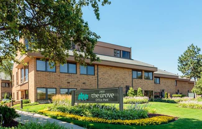
Property Record
2100 Manchester Rd, Wheaton, IL 60187


Current Lease Availabilities
Property Detail
2100 Manchester Rd
05-18-402-017
THE GROVES ALL
Commercialnec
DUPAGE
C
Illinois
B and X Area of moderate flood hazard, usually the area between the limits of the 100-year and 500-year floods.
3
2024
1.86 AC
2024
Western East/West Corr
842604
Chicago
38,830 SF
Chicago-Naperville-Elgin, IL-IN
NEARBY LISTINGS FOR SALE OR LEASE
DEMOGRAPHICS near 2100 Manchester Rd
1 mile
3 mile
5 mile
2025 Total Population
12,048
76,816
213,933
2030 Population
12,224
77,412
215,335
Pop Growth 2025-2030
+ 1.46%
+ 0.78%
+ 0.66%
Average Age
44
41
40
2025 Total Households
4,508
27,648
76,837
HH Growth 2025-2030
+ 1.53%
+ 0.87%
+ 0.70%
Median Household Inc
$102,372
$117,361
$111,527
Avg Household Size
2.40
2.60
2.70
2025 Avg HH Vehicles
2.00
2.00
2.00
Median Home Value
$357,172
$430,244
$387,077
Median Year Built
1975
1976
1977
Nearby Places
Map Layers
Map Styles
 Street
 Aerial
Layers
 Traffic
 Biking
Places
Listings with unknown addresses are not visible on the map
- Restaurants
- Banks
- Shops
- Fitness
- Groceries
PUBLIC TRANSPORTATION
COMMUTER RAIL
Wheaton Station (Union Pacific West Line - Northeast Illinois Regional Commuter Railroad (Metra))
Drive
Walk
Distance
Wheaton Station (Union Pacific West Line - Northeast Illinois Regional Commuter Railroad (Metra))
5 min
1.6 mi
Winfield Station (Union Pacific West Line - Northeast Illinois Regional Commuter Railroad (Metra))
Drive
Walk
Distance
Winfield Station (Union Pacific West Line - Northeast Illinois Regional Commuter Railroad (Metra))
6 min
1.9 mi
AIRPORT
Chicago Midway International
Drive
Walk
Distance
Chicago Midway International
44 min
24.8 mi
Chicago O'Hare International
Drive
Walk
Distance
Chicago O'Hare International
42 min
24.9 mi
Nearby Properties
Address
Land Use
TOTAL SIZE
Lot Size
Zoning
Address
Land Use
TOTAL SIZE
Lot Size
Zoning
818,262 SF
13.70 AC
M
Address
Land Use
TOTAL SIZE
Lot Size
Zoning
594,125 SF
2.60 AC
Address
Land Use
TOTAL SIZE
Lot Size
Zoning
545,570 SF
22.66 AC
C
Address
Land Use
TOTAL SIZE
Lot Size
Zoning
295,773 SF
17.45 AC
M
Address
Land Use
TOTAL SIZE
Lot Size
Zoning
254,992 SF
14.21 AC
M
Address
Land Use
TOTAL SIZE
Lot Size
Zoning
254,201 SF
27.84 AC
Address
Land Use
TOTAL SIZE
Lot Size
Zoning
26,302 SF
2.09 AC
C
Address
Land Use
TOTAL SIZE
Lot Size
Zoning
201,048 SF
20.24 AC
Address
Land Use
TOTAL SIZE
Lot Size
Zoning
Address
Land Use
TOTAL SIZE
Lot Size
Zoning
146,492 SF
0.42 AC
Address
Land Use
TOTAL SIZE
Lot Size
Zoning
235,131 SF
14.18 AC
I
Address
Land Use
TOTAL SIZE
Lot Size
Zoning
216,720 SF
12.40 AC
M
Address
Land Use
TOTAL SIZE
Lot Size
Zoning
290,280 SF
14 AC
Address
Land Use
TOTAL SIZE
Lot Size
Zoning
162,819 SF
19.82 AC
C
Address
Land Use
TOTAL SIZE
Lot Size
Zoning
582,089 SF
41.71 AC
C
Address
Land Use
TOTAL SIZE
Lot Size
Zoning
165,528 SF
16.08 AC
M
Address
Land Use
TOTAL SIZE
Lot Size
Zoning
242,748 SF
11.65 AC
R
Address
Land Use
TOTAL SIZE
Lot Size
Zoning
166,382 SF
10.50 AC
R-4
Address
Land Use
TOTAL SIZE
Lot Size
Zoning
13.15 AC
R
Address
Land Use
TOTAL SIZE
Lot Size
Zoning
180,216 SF
6.57 AC
M
Address
Land Use
TOTAL SIZE
Lot Size
Zoning
103,000 SF
7.53 AC
C
Address
Land Use
TOTAL SIZE
Lot Size
Zoning
151,850 SF
0.73 AC
C
Address
Land Use
TOTAL SIZE
Lot Size
Zoning
442,300 SF
24.52 AC
Address
Land Use
TOTAL SIZE
Lot Size
Zoning
91,074 SF
7.02 AC
M
Address
Land Use
TOTAL SIZE
Lot Size
Zoning
233,975 SF
12.02 AC
I
Address
Land Use
TOTAL SIZE
Lot Size
Zoning
249,576 SF
8.94 AC
I
Address
Land Use
TOTAL SIZE
Lot Size
Zoning
439,421 SF
24.54 AC
I
Address
Land Use
TOTAL SIZE
Lot Size
Zoning
76,391 SF
4.96 AC
M
Address
Land Use
TOTAL SIZE
Lot Size
Zoning
169,078 SF
20.48 AC
I
Address
Land Use
TOTAL SIZE
Lot Size
Zoning
215,948 SF
9.55 AC
The World's #1 Commercial Real Estate Marketplace
Connect with us
© 2026 CoStar Group
The information above has been obtained from sources believed reliable. While we do not doubt its accuracy we have not verified it and make no guarantee, warranty or representation about it. It is your responsibility to independently confirm its accuracy and completeness. Any projections, opinions, assumptions, or estimates used are for example only and do not represent the current or future performance of the property. The value of this transaction to you depends on tax and other factors which should be evaluated by your tax, financial, and legal advisors. You and your advisors should conduct a careful, independent investigation of the property to determine to your satisfaction the suitability of the property for your needs.