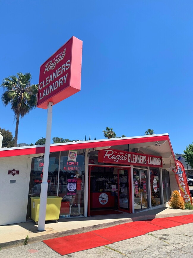
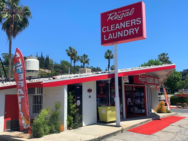
Property Record
2111 Verdugo Blvd, Montrose, CA 91020


Save to a Folder
{{folder.Name}}
{{folder.ListingIds.length}} Properties
{{folder.ListingIds.length}} Property
Create a New Folder
Property Detail
2111 Verdugo Blvd
5807-011-021
TRACT # 1701 SW 82.5 FT OF NW 187.5 FT MEASURED ON NW LINE OF LOT 93
Storemultistory
Los Angeles
GLC3*
California
B and X Area of moderate flood hazard, usually the area between the limits of the 100-year and 500-year floods.
93
2025
0.23 AC
2025
Glendale
300800
Los Angeles
1,225 SF
Los Angeles-Long Beach-Glendale, CA
NEARBY LISTINGS FOR SALE OR LEASE
DEMOGRAPHICS near 2111 Verdugo Blvd
1 mile
3 mile
5 mile
2025 Total Population
14,833
75,813
289,773
2030 Population
14,607
74,804
285,731
Pop Growth 2025-2030
(1.52%)
(1.33%)
(1.39%)
Average Age
43
44
43
2025 Total Households
5,632
26,668
107,785
HH Growth 2025-2030
(1.81%)
(1.63%)
(1.64%)
Median Household Inc
$112,914
$145,375
$98,885
Avg Household Size
2.60
2.80
2.60
2025 Avg HH Vehicles
2.00
2.00
2.00
Median Home Value
$1,081,953
$1,108,461
$1,059,170
Median Year Built
1959
1958
1960
Nearby Places
Map Layers
Map Styles
 Street
 Aerial
Layers
 Traffic
 Biking
Places
Listings with unknown addresses are not visible on the map
- Restaurants
- Banks
- Shops
- Fitness
- Groceries
PUBLIC TRANSPORTATION
COMMUTER RAIL
Glendale (Antelope Valley Line - Southern California Regional Rail Authority (Metrolink), Ventura County Line - Southern California Regional Rail Authority (Metrolink))
Drive
Walk
Distance
Glendale (Antelope Valley Line - Southern California Regional Rail Authority (Metrolink), Ventura County Line - Southern California Regional Rail Authority (Metrolink))
12 min
8.4 mi
Drive
Walk
Distance
12 min
8.4 mi
AIRPORT
Bob Hope
Drive
Walk
Distance
Bob Hope
22 min
12.0 mi
Los Angeles International
Drive
Walk
Distance
Los Angeles International
41 min
30.4 mi
Long Beach (Daugherty Field)
Drive
Walk
Distance
Long Beach (Daugherty Field)
45 min
34.0 mi
Freight Ports
Port of Long Beach
Drive
Walk
Distance
Port of Long Beach
48 min
35.9 mi
SALE & LEASE HISTORY
LISTING DATE
SALE/LEASE

Sep 05, 2017
For Sale
May 14, 2020
For Sale
Nearby Properties
Address
Land Use
TOTAL SIZE
Lot Size
Zoning
Address
Land Use
TOTAL SIZE
Lot Size
Zoning
386,909 SF
9.29 AC
GLC3*
Address
Land Use
TOTAL SIZE
Lot Size
Zoning
86,008 SF
3.75 AC
GLR3YY
Address
Land Use
TOTAL SIZE
Lot Size
Zoning
86,163 SF
4.20 AC
GLR3*
Address
Land Use
TOTAL SIZE
Lot Size
Zoning
175,037 SF
4.77 AC
LFC2*
Address
Land Use
TOTAL SIZE
Lot Size
Zoning
80,150 SF
1.47 AC
LCC1-R2*
Address
Land Use
TOTAL SIZE
Lot Size
Zoning
86,141 SF
8.79 AC
LFR1
Address
Land Use
TOTAL SIZE
Lot Size
Zoning
52,278 SF
1.96 AC
GLR4*
Address
Land Use
TOTAL SIZE
Lot Size
Zoning
48,664 SF
3.42 AC
GLC3*
Address
Land Use
TOTAL SIZE
Lot Size
Zoning
46,812 SF
2.77 AC
GLC3*
Address
Land Use
TOTAL SIZE
Lot Size
Zoning
41,987 SF
2.09 AC
LFCPD*
Address
Land Use
TOTAL SIZE
Lot Size
Zoning
45,927 SF
2.16 AC
Address
Land Use
TOTAL SIZE
Lot Size
Zoning
28,636 SF
1.09 AC
GLR3*
Address
Land Use
TOTAL SIZE
Lot Size
Zoning
41,448 SF
2.96 AC
GLR4-R1*
Address
Land Use
TOTAL SIZE
Lot Size
Zoning
64,235 SF
1.44 AC
GLC2*
Address
Land Use
TOTAL SIZE
Lot Size
Zoning
55,657 SF
102.25 AC
GLSR*
Address
Land Use
TOTAL SIZE
Lot Size
Zoning
61,346 SF
1.32 AC
GLC3*
Address
Land Use
TOTAL SIZE
Lot Size
Zoning
32,754 SF
3.82 AC
LFR3-R1200
Address
Land Use
TOTAL SIZE
Lot Size
Zoning
59,744 SF
0.93 AC
GLC3-R1*
Address
Land Use
TOTAL SIZE
Lot Size
Zoning
28,904 SF
0.89 AC
GLR3*
Address
Land Use
TOTAL SIZE
Lot Size
Zoning
35,745 SF
1.11 AC
GLR3R*
Address
Land Use
TOTAL SIZE
Lot Size
Zoning
125,000 SF
3.32 AC
LFR110000-
Address
Land Use
TOTAL SIZE
Lot Size
Zoning
66,163 SF
0.62 AC
GLC3*
Address
Land Use
TOTAL SIZE
Lot Size
Zoning
29,794 SF
0.37 AC
GLM1A*
Address
Land Use
TOTAL SIZE
Lot Size
Zoning
92,489 SF
2.03 AC
GLC3*
Address
Land Use
TOTAL SIZE
Lot Size
Zoning
74,944 SF
2.10 AC
Address
Land Use
TOTAL SIZE
Lot Size
Zoning
88,624 SF
5 AC
LCR330U*
Address
Land Use
TOTAL SIZE
Lot Size
Zoning
Address
Land Use
TOTAL SIZE
Lot Size
Zoning
52,252 SF
5.22 AC
LFR17500*
Address
Land Use
TOTAL SIZE
Lot Size
Zoning
17,754 SF
1.70 AC
Address
Land Use
TOTAL SIZE
Lot Size
Zoning
57,768 SF
1.07 AC
GLC3*
The World's #1 Commercial Real Estate Marketplace
Connect with us
© 2026 CoStar Group
The information above has been obtained from sources believed reliable. While we do not doubt its accuracy we have not verified it and make no guarantee, warranty or representation about it. It is your responsibility to independently confirm its accuracy and completeness. Any projections, opinions, assumptions, or estimates used are for example only and do not represent the current or future performance of the property. The value of this transaction to you depends on tax and other factors which should be evaluated by your tax, financial, and legal advisors. You and your advisors should conduct a careful, independent investigation of the property to determine to your satisfaction the suitability of the property for your needs.