Property Record
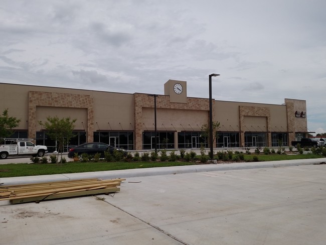
2111 W Fm 528 Ave, Friendswood, TX 77546


NEARBY LISTINGS FOR SALE OR LEASE
Property Detail
2111 W Fm 528 Ave
Houston-The Woodlands-Sugar Land, TX
Fountains @ Friendswood (2017) Abst 645
3407-0000-0005-200
FOUNTAINS @ FRIENDSWOOD (2017) ABST 645, RES E2 (5-200) ACRES 1.075
Commercialnec
Galveston
X
Texas
48039C0155K
e2
2024
1.08 AC
2025
Southeast Outlier
720301
Houston
18,800 SF
DEMOGRAPHICS near 2111 W Fm 528 Ave
1 Mile
3 Mile
5 Mile
2024 Total Population
5,640
30,877
108,557
2029 Population
5,882
32,482
114,286
Pop Growth 2024-2029
+ 4.29%
+ 5.20%
+ 5.28%
Average Age
39
39
38
2024 Total Households
1,809
10,260
37,137
HH Growth 2024-2029
+ 4.53%
+ 5.44%
+ 5.35%
Median Household Inc
$137,375
$131,285
$102,545
Avg Household Size
3.10
3.00
2.90
2024 Avg HH Vehicles
2.00
2.00
2.00
Median Home Value
$324,311
$374,477
$286,247
Median Year Built
1991
1995
1993
Nearby Places
Map Layers
Map Styles
 Street
 Aerial
- Restaurants
- Banks
- Shops
- Fitness
- Groceries
PUBLIC TRANSPORTATION
AIRPORT
William P Hobby
DRIVE
WALK
Distance
William P Hobby
29 min
15.7 mi
Freight Ports
Port of Houston
DRIVE
WALK
Distance
Port of Houston
37 min
23.6 mi
SALE & LEASE HISTORY
LISTING DATE
SALE/LEASE

Sep 01, 2017
For Lease
Jan 07, 2020
For Lease
Aug 11, 2017
For Lease
Nearby Properties
Address
Land Use
TOTAL SIZE
Lot Size
Zoning
Address
Land Use
TOTAL SIZE
Lot Size
Zoning
Address
Land Use
TOTAL SIZE
Lot Size
Zoning
142,155 SF
19.16 AC
SP
Address
Land Use
TOTAL SIZE
Lot Size
Zoning
65,935 SF
81.27 AC
Address
Land Use
TOTAL SIZE
Lot Size
Zoning
161,803 SF
54.82 AC
Address
Land Use
TOTAL SIZE
Lot Size
Zoning
107,600 SF
3.73 AC
Address
Land Use
TOTAL SIZE
Lot Size
Zoning
130,563 SF
13.23 AC
CSC
Address
Land Use
TOTAL SIZE
Lot Size
Zoning
84,272 SF
16.93 AC
Address
Land Use
TOTAL SIZE
Lot Size
Zoning
95,812 SF
11.92 AC
Address
Land Use
TOTAL SIZE
Lot Size
Zoning
49,444 SF
7.23 AC
Address
Land Use
TOTAL SIZE
Lot Size
Zoning
115,805 SF
10.12 AC
SP
Address
Land Use
TOTAL SIZE
Lot Size
Zoning
138,839 SF
7.46 AC
MFRH
Address
Land Use
TOTAL SIZE
Lot Size
Zoning
68,894 SF
6.11 AC
Address
Land Use
TOTAL SIZE
Lot Size
Zoning
6,948 SF
54.94 AC
2080
Address
Land Use
TOTAL SIZE
Lot Size
Zoning
63,377 SF
2.71 AC
OBD
Address
Land Use
TOTAL SIZE
Lot Size
Zoning
76,646 SF
11.39 AC
SP
Address
Land Use
TOTAL SIZE
Lot Size
Zoning
68,435 SF
5.62 AC
0041
Address
Land Use
TOTAL SIZE
Lot Size
Zoning
67,997 SF
3.98 AC
OBD
Address
Land Use
TOTAL SIZE
Lot Size
Zoning
56,905 SF
7 AC
Address
Land Use
TOTAL SIZE
Lot Size
Zoning
3,680 SF
3.35 AC
OBD
Address
Land Use
TOTAL SIZE
Lot Size
Zoning
78,876 SF
9.22 AC
Address
Land Use
TOTAL SIZE
Lot Size
Zoning
98,005 SF
4.64 AC
Address
Land Use
TOTAL SIZE
Lot Size
Zoning
54,656 SF
4.57 AC
Address
Land Use
TOTAL SIZE
Lot Size
Zoning
36,596 SF
14.75 AC
Address
Land Use
TOTAL SIZE
Lot Size
Zoning
28,320 SF
1.64 AC
CSC
Address
Land Use
TOTAL SIZE
Lot Size
Zoning
39,564 SF
2.57 AC
Address
Land Use
TOTAL SIZE
Lot Size
Zoning
22,144 SF
9.27 AC
Address
Land Use
TOTAL SIZE
Lot Size
Zoning
34,480 SF
2.46 AC
CSC
Address
Land Use
TOTAL SIZE
Lot Size
Zoning
22,320 SF
3.68 AC
CSC
Address
Land Use
TOTAL SIZE
Lot Size
Zoning
1,920 SF
14.94 AC
Address
Land Use
TOTAL SIZE
Lot Size
Zoning
74,002 SF
9.58 AC
The World's #1 Commercial Real Estate Marketplace
Connect with us
© 2026 CoStar Group
The information above has been obtained from sources believed reliable. While we do not doubt its accuracy we have not verified it and make no guarantee, warranty or representation about it. It is your responsibility to independently confirm its accuracy and completeness. Any projections, opinions, assumptions, or estimates used are for example only and do not represent the current or future performance of the property. The value of this transaction to you depends on tax and other factors which should be evaluated by your tax, financial, and legal advisors. You and your advisors should conduct a careful, independent investigation of the property to determine to your satisfaction the suitability of the property for your needs.