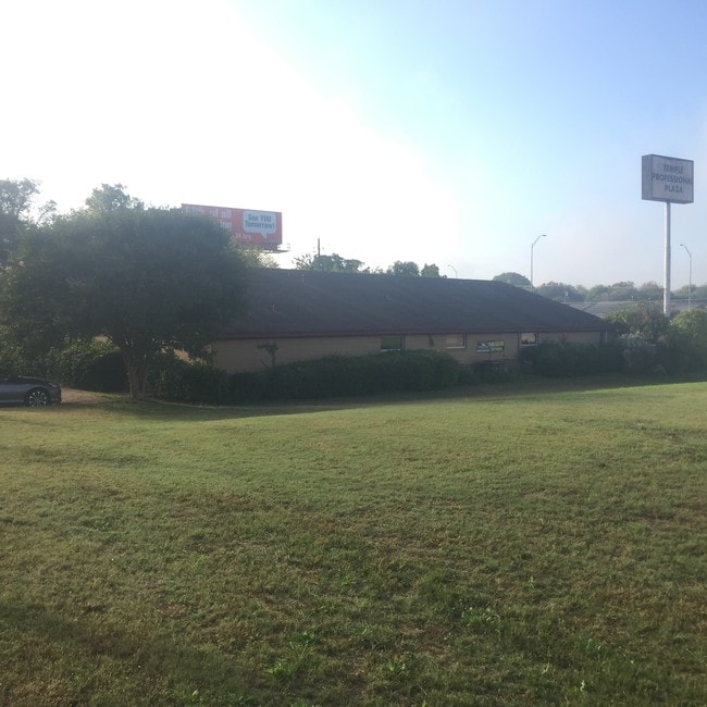
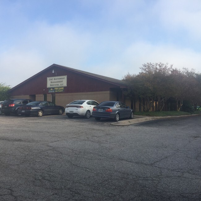
Property Record
2125 S 61St St, Temple, TX 76504

Property Detail
2125 S 61St St
37557
MEDICAL CENTER, LOT TRACT PT G, (G, LESS SW 9.64),, ACRES .803
Commercialnec
Bell
PD NS
Texas
B and X Area of moderate flood hazard, usually the area between the limits of the 100-year and 500-year floods.
g
2025
0.80 AC
2025
Temple
021101
Killeen/Temple/Fort Hood
5,168 SF
Killeen-Temple, TX
NEARBY LISTINGS FOR SALE OR LEASE
DEMOGRAPHICS near 2125 S 61St St
1 mile
3 mile
5 mile
2025 Total Population
9,130
55,891
97,541
2030 Population
9,638
59,483
104,073
Pop Growth 2025-2030
+ 5.56%
+ 6.43%
+ 6.70%
Average Age
42
39
38
2025 Total Households
4,267
23,884
38,920
HH Growth 2025-2030
+ 5.72%
+ 6.56%
+ 6.77%
Median Household Inc
$57,736
$62,910
$68,509
Avg Household Size
2.00
2.20
2.40
2025 Avg HH Vehicles
2.00
2.00
2.00
Median Home Value
$208,881
$242,457
$253,917
Median Year Built
1977
1986
1991
Nearby Places
Map Layers
Map Styles
 Street
 Aerial
Transit
 Traffic
 Biking
Places
Listings with unknown addresses are not visible on the map
- Restaurants
- Banks
- Shops
- Fitness
- Groceries
PUBLIC TRANSPORTATION
COMMUTER RAIL
Drive
Walk
Distance
7 min
3.4 mi
AIRPORT
Killeen Municipal
Drive
Walk
Distance
Killeen Municipal
27 min
20.9 mi
Robert Gray AAF
Drive
Walk
Distance
Robert Gray AAF
47 min
34.8 mi
SALE & LEASE HISTORY
LISTING DATE
SALE/LEASE

Oct 04, 2017
For Lease
Nearby Properties
Address
Land Use
TOTAL SIZE
Lot Size
Zoning
Address
Land Use
TOTAL SIZE
Lot Size
Zoning
1,656,661 SF
194.39 AC
Address
Land Use
TOTAL SIZE
Lot Size
Zoning
274,710 SF
38.05 AC
C
Address
Land Use
TOTAL SIZE
Lot Size
Zoning
1,546,481 SF
111.97 AC
MF2
Address
Land Use
TOTAL SIZE
Lot Size
Zoning
250,571 SF
12 AC
Address
Land Use
TOTAL SIZE
Lot Size
Zoning
1 SF
30.52 AC
Address
Land Use
TOTAL SIZE
Lot Size
Zoning
202,292 SF
10.17 AC
Address
Land Use
TOTAL SIZE
Lot Size
Zoning
86,326 SF
8.70 AC
MF1
Address
Land Use
TOTAL SIZE
Lot Size
Zoning
77,450 SF
16.51 AC
Address
Land Use
TOTAL SIZE
Lot Size
Zoning
Address
Land Use
TOTAL SIZE
Lot Size
Zoning
180,360 SF
9.66 AC
Address
Land Use
TOTAL SIZE
Lot Size
Zoning
216,109 SF
8.16 AC
Address
Land Use
TOTAL SIZE
Lot Size
Zoning
208,941 SF
9.23 AC
Address
Land Use
TOTAL SIZE
Lot Size
Zoning
1 SF
15 AC
SCHL
Address
Land Use
TOTAL SIZE
Lot Size
Zoning
167,344 SF
11.29 AC
Address
Land Use
TOTAL SIZE
Lot Size
Zoning
287,006 SF
22.67 AC
Address
Land Use
TOTAL SIZE
Lot Size
Zoning
214,028 SF
14.37 AC
Address
Land Use
TOTAL SIZE
Lot Size
Zoning
228,154 SF
17.95 AC
Address
Land Use
TOTAL SIZE
Lot Size
Zoning
Address
Land Use
TOTAL SIZE
Lot Size
Zoning
198,957 SF
15.18 AC
Address
Land Use
TOTAL SIZE
Lot Size
Zoning
175,904 SF
20.33 AC
C
Address
Land Use
TOTAL SIZE
Lot Size
Zoning
45,641 SF
3.94 AC
O
Address
Land Use
TOTAL SIZE
Lot Size
Zoning
188,072 SF
9.51 AC
C
Address
Land Use
TOTAL SIZE
Lot Size
Zoning
170,234 SF
8.97 AC
C
Address
Land Use
TOTAL SIZE
Lot Size
Zoning
168,754 SF
10.36 AC
LI
Address
Land Use
TOTAL SIZE
Lot Size
Zoning
41,630 SF
11.85 AC
Address
Land Use
TOTAL SIZE
Lot Size
Zoning
195,291 SF
36.30 AC
Address
Land Use
TOTAL SIZE
Lot Size
Zoning
153,043 SF
12.61 AC
Address
Land Use
TOTAL SIZE
Lot Size
Zoning
85,860 SF
4.26 AC
Address
Land Use
TOTAL SIZE
Lot Size
Zoning
161,036 SF
52.18 AC
PD
Address
Land Use
TOTAL SIZE
Lot Size
Zoning
71,931 SF
8.64 AC
The World's #1 Commercial Real Estate Marketplace
Connect with us
© 2026 CoStar Group
The information above has been obtained from sources believed reliable. While we do not doubt its accuracy we have not verified it and make no guarantee, warranty or representation about it. It is your responsibility to independently confirm its accuracy and completeness. Any projections, opinions, assumptions, or estimates used are for example only and do not represent the current or future performance of the property. The value of this transaction to you depends on tax and other factors which should be evaluated by your tax, financial, and legal advisors. You and your advisors should conduct a careful, independent investigation of the property to determine to your satisfaction the suitability of the property for your needs.