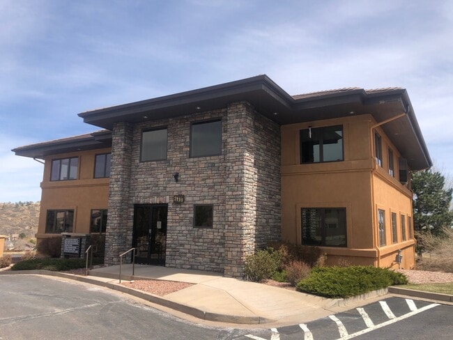
Property Record
2139 Chuckwagon Rd, Colorado Springs, CO 80919


Property Detail
2139 Chuckwagon Rd
73143-15-010
LOT 2 NICHOLS OFFICE PARK FIL NO 3
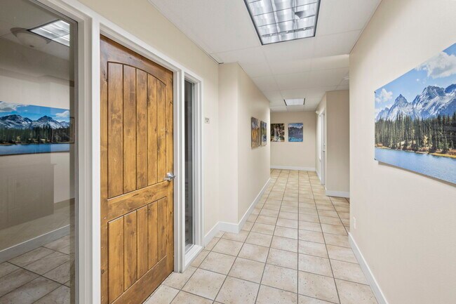
Officebuilding
EL PASO
BP HS
Colorado
B and X Area of moderate flood hazard, usually the area between the limits of the 100-year and 500-year floods.
2
2024
0.14 AC
2025
Northwest
003708
Colorado Springs
7,157 SF
Colorado Springs, CO
NEARBY LISTINGS FOR SALE OR LEASE
DEMOGRAPHICS near 2139 Chuckwagon Rd
1 mile
3 mile
5 mile
2025 Total Population
7,729
39,892
108,159
2030 Population
7,901
40,489
109,657
Pop Growth 2025-2030
+ 2.23%
+ 1.50%
+ 1.38%
Average Age
43
42
42
2025 Total Households
3,268
16,717
46,891
HH Growth 2025-2030
+ 2.48%
+ 1.79%
+ 1.67%
Median Household Inc
$111,883
$99,881
$85,488
Avg Household Size
2.30
2.30
2.20
2025 Avg HH Vehicles
2.00
2.00
2.00
Median Home Value
$600,724
$624,020
$495,730
Median Year Built
1994
1988
1982
Nearby Places
Map Layers
Map Styles
 Street
 Aerial
Layers
 Traffic
 Biking
Places
Listings with unknown addresses are not visible on the map
- Restaurants
- Banks
- Shops
- Fitness
- Groceries
PUBLIC TRANSPORTATION
AIRPORT
City of Colorado Springs Municipal
Drive
Walk
Distance
City of Colorado Springs Municipal
32 min
18.9 mi
Freight Ports
Tulsa Port Of Catoosa
Drive
Walk
Distance
Tulsa Port Of Catoosa
745 min
694.6 mi
SALE & LEASE HISTORY
LISTING DATE
SALE/LEASE

Sep 07, 2022
For Lease
Jan 31, 2022
For Sale
Jan 24, 2025
For Sale
Jan 10, 2017
For Lease
Feb 03, 2022
For Lease
Dec 20, 2021
For Lease
Nearby Properties
Address
Land Use
TOTAL SIZE
Lot Size
Zoning
Address
Land Use
TOTAL SIZE
Lot Size
Zoning
662,208 SF
14.96 AC
BP
Address
Land Use
TOTAL SIZE
Lot Size
Zoning
62,201 SF
5.68 AC
MX-N
Address
Land Use
TOTAL SIZE
Lot Size
Zoning
117,227 SF
12.28 AC
PDZ HS
Address
Land Use
TOTAL SIZE
Lot Size
Zoning
747,294 SF
61.26 AC
BP HS
Address
Land Use
TOTAL SIZE
Lot Size
Zoning
139,621 SF
403.34 AC
A R-E HS
Address
Land Use
TOTAL SIZE
Lot Size
Zoning
77,655 SF
8.39 AC
MX-N MX-N/
Address
Land Use
TOTAL SIZE
Lot Size
Zoning
113,069 SF
44.99 AC
R-E HS
Address
Land Use
TOTAL SIZE
Lot Size
Zoning
93,939 SF
112.21 AC
PDZ
Address
Land Use
TOTAL SIZE
Lot Size
Zoning
131,696 SF
9.24 AC
MX-M
Address
Land Use
TOTAL SIZE
Lot Size
Zoning
100,930 SF
7.75 AC
BP CU
Address
Land Use
TOTAL SIZE
Lot Size
Zoning
99,488 SF
13.01 AC
PDZ
Address
Land Use
TOTAL SIZE
Lot Size
Zoning
30,757 SF
6.19 AC
MX-N CU HS
Address
Land Use
TOTAL SIZE
Lot Size
Zoning
34,443 SF
5.14 AC
PF
Address
Land Use
TOTAL SIZE
Lot Size
Zoning
53,632 SF
3.42 AC
PF SS
Address
Land Use
TOTAL SIZE
Lot Size
Zoning
158,502 SF
5.73 AC
MX-N HS
Address
Land Use
TOTAL SIZE
Lot Size
Zoning
41,015 SF
0.62 AC
BP
Address
Land Use
TOTAL SIZE
Lot Size
Zoning
23,431 SF
0.17 AC
R-E MX-M P
Address
Land Use
TOTAL SIZE
Lot Size
Zoning
301,559 SF
46.67 AC
BP/CR CU H
Address
Land Use
TOTAL SIZE
Lot Size
Zoning
61,098 SF
5.93 AC
LI
Address
Land Use
TOTAL SIZE
Lot Size
Zoning
88.37 AC
BP/CR HS C
Address
Land Use
TOTAL SIZE
Lot Size
Zoning
249,958 SF
21.03 AC
BP/CR HS C
Address
Land Use
TOTAL SIZE
Lot Size
Zoning
554,579 SF
97.22 AC
BP
Address
Land Use
TOTAL SIZE
Lot Size
Zoning
39,120 SF
2.16 AC
LI/CR CU
Address
Land Use
TOTAL SIZE
Lot Size
Zoning
70,999 SF
2.82 AC
C6
Address
Land Use
TOTAL SIZE
Lot Size
Zoning
39,807 SF
12.94 AC
MX-N CU UV
Address
Land Use
TOTAL SIZE
Lot Size
Zoning
26,040 SF
0.94 AC
R-5
Address
Land Use
TOTAL SIZE
Lot Size
Zoning
437,714 SF
24.97 AC
BP PDZ UV
Address
Land Use
TOTAL SIZE
Lot Size
Zoning
331,438 SF
14.63 AC
PDZ
Address
Land Use
TOTAL SIZE
Lot Size
Zoning
199,901 SF
9.77 AC
MX-M/CR HS
Address
Land Use
TOTAL SIZE
Lot Size
Zoning
150,075 SF
10.78 AC
BP HS CU S
The World's #1 Commercial Real Estate Marketplace
Connect with us
© 2026 CoStar Group
The information above has been obtained from sources believed reliable. While we do not doubt its accuracy we have not verified it and make no guarantee, warranty or representation about it. It is your responsibility to independently confirm its accuracy and completeness. Any projections, opinions, assumptions, or estimates used are for example only and do not represent the current or future performance of the property. The value of this transaction to you depends on tax and other factors which should be evaluated by your tax, financial, and legal advisors. You and your advisors should conduct a careful, independent investigation of the property to determine to your satisfaction the suitability of the property for your needs.