Property Record
200 E Little Creek Rd, Norfolk, VA 23505
NEARBY LISTINGS FOR SALE OR LEASE
Property Detail
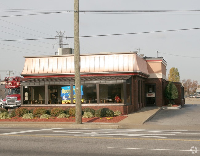
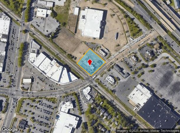
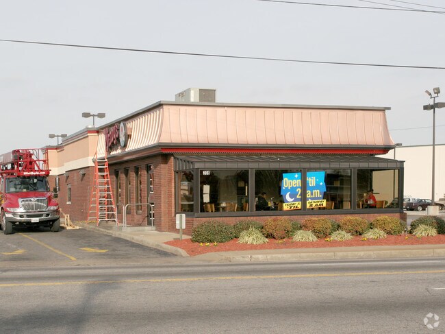
200 E Little Creek Rd
13529100
PARCEL & 211.47FT
Restaurantdrivein
Norfolk City
X
Virginia
5101040017H
1.01 AC
2025
Wards Corner
2025
Hampton Roads
001500
Virginia Beach-Norfolk-Newport News, VA-NC
3,490 SF
DEMOGRAPHICS near 200 E Little Creek Rd
1 Mile
3 Mile
5 Mile
2024 Total Population
12,331
122,860
209,448
2029 Population
11,990
119,585
204,771
Pop Growth 2024-2029
(2.77%)
(2.67%)
(2.23%)
Average Age
39
36
36
2024 Total Households
5,792
46,126
82,063
HH Growth 2024-2029
(3.18%)
(3.11%)
(2.60%)
Median Household Inc
$50,590
$60,938
$60,065
Avg Household Size
2.10
2.30
2.20
2024 Avg HH Vehicles
1.00
2.00
2.00
Median Home Value
$235,271
$250,459
$254,025
Median Year Built
1957
1960
1964
Nearby Places
Map Layers
Map Styles
 Street
 Aerial
- Restaurants
- Banks
- Shops
- Fitness
- Groceries
PUBLIC TRANSPORTATION
COMMUTER RAIL
Norfolk (Northeast Regional - Amtrak)
DRIVE
WALK
Distance
Norfolk (Northeast Regional - Amtrak)
11 min
6.0 mi
AIRPORT
Norfolk International
DRIVE
WALK
Distance
Norfolk International
10 min
5.0 mi
Newport News/Williamsburg International
DRIVE
WALK
Distance
Newport News/Williamsburg International
35 min
23.9 mi
Freight Ports
Virginia Port Authority - Norfolk
DRIVE
WALK
Distance
Virginia Port Authority - Norfolk
11 min
3.9 mi
Nearby Properties
Address
Land Use
TOTAL SIZE
Lot Size
Zoning
Address
Land Use
TOTAL SIZE
Lot Size
Zoning
1,190.45 AC
Address
Land Use
TOTAL SIZE
Lot Size
Zoning
777.89 AC
Address
Land Use
TOTAL SIZE
Lot Size
Zoning
92.17 AC
OSP
Address
Land Use
TOTAL SIZE
Lot Size
Zoning
8,423 SF
53.95 AC
Address
Land Use
TOTAL SIZE
Lot Size
Zoning
40.37 AC
R6
Address
Land Use
TOTAL SIZE
Lot Size
Zoning
213 AC
I5
Address
Land Use
TOTAL SIZE
Lot Size
Zoning
321,691 SF
30.58 AC
Address
Land Use
TOTAL SIZE
Lot Size
Zoning
126,088 SF
4.91 AC
C2
Address
Land Use
TOTAL SIZE
Lot Size
Zoning
91,982 SF
22.78 AC
IN1
Address
Land Use
TOTAL SIZE
Lot Size
Zoning
167,279 SF
9.97 AC
IN1
Address
Land Use
TOTAL SIZE
Lot Size
Zoning
103,496 SF
25.81 AC
IN1
Address
Land Use
TOTAL SIZE
Lot Size
Zoning
10.40 AC
IN1
Address
Land Use
TOTAL SIZE
Lot Size
Zoning
235,750 SF
4.16 AC
UV
Address
Land Use
TOTAL SIZE
Lot Size
Zoning
11.09 AC
R14
Address
Land Use
TOTAL SIZE
Lot Size
Zoning
1,020 SF
13.45 AC
R11
Address
Land Use
TOTAL SIZE
Lot Size
Zoning
47,832 SF
7.51 AC
C2
Address
Land Use
TOTAL SIZE
Lot Size
Zoning
6,170 SF
18.46 AC
R13
Address
Land Use
TOTAL SIZE
Lot Size
Zoning
19.47 AC
86
Address
Land Use
TOTAL SIZE
Lot Size
Zoning
52,612 SF
4.94 AC
Address
Land Use
TOTAL SIZE
Lot Size
Zoning
27,840 SF
5.80 AC
R11
Address
Land Use
TOTAL SIZE
Lot Size
Zoning
14.02 AC
Address
Land Use
TOTAL SIZE
Lot Size
Zoning
41,754 SF
6.01 AC
Address
Land Use
TOTAL SIZE
Lot Size
Zoning
40,086 SF
4.81 AC
UV
Address
Land Use
TOTAL SIZE
Lot Size
Zoning
40,086 SF
4.95 AC
UV
Address
Land Use
TOTAL SIZE
Lot Size
Zoning
170,152 SF
6.07 AC
PDMU1
Address
Land Use
TOTAL SIZE
Lot Size
Zoning
6.96 AC
R11
Address
Land Use
TOTAL SIZE
Lot Size
Zoning
123,868 SF
0.12 AC
IN2
Address
Land Use
TOTAL SIZE
Lot Size
Zoning
25,880 SF
31.21 AC
91
Address
Land Use
TOTAL SIZE
Lot Size
Zoning
1.81 AC
R13
Address
Land Use
TOTAL SIZE
Lot Size
Zoning
36,530 SF
16.46 AC
IN1
The World's #1 Commercial Real Estate Marketplace
Connect with us
© 2025 CoStar Group
The information above has been obtained from sources believed reliable. While we do not doubt its accuracy we have not verified it and make no guarantee, warranty or representation about it. It is your responsibility to independently confirm its accuracy and completeness. Any projections, opinions, assumptions, or estimates used are for example only and do not represent the current or future performance of the property. The value of this transaction to you depends on tax and other factors which should be evaluated by your tax, financial, and legal advisors. You and your advisors should conduct a careful, independent investigation of the property to determine to your satisfaction the suitability of the property for your needs.