Property Record
2142 E Durham Ferry Rd, Tracy, CA 95304

Property Detail
2142 E Durham Ferry Rd
255-200-19
08-FM PT OF 255-200-15/PT TO 20 PER 07142312
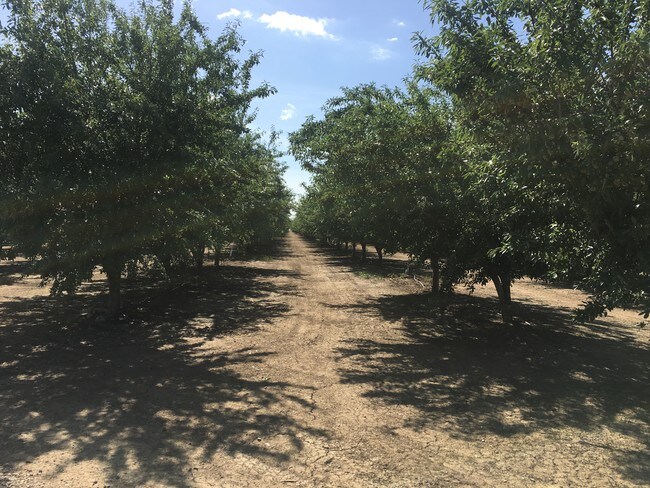
Residentialacreage
SAN JOAQUIN
AG40
California
B and X Area of moderate flood hazard, usually the area between the limits of the 100-year and 500-year floods.
3.54 AC
2025
Tracy/Manteca
2025
Stockton/Modesto
005503
Stockton-Lodi, CA
NEARBY LISTINGS FOR SALE OR LEASE
-
-
View all Tracy listings for sale on LoopNet.com
DEMOGRAPHICS near 2142 E Durham Ferry Rd
1 mile
3 mile
5 mile
2025 Total Population
907
1,611
2,632
2030 Population
910
1,595
2,609
Pop Growth 2025-2030
+ 0.33%
(0.99%)
(0.87%)
Average Age
48
45
42
2025 Total Households
413
657
979
HH Growth 2025-2030
+ 0.48%
(0.76%)
(0.72%)
Median Household Inc
$50,678
$56,841
$61,526
Avg Household Size
2.10
2.40
2.60
2025 Avg HH Vehicles
2.00
3.00
3.00
Median Home Value
$141,118
$165,806
$240,217
Median Year Built
1961
1967
1972
Nearby Places
Map Layers
Map Styles
 Street
 Aerial
Layers
 Traffic
 Biking
Places
Listings with unknown addresses are not visible on the map
- Restaurants
- Banks
- Shops
- Fitness
- Groceries
PUBLIC TRANSPORTATION
AIRPORT
Stockton Metro
Drive
Walk
Distance
Stockton Metro
32 min
21.1 mi
Freight Ports
Port of Stockton
Drive
Walk
Distance
Port of Stockton
35 min
24.6 mi
SALE & LEASE HISTORY
LISTING DATE
SALE/LEASE

Sep 03, 2021
For Sale
May 16, 2019
For Sale
Nearby Properties
Address
Land Use
TOTAL SIZE
Lot Size
Zoning
Address
Land Use
TOTAL SIZE
Lot Size
Zoning
1,660 SF
919.32 AC
A240
Address
Land Use
TOTAL SIZE
Lot Size
Zoning
81.43 AC
AG40
Address
Land Use
TOTAL SIZE
Lot Size
Zoning
372.77 AC
Address
Land Use
TOTAL SIZE
Lot Size
Zoning
3,533 SF
444.68 AC
AG40
Address
Land Use
TOTAL SIZE
Lot Size
Zoning
483.86 AC
AG40
Address
Land Use
TOTAL SIZE
Lot Size
Zoning
210 AC
AG40
Address
Land Use
TOTAL SIZE
Lot Size
Zoning
459.92 AC
AG40
Address
Land Use
TOTAL SIZE
Lot Size
Zoning
196.79 AC
AG40
Address
Land Use
TOTAL SIZE
Lot Size
Zoning
114.57 AC
AG40
Address
Land Use
TOTAL SIZE
Lot Size
Zoning
1,245 SF
411.96 AC
AG40
Address
Land Use
TOTAL SIZE
Lot Size
Zoning
281.44 AC
AG40
Address
Land Use
TOTAL SIZE
Lot Size
Zoning
290.79 AC
AG40
Address
Land Use
TOTAL SIZE
Lot Size
Zoning
403 SF
52.84 AC
AG40
Address
Land Use
TOTAL SIZE
Lot Size
Zoning
1,804 SF
574.65 AC
AG40
Address
Land Use
TOTAL SIZE
Lot Size
Zoning
38.94 AC
AG40
Address
Land Use
TOTAL SIZE
Lot Size
Zoning
9,640 SF
40.01 AC
AG40
Address
Land Use
TOTAL SIZE
Lot Size
Zoning
6,300 SF
43.10 AC
AG40
Address
Land Use
TOTAL SIZE
Lot Size
Zoning
940 SF
5.85 AC
IW
Address
Land Use
TOTAL SIZE
Lot Size
Zoning
6,752 SF
36.02 AC
Address
Land Use
TOTAL SIZE
Lot Size
Zoning
200 AC
AG40
Address
Land Use
TOTAL SIZE
Lot Size
Zoning
1,440 SF
202.38 AC
AG40
Address
Land Use
TOTAL SIZE
Lot Size
Zoning
2,491 SF
55.88 AC
AG40
Address
Land Use
TOTAL SIZE
Lot Size
Zoning
3,582 SF
52.22 AC
AG40
Address
Land Use
TOTAL SIZE
Lot Size
Zoning
147.65 AC
AG40
Address
Land Use
TOTAL SIZE
Lot Size
Zoning
347.70 AC
Address
Land Use
TOTAL SIZE
Lot Size
Zoning
45.22 AC
AG40
Address
Land Use
TOTAL SIZE
Lot Size
Zoning
2,486 SF
5.35 AC
Address
Land Use
TOTAL SIZE
Lot Size
Zoning
2,950 SF
86.19 AC
AG40
Address
Land Use
TOTAL SIZE
Lot Size
Zoning
10,709 SF
40.96 AC
AG40
Address
Land Use
TOTAL SIZE
Lot Size
Zoning
39.29 AC
AG40
The World's #1 Commercial Real Estate Marketplace
Connect with us
© 2026 CoStar Group
The information above has been obtained from sources believed reliable. While we do not doubt its accuracy we have not verified it and make no guarantee, warranty or representation about it. It is your responsibility to independently confirm its accuracy and completeness. Any projections, opinions, assumptions, or estimates used are for example only and do not represent the current or future performance of the property. The value of this transaction to you depends on tax and other factors which should be evaluated by your tax, financial, and legal advisors. You and your advisors should conduct a careful, independent investigation of the property to determine to your satisfaction the suitability of the property for your needs.