Property Record
2145 31E Hwy, Gallatin, TN 37066
NEARBY LISTINGS FOR SALE OR LEASE
Property Detail
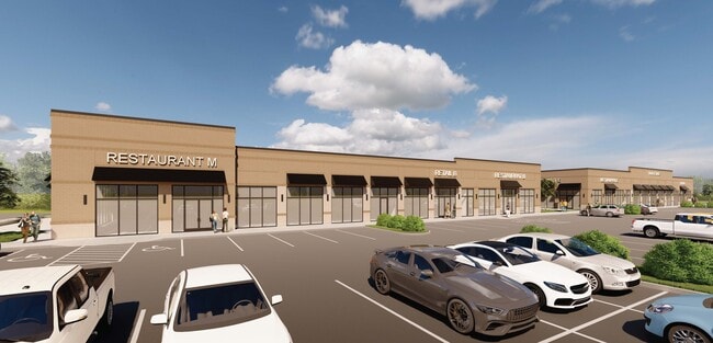
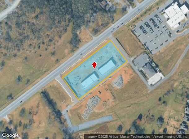
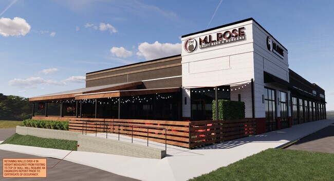
2145 31E Hwy
Nashville
Savannah Marketplace Ph 4 Com 2+3
Nashville-Davidson--Murfreesboro--Franklin, TN
PB32 PG380 LT2
083146 11200
Sumner
Residentialacreage
Tennessee
2024
2
2025
4.02 AC
020905
Hendersonville-Gallatin
12,040 SF
DEMOGRAPHICS near 2145 31E Hwy
1 Mile
3 Mile
5 Mile
2024 Total Population
3,434
30,624
78,387
2029 Population
3,851
34,558
88,318
Pop Growth 2024-2029
+ 12.14%
+ 12.85%
+ 12.67%
Average Age
40
41
41
2024 Total Households
1,272
11,956
29,776
HH Growth 2024-2029
+ 12.34%
+ 13.16%
+ 12.89%
Median Household Inc
$96,963
$93,448
$88,064
Avg Household Size
2.70
2.50
2.60
2024 Avg HH Vehicles
2.00
2.00
2.00
Median Home Value
$461,851
$449,148
$398,130
Median Year Built
2007
2008
2002
Nearby Places
Map Layers
Map Styles
 Street
 Aerial
- Restaurants
- Banks
- Shops
- Fitness
- Groceries
PUBLIC TRANSPORTATION
AIRPORT
Nashville International
DRIVE
WALK
Distance
Nashville International
38 min
30.4 mi
Freight Ports
Port of Mobile
DRIVE
WALK
Distance
Port of Mobile
510 min
468.0 mi
SALE & LEASE HISTORY
LISTING DATE
SALE/LEASE

Jul 05, 2023
For Lease
Nearby Properties
Address
Land Use
TOTAL SIZE
Lot Size
Zoning
Address
Land Use
TOTAL SIZE
Lot Size
Zoning
2,109 SF
1.30 AC
Address
Land Use
TOTAL SIZE
Lot Size
Zoning
47,729 SF
28.52 AC
Address
Land Use
TOTAL SIZE
Lot Size
Zoning
58,184 SF
26.27 AC
Address
Land Use
TOTAL SIZE
Lot Size
Zoning
31,163 SF
24.37 AC
Address
Land Use
TOTAL SIZE
Lot Size
Zoning
10,208 SF
29.53 AC
ESTATEA
Address
Land Use
TOTAL SIZE
Lot Size
Zoning
27,317 SF
22.74 AC
Address
Land Use
TOTAL SIZE
Lot Size
Zoning
30,149 SF
21.02 AC
Address
Land Use
TOTAL SIZE
Lot Size
Zoning
29,438 SF
6.53 AC
Address
Land Use
TOTAL SIZE
Lot Size
Zoning
101,672 SF
16.53 AC
Address
Land Use
TOTAL SIZE
Lot Size
Zoning
29,160 SF
20.02 AC
Address
Land Use
TOTAL SIZE
Lot Size
Zoning
31,764 SF
MU
Address
Land Use
TOTAL SIZE
Lot Size
Zoning
18,734 SF
12.33 AC
MU
Address
Land Use
TOTAL SIZE
Lot Size
Zoning
81,584 SF
5.99 AC
Address
Land Use
TOTAL SIZE
Lot Size
Zoning
47,319 SF
7.52 AC
Address
Land Use
TOTAL SIZE
Lot Size
Zoning
21,126 SF
7.67 AC
Address
Land Use
TOTAL SIZE
Lot Size
Zoning
11,274 SF
15.30 AC
Address
Land Use
TOTAL SIZE
Lot Size
Zoning
27,148 SF
8 AC
Address
Land Use
TOTAL SIZE
Lot Size
Zoning
Address
Land Use
TOTAL SIZE
Lot Size
Zoning
131,339 SF
18.22 AC
Address
Land Use
TOTAL SIZE
Lot Size
Zoning
99,333 SF
1.73 AC
ESTATEA
Address
Land Use
TOTAL SIZE
Lot Size
Zoning
73,567 SF
9.99 AC
MRO
Address
Land Use
TOTAL SIZE
Lot Size
Zoning
52,364 SF
5.78 AC
OPS
Address
Land Use
TOTAL SIZE
Lot Size
Zoning
22,364 SF
5 AC
Address
Land Use
TOTAL SIZE
Lot Size
Zoning
26,848 SF
21.70 AC
OPS
Address
Land Use
TOTAL SIZE
Lot Size
Zoning
1.27 AC
Address
Land Use
TOTAL SIZE
Lot Size
Zoning
38,274 SF
9.27 AC
CPUD
Address
Land Use
TOTAL SIZE
Lot Size
Zoning
19,264 SF
12.38 AC
Address
Land Use
TOTAL SIZE
Lot Size
Zoning
34,548 SF
5.11 AC
MU
Address
Land Use
TOTAL SIZE
Lot Size
Zoning
24,740 SF
5.91 AC
CS
Address
Land Use
TOTAL SIZE
Lot Size
Zoning
31,700 SF
8.50 AC
The World's #1 Commercial Real Estate Marketplace
Connect with us
© 2026 CoStar Group
The information above has been obtained from sources believed reliable. While we do not doubt its accuracy we have not verified it and make no guarantee, warranty or representation about it. It is your responsibility to independently confirm its accuracy and completeness. Any projections, opinions, assumptions, or estimates used are for example only and do not represent the current or future performance of the property. The value of this transaction to you depends on tax and other factors which should be evaluated by your tax, financial, and legal advisors. You and your advisors should conduct a careful, independent investigation of the property to determine to your satisfaction the suitability of the property for your needs.