Property Record
2149 S Nevada Ave, Provo, UT 84606

Property Detail
2149 S Nevada Ave
Provo-Orem-Lehi, UT
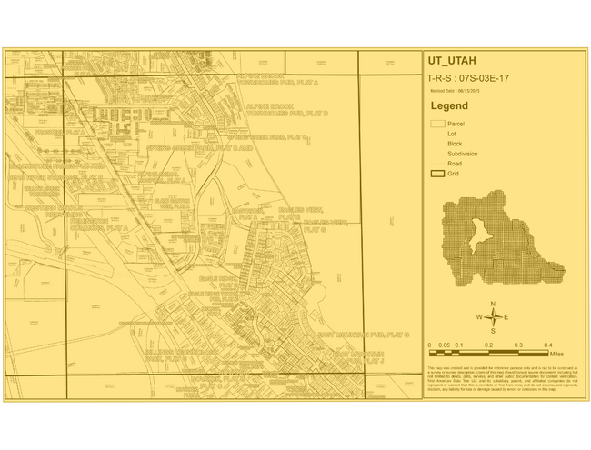
LOT 6, PLAT B, CRESCENT HILLS SUBDV. AREA 0.296 AC.
36-141-0013
Utah
Multifamilydwelling
Utah
2024
6
2025
0.30 AC
002702
Provo South
4,658 SF
Salt Lake City
NEARBY LISTINGS FOR SALE OR LEASE
DEMOGRAPHICS near 2149 S Nevada Ave
1 mile
3 mile
5 mile
2025 Total Population
3,266
59,904
157,332
2030 Population
3,580
65,926
173,151
Pop Growth 2025-2030
+ 9.61%
+ 10.05%
+ 10.05%
Average Age
30
29
30
2025 Total Households
940
19,417
47,863
HH Growth 2025-2030
+ 10.32%
+ 10.91%
+ 11.19%
Median Household Inc
$93,263
$64,576
$69,081
Avg Household Size
3.30
2.90
3.00
2025 Avg HH Vehicles
2.00
2.00
2.00
Median Home Value
$496,841
$455,212
$488,739
Median Year Built
2001
1989
1989
Nearby Places
Map Layers
Map Styles
 Street
 Aerial
Layers
 Traffic
 Biking
Places
Listings with unknown addresses are not visible on the map
- Restaurants
- Banks
- Shops
- Fitness
- Groceries
PUBLIC TRANSPORTATION
COMMUTER RAIL
Provo Central Station (FrontRunner - Utah Transit Authority (UTA))
Drive
Walk
Distance
Provo Central Station (FrontRunner - Utah Transit Authority (UTA))
5 min
2.8 mi
Provo Amtrak (California Zephyr - Amtrak)
Drive
Walk
Distance
Provo Amtrak (California Zephyr - Amtrak)
5 min
3.0 mi
AIRPORT
Provo Municipal
Drive
Walk
Distance
Provo Municipal
10 min
5.5 mi
Freight Ports
Port of Stockton
Drive
Walk
Distance
Port of Stockton
760 min
742.0 mi
Nearby Properties
Address
Land Use
TOTAL SIZE
Lot Size
Zoning
Address
Land Use
TOTAL SIZE
Lot Size
Zoning
442,598 SF
22.94 AC
Address
Land Use
TOTAL SIZE
Lot Size
Zoning
347,829 SF
5.26 AC
Address
Land Use
TOTAL SIZE
Lot Size
Zoning
366,509 SF
2.83 AC
Address
Land Use
TOTAL SIZE
Lot Size
Zoning
138,990 SF
2.87 AC
Address
Land Use
TOTAL SIZE
Lot Size
Zoning
297,467 SF
16.87 AC
Address
Land Use
TOTAL SIZE
Lot Size
Zoning
371,881 SF
4.91 AC
Address
Land Use
TOTAL SIZE
Lot Size
Zoning
69,236 SF
30.28 AC
Address
Land Use
TOTAL SIZE
Lot Size
Zoning
286,188 SF
13.63 AC
Address
Land Use
TOTAL SIZE
Lot Size
Zoning
269,742 SF
16.30 AC
Address
Land Use
TOTAL SIZE
Lot Size
Zoning
671,002 SF
59.02 AC
Address
Land Use
TOTAL SIZE
Lot Size
Zoning
370,735 SF
18.54 AC
Address
Land Use
TOTAL SIZE
Lot Size
Zoning
222,848 SF
11.14 AC
Address
Land Use
TOTAL SIZE
Lot Size
Zoning
266,387 SF
1.76 AC
Address
Land Use
TOTAL SIZE
Lot Size
Zoning
174,883 SF
17.42 AC
Address
Land Use
TOTAL SIZE
Lot Size
Zoning
269,652 SF
3.65 AC
Address
Land Use
TOTAL SIZE
Lot Size
Zoning
208,492 SF
12.49 AC
Address
Land Use
TOTAL SIZE
Lot Size
Zoning
177,428 SF
9.83 AC
Address
Land Use
TOTAL SIZE
Lot Size
Zoning
233,451 SF
1.73 AC
Address
Land Use
TOTAL SIZE
Lot Size
Zoning
386,576 SF
128.19 AC
Address
Land Use
TOTAL SIZE
Lot Size
Zoning
240,674 SF
19.41 AC
Address
Land Use
TOTAL SIZE
Lot Size
Zoning
238,651 SF
14.45 AC
Address
Land Use
TOTAL SIZE
Lot Size
Zoning
124,986 SF
8.67 AC
Address
Land Use
TOTAL SIZE
Lot Size
Zoning
151,447 SF
16.14 AC
Address
Land Use
TOTAL SIZE
Lot Size
Zoning
141,566 SF
7.89 AC
Address
Land Use
TOTAL SIZE
Lot Size
Zoning
231,991 SF
13.76 AC
Address
Land Use
TOTAL SIZE
Lot Size
Zoning
151,447 SF
8.61 AC
Address
Land Use
TOTAL SIZE
Lot Size
Zoning
195,248 SF
13.20 AC
Address
Land Use
TOTAL SIZE
Lot Size
Zoning
128,650 SF
10 AC
Address
Land Use
TOTAL SIZE
Lot Size
Zoning
120,613 SF
5.13 AC
Address
Land Use
TOTAL SIZE
Lot Size
Zoning
170,273 SF
9.19 AC
The World's #1 Commercial Real Estate Marketplace
Connect with us
© 2026 CoStar Group
The information above has been obtained from sources believed reliable. While we do not doubt its accuracy we have not verified it and make no guarantee, warranty or representation about it. It is your responsibility to independently confirm its accuracy and completeness. Any projections, opinions, assumptions, or estimates used are for example only and do not represent the current or future performance of the property. The value of this transaction to you depends on tax and other factors which should be evaluated by your tax, financial, and legal advisors. You and your advisors should conduct a careful, independent investigation of the property to determine to your satisfaction the suitability of the property for your needs.