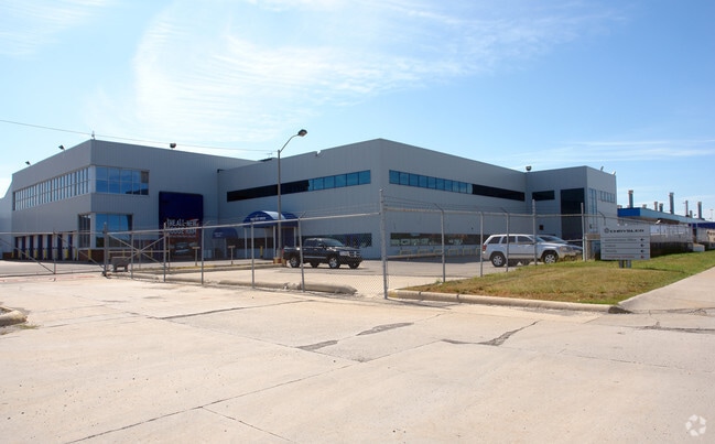
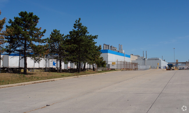
Property Record
21500 Mound Rd, Warren, MI 48091

Property Detail
21500 Mound Rd
12-13-33-100-006
SEC 33; COM AT NW COR SEC 33; TH N89*09'22"E 102.01 FT ALG NSEC LINE TO POB; TH CONT N89*-09'22"E 1783.61 FT ALG SD SEC LINE;
Lightindustrial
Macomb
M-4
Michigan
B and X Area of moderate flood hazard, usually the area between the limits of the 100-year and 500-year floods.
58.32 AC
2025
W of Van Dyke/Macomb
2025
Detroit
982200
Detroit-Warren-Dearborn, MI
1,784,888 SF
NEARBY LISTINGS FOR SALE OR LEASE
DEMOGRAPHICS near 21500 Mound Rd
1 mile
3 mile
5 mile
2025 Total Population
12,992
127,735
369,801
2030 Population
13,194
130,263
376,591
Pop Growth 2025-2030
+ 1.55%
+ 1.98%
+ 1.84%
Average Age
36
38
38
2025 Total Households
4,602
49,058
143,116
HH Growth 2025-2030
+ 1.61%
+ 1.95%
+ 1.95%
Median Household Inc
$50,112
$46,690
$52,786
Avg Household Size
2.70
2.50
2.50
2025 Avg HH Vehicles
2.00
1.00
1.00
Median Home Value
$73,635
$94,883
$134,596
Median Year Built
1954
1955
1955
Nearby Places
Map Layers
Map Styles
 Street
 Aerial
Layers
 Traffic
 Biking
Places
Listings with unknown addresses are not visible on the map
- Restaurants
- Banks
- Shops
- Fitness
- Groceries
PUBLIC TRANSPORTATION
COMMUTER RAIL
Royal Oak Amtrak (Wolverine - Amtrak)
Drive
Walk
Distance
Royal Oak Amtrak (Wolverine - Amtrak)
17 min
8.3 mi
Detroit (Wolverine - Amtrak)
Drive
Walk
Distance
Detroit (Wolverine - Amtrak)
18 min
9.8 mi
AIRPORT
Windsor International
Drive
Walk
Distance
Windsor International
43 min
21.6 mi
Detroit Metro Wayne County
Drive
Walk
Distance
Detroit Metro Wayne County
48 min
31.2 mi
Freight Ports
Port of Toledo
Drive
Walk
Distance
Port of Toledo
93 min
72.2 mi
Nearby Properties
Address
Land Use
TOTAL SIZE
Lot Size
Zoning
Address
Land Use
TOTAL SIZE
Lot Size
Zoning
910,140 SF
47.78 AC
Address
Land Use
TOTAL SIZE
Lot Size
Zoning
419,600 SF
Address
Land Use
TOTAL SIZE
Lot Size
Zoning
649,140 SF
43.98 AC
Address
Land Use
TOTAL SIZE
Lot Size
Zoning
3,327,621 SF
130.89 AC
M-4
Address
Land Use
TOTAL SIZE
Lot Size
Zoning
576,924 SF
31.35 AC
Address
Land Use
TOTAL SIZE
Lot Size
Zoning
450,958 SF
Address
Land Use
TOTAL SIZE
Lot Size
Zoning
306,345 SF
Address
Land Use
TOTAL SIZE
Lot Size
Zoning
455,425 SF
Address
Land Use
TOTAL SIZE
Lot Size
Zoning
576,924 SF
36.24 AC
Address
Land Use
TOTAL SIZE
Lot Size
Zoning
401,671 SF
19.40 AC
MZ
Address
Land Use
TOTAL SIZE
Lot Size
Zoning
198,064 SF
11.11 AC
MZ
Address
Land Use
TOTAL SIZE
Lot Size
Zoning
1,261,658 SF
71.94 AC
M-2
Address
Land Use
TOTAL SIZE
Lot Size
Zoning
233,900 SF
15.56 AC
M-2
Address
Land Use
TOTAL SIZE
Lot Size
Zoning
Address
Land Use
TOTAL SIZE
Lot Size
Zoning
272,046 SF
17.63 AC
M-2
Address
Land Use
TOTAL SIZE
Lot Size
Zoning
362,895 SF
14.85 AC
M-2
Address
Land Use
TOTAL SIZE
Lot Size
Zoning
259,959 SF
27.39 AC
MZ
Address
Land Use
TOTAL SIZE
Lot Size
Zoning
287,360 SF
21.42 AC
AD
Address
Land Use
TOTAL SIZE
Lot Size
Zoning
220,561 SF
10.62 AC
M-2
Address
Land Use
TOTAL SIZE
Lot Size
Zoning
1,094,075 SF
58.76 AC
M-4
Address
Land Use
TOTAL SIZE
Lot Size
Zoning
303,615 SF
22.07 AC
MZ
Address
Land Use
TOTAL SIZE
Lot Size
Zoning
426,764 SF
38.46 AC
R-M
Address
Land Use
TOTAL SIZE
Lot Size
Zoning
197,670 SF
42.84 AC
M4
Address
Land Use
TOTAL SIZE
Lot Size
Zoning
166,064 SF
6.33 AC
M-3
Address
Land Use
TOTAL SIZE
Lot Size
Zoning
123,844 SF
1.81 AC
R2
Address
Land Use
TOTAL SIZE
Lot Size
Zoning
156,250 SF
8.79 AC
B4
Address
Land Use
TOTAL SIZE
Lot Size
Zoning
168,200 SF
12.08 AC
R-3
Address
Land Use
TOTAL SIZE
Lot Size
Zoning
162,400 SF
M1LT
Address
Land Use
TOTAL SIZE
Lot Size
Zoning
184,986 SF
13.49 AC
MZ
The World's #1 Commercial Real Estate Marketplace
Connect with us
© 2026 CoStar Group
The information above has been obtained from sources believed reliable. While we do not doubt its accuracy we have not verified it and make no guarantee, warranty or representation about it. It is your responsibility to independently confirm its accuracy and completeness. Any projections, opinions, assumptions, or estimates used are for example only and do not represent the current or future performance of the property. The value of this transaction to you depends on tax and other factors which should be evaluated by your tax, financial, and legal advisors. You and your advisors should conduct a careful, independent investigation of the property to determine to your satisfaction the suitability of the property for your needs.