Property Record
2159 Browns Bridge Rd, Gainesville, GA 30501


Property Detail
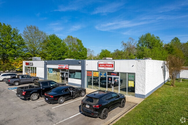
2159 Browns Bridge Rd
01-00127-03-080
BROWNS BRIDGE ROAD
Stripcommercialcenter
Hall
G-B
Georgia
B and X Area of moderate flood hazard, usually the area between the limits of the 100-year and 500-year floods.
169
2025
1.16 AC
2025
Gainesville/Hall Cnty
001102
Atlanta
6,600 SF
Gainesville, GA
NEARBY LISTINGS FOR SALE OR LEASE
DEMOGRAPHICS near 2159 Browns Bridge Rd
1 mile
3 mile
5 mile
2025 Total Population
9,562
46,205
86,229
2030 Population
10,252
49,918
93,567
Pop Growth 2025-2030
+ 7.22%
+ 8.04%
+ 8.51%
Average Age
31
36
38
2025 Total Households
2,598
15,370
30,055
HH Growth 2025-2030
+ 7.39%
+ 8.04%
+ 8.60%
Median Household Inc
$52,608
$63,604
$66,320
Avg Household Size
3.40
2.80
2.70
2025 Avg HH Vehicles
1.00
2.00
2.00
Median Home Value
$211,082
$307,924
$328,385
Median Year Built
1987
1990
1991
Nearby Places
Map Layers
Map Styles
 Street
 Aerial
Layers
 Traffic
 Biking
Places
Listings with unknown addresses are not visible on the map
- Restaurants
- Banks
- Shops
- Fitness
- Groceries
PUBLIC TRANSPORTATION
COMMUTER RAIL
Drive
Walk
Distance
5 min
2.5 mi
SALE & LEASE HISTORY
LISTING DATE
SALE/LEASE

Sep 25, 2019
For Lease
Nov 04, 2020
For Lease
Jul 05, 2018
For Lease
Jan 10, 2021
For Sale
Aug 05, 2022
For Lease
Nearby Properties
Address
Land Use
TOTAL SIZE
Lot Size
Zoning
Address
Land Use
TOTAL SIZE
Lot Size
Zoning
564,132 SF
48.45 AC
PUD
Address
Land Use
TOTAL SIZE
Lot Size
Zoning
66,720 SF
27.49 AC
PUD
Address
Land Use
TOTAL SIZE
Lot Size
Zoning
157,050 SF
144.96 AC
N-B
Address
Land Use
TOTAL SIZE
Lot Size
Zoning
27,221 SF
2.23 AC
G-B
Address
Land Use
TOTAL SIZE
Lot Size
Zoning
2,160 SF
5.60 AC
PUD
Address
Land Use
TOTAL SIZE
Lot Size
Zoning
760,440 SF
53.33 AC
L-I
Address
Land Use
TOTAL SIZE
Lot Size
Zoning
58,020 SF
3.15 AC
PUD
Address
Land Use
TOTAL SIZE
Lot Size
Zoning
3,620 SF
20.20 AC
PUD
Address
Land Use
TOTAL SIZE
Lot Size
Zoning
100,864 SF
4.10 AC
PUD
Address
Land Use
TOTAL SIZE
Lot Size
Zoning
41,471 SF
27.60 AC
G-B/R-1
Address
Land Use
TOTAL SIZE
Lot Size
Zoning
77,333 SF
11.74 AC
PUD
Address
Land Use
TOTAL SIZE
Lot Size
Zoning
19,875 SF
19.76 AC
R-B
Address
Land Use
TOTAL SIZE
Lot Size
Zoning
277,684 SF
23.06 AC
L-I
Address
Land Use
TOTAL SIZE
Lot Size
Zoning
76,726 SF
0.42 AC
C-B
Address
Land Use
TOTAL SIZE
Lot Size
Zoning
132,557 SF
32.85 AC
O-I
Address
Land Use
TOTAL SIZE
Lot Size
Zoning
469,180 SF
25.56 AC
H-I
Address
Land Use
TOTAL SIZE
Lot Size
Zoning
46,795 SF
17.38 AC
PUD
Address
Land Use
TOTAL SIZE
Lot Size
Zoning
102,317 SF
6.90 AC
PUD
Address
Land Use
TOTAL SIZE
Lot Size
Zoning
11,430 SF
38 AC
R-I
Address
Land Use
TOTAL SIZE
Lot Size
Zoning
258,372 SF
24.38 AC
L-I
Address
Land Use
TOTAL SIZE
Lot Size
Zoning
308,672 SF
41.22 AC
L-I
Address
Land Use
TOTAL SIZE
Lot Size
Zoning
308,672 SF
41.22 AC
L-I
Address
Land Use
TOTAL SIZE
Lot Size
Zoning
1,191 SF
262.63 AC
H-I
Address
Land Use
TOTAL SIZE
Lot Size
Zoning
172,114 SF
43.32 AC
M-2
Address
Land Use
TOTAL SIZE
Lot Size
Zoning
1,441 SF
10.46 AC
PUD
Address
Land Use
TOTAL SIZE
Lot Size
Zoning
304,088 SF
17.45 AC
H-I
Address
Land Use
TOTAL SIZE
Lot Size
Zoning
140,805 SF
3.74 AC
PUD
Address
Land Use
TOTAL SIZE
Lot Size
Zoning
102,996 SF
10.94 AC
L-I
Address
Land Use
TOTAL SIZE
Lot Size
Zoning
123,944 SF
13.21 AC
G-B
Address
Land Use
TOTAL SIZE
Lot Size
Zoning
1,392 SF
22.44 AC
PUD
The World's #1 Commercial Real Estate Marketplace
Connect with us
© 2026 CoStar Group
The information above has been obtained from sources believed reliable. While we do not doubt its accuracy we have not verified it and make no guarantee, warranty or representation about it. It is your responsibility to independently confirm its accuracy and completeness. Any projections, opinions, assumptions, or estimates used are for example only and do not represent the current or future performance of the property. The value of this transaction to you depends on tax and other factors which should be evaluated by your tax, financial, and legal advisors. You and your advisors should conduct a careful, independent investigation of the property to determine to your satisfaction the suitability of the property for your needs.