Property Record
217 Stirling Rd, Warren, NJ 07059
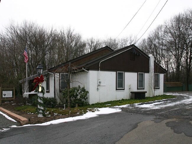


Property Detail
217 Stirling Rd
20-00160-0000-00008
Somerset
Vacantlandnec
New Jersey
EP
8
B and X Area of moderate flood hazard, usually the area between the limits of the 100-year and 500-year floods.
1 AC
2024
Route 78 East
2025
Northern New Jersey
052201
Lakewood-New Brunswick, NJ
2,730 SF
NEARBY LISTINGS FOR SALE OR LEASE
DEMOGRAPHICS near 217 Stirling Rd
1 mile
3 mile
5 mile
2025 Total Population
2,926
31,522
150,194
2030 Population
3,027
33,098
156,215
Pop Growth 2025-2030
+ 3.45%
+ 5.00%
+ 4.01%
Average Age
43
43
40
2025 Total Households
1,039
11,056
50,414
HH Growth 2025-2030
+ 3.37%
+ 5.09%
+ 4.15%
Median Household Inc
$163,517
$180,423
$123,234
Avg Household Size
2.80
2.80
2.90
2025 Avg HH Vehicles
2.00
2.00
2.00
Median Home Value
$765,839
$774,309
$668,017
Median Year Built
1967
1973
1963
Nearby Places
Map Layers
Map Styles
 Street
 Aerial
Layers
 Traffic
 Biking
Places
Listings with unknown addresses are not visible on the map
- Restaurants
- Banks
- Shops
- Fitness
- Groceries
PUBLIC TRANSPORTATION
COMMUTER RAIL
Stirling (Morris & Essex Gladstone Branch - NJ Transit Commuter Rail (NJ Transit))
Drive
Walk
Distance
Stirling (Morris & Essex Gladstone Branch - NJ Transit Commuter Rail (NJ Transit))
4 min
1.5 mi
Gillette (Morris & Essex Gladstone Branch - NJ Transit Commuter Rail (NJ Transit))
Drive
Walk
Distance
Gillette (Morris & Essex Gladstone Branch - NJ Transit Commuter Rail (NJ Transit))
4 min
1.6 mi
AIRPORT
Newark Liberty International
Drive
Walk
Distance
Newark Liberty International
30 min
22.3 mi
Freight Ports
New York Container Terminal
Drive
Walk
Distance
New York Container Terminal
40 min
25.3 mi
Nearby Properties
Address
Land Use
TOTAL SIZE
Lot Size
Zoning
Address
Land Use
TOTAL SIZE
Lot Size
Zoning
52.31 AC
OR
Address
Land Use
TOTAL SIZE
Lot Size
Zoning
206,077 SF
22.03 AC
B5
Address
Land Use
TOTAL SIZE
Lot Size
Zoning
34.27 AC
R65
Address
Land Use
TOTAL SIZE
Lot Size
Zoning
67.22 AC
R65
Address
Land Use
TOTAL SIZE
Lot Size
Zoning
23.93 AC
B2
Address
Land Use
TOTAL SIZE
Lot Size
Zoning
Address
Land Use
TOTAL SIZE
Lot Size
Zoning
18.66 AC
CR
Address
Land Use
TOTAL SIZE
Lot Size
Zoning
8.64 AC
AH-4
Address
Land Use
TOTAL SIZE
Lot Size
Zoning
68,160 SF
11.66 AC
R6
Address
Land Use
TOTAL SIZE
Lot Size
Zoning
1,096 SF
15.12 AC
R5
Address
Land Use
TOTAL SIZE
Lot Size
Zoning
8.09 AC
B3
Address
Land Use
TOTAL SIZE
Lot Size
Zoning
40.36 AC
OR
Address
Land Use
TOTAL SIZE
Lot Size
Zoning
30.84 AC
OR
Address
Land Use
TOTAL SIZE
Lot Size
Zoning
61,059 SF
9.10 AC
R6
Address
Land Use
TOTAL SIZE
Lot Size
Zoning
40.73 AC
OR
Address
Land Use
TOTAL SIZE
Lot Size
Zoning
1,950 SF
10.56 AC
CR
Address
Land Use
TOTAL SIZE
Lot Size
Zoning
15.73 AC
GI
Address
Land Use
TOTAL SIZE
Lot Size
Zoning
7,670 SF
7 AC
R-R
Address
Land Use
TOTAL SIZE
Lot Size
Zoning
22.61 AC
GI
Address
Land Use
TOTAL SIZE
Lot Size
Zoning
Address
Land Use
TOTAL SIZE
Lot Size
Zoning
1.59 AC
GI
Address
Land Use
TOTAL SIZE
Lot Size
Zoning
2.71 AC
CR
Address
Land Use
TOTAL SIZE
Lot Size
Zoning
1.28 AC
GI
Address
Land Use
TOTAL SIZE
Lot Size
Zoning
9.53 AC
DD
Address
Land Use
TOTAL SIZE
Lot Size
Zoning
1.21 AC
GI
Address
Land Use
TOTAL SIZE
Lot Size
Zoning
19.20 AC
GI
Address
Land Use
TOTAL SIZE
Lot Size
Zoning
24.29 AC
GI
Address
Land Use
TOTAL SIZE
Lot Size
Zoning
7.46 AC
BR80
Address
Land Use
TOTAL SIZE
Lot Size
Zoning
6.43 AC
CB
Address
Land Use
TOTAL SIZE
Lot Size
Zoning
23.61 AC
R65
The World's #1 Commercial Real Estate Marketplace
Connect with us
© 2026 CoStar Group
The information above has been obtained from sources believed reliable. While we do not doubt its accuracy we have not verified it and make no guarantee, warranty or representation about it. It is your responsibility to independently confirm its accuracy and completeness. Any projections, opinions, assumptions, or estimates used are for example only and do not represent the current or future performance of the property. The value of this transaction to you depends on tax and other factors which should be evaluated by your tax, financial, and legal advisors. You and your advisors should conduct a careful, independent investigation of the property to determine to your satisfaction the suitability of the property for your needs.