Property Record
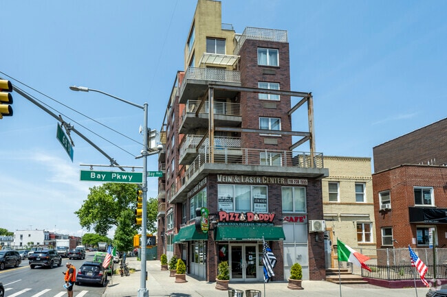
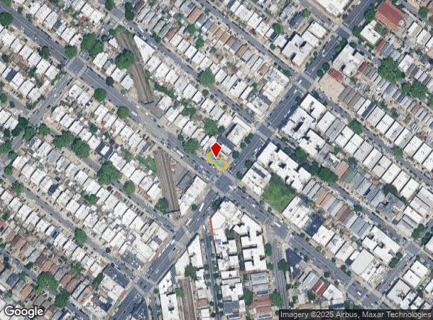
6422 Bay Pky, Brooklyn, NY 11204

This Property Is For Sale
NEARBY LISTINGS FOR SALE OR LEASE
Property Detail
6422 Bay Pky
05550-1001
ID2011101701200001
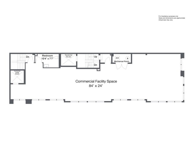
Condominium
Kings
X
New York
3604970351F
1001
2024
Bensonhurst
2025
Long Island (New York)
025400
New York-Jersey City-White Plains, NY-NJ
746 SF
DEMOGRAPHICS near 6422 Bay Pky
1 mile
3 mile
5 mile
2024 Total Population
138,302
1,052,772
1,692,823
2029 Population
127,581
978,933
1,578,842
Pop Growth 2024-2029
(7.75%)
(7.01%)
(6.73%)
Average Age
39
40
40
2024 Total Households
44,103
361,087
610,193
HH Growth 2024-2029
(8.28%)
(7.31%)
(7.01%)
Median Household Inc
$62,584
$63,185
$69,435
Avg Household Size
3.00
2.80
2.60
2024 Avg HH Vehicles
1.00
1.00
1.00
Median Home Value
$955,617
$806,639
$814,800
Median Year Built
1946
1948
1948
Nearby Places
Map Layers
Map Styles
 Street
 Aerial
Transit
 Traffic
 Biking
Places
Listings with unknown addresses are not visible on the map
- Restaurants
- Banks
- Shops
- Fitness
- Groceries
PUBLIC TRANSPORTATION
TRANSIT/SUBWAY
Bay Parkway (N Line) (N - New York MTA Subway (The Subway))
Drive
Walk
Distance
Bay Parkway (N Line) (N - New York MTA Subway (The Subway))
2 min
3 min
0.2 mi
20 Avenue (N Line) (N - New York MTA Subway (The Subway))
Drive
Walk
Distance
20 Avenue (N Line) (N - New York MTA Subway (The Subway))
1 min
7 min
0.4 mi
Bay Parkway (F Line) (F - New York MTA Subway (The Subway))
Drive
Walk
Distance
Bay Parkway (F Line) (F - New York MTA Subway (The Subway))
1 min
11 min
0.6 mi
Avenue P (F - New York MTA Subway (The Subway))
Drive
Walk
Distance
Avenue P (F - New York MTA Subway (The Subway))
2 min
12 min
0.6 mi
Avenue N (F - New York MTA Subway (The Subway))
Drive
Walk
Distance
Avenue N (F - New York MTA Subway (The Subway))
2 min
12 min
0.6 mi
COMMUTER RAIL
Drive
Walk
Distance
13 min
5.9 mi
Nostrand Avenue Station (Far Rockaway Branch - Long Island Rail Road, Hempstead Branch - Long Island Rail Road, Long Beach Branch - Long Island Rail Road, West Hempstead Branch - Long Island Rail Road)
Drive
Walk
Distance
Nostrand Avenue Station (Far Rockaway Branch - Long Island Rail Road, Hempstead Branch - Long Island Rail Road, Long Beach Branch - Long Island Rail Road, West Hempstead Branch - Long Island Rail Road)
14 min
5.9 mi
AIRPORT
John F Kennedy International
Drive
Walk
Distance
John F Kennedy International
27 min
14.2 mi
LaGuardia
Drive
Walk
Distance
LaGuardia
30 min
16.9 mi
Newark Liberty International
Drive
Walk
Distance
Newark Liberty International
35 min
20.4 mi
Freight Ports
NY - Red Hook Container Terminal
Drive
Walk
Distance
NY - Red Hook Container Terminal
11 min
5.8 mi
Nearby Properties
Address
Land Use
TOTAL SIZE
Lot Size
Zoning
Address
Land Use
TOTAL SIZE
Lot Size
Zoning
1,524,659 SF
170.96 AC
R4
Address
Land Use
TOTAL SIZE
Lot Size
Zoning
1,078,317 SF
10.45 AC
R4
Address
Land Use
TOTAL SIZE
Lot Size
Zoning
5,800 SF
20.10 AC
R6
Address
Land Use
TOTAL SIZE
Lot Size
Zoning
5,800 SF
20.10 AC
R6
Address
Land Use
TOTAL SIZE
Lot Size
Zoning
5,800 SF
20.10 AC
R6
Address
Land Use
TOTAL SIZE
Lot Size
Zoning
5,800 SF
20.10 AC
R6
Address
Land Use
TOTAL SIZE
Lot Size
Zoning
5,800 SF
20.10 AC
R6
Address
Land Use
TOTAL SIZE
Lot Size
Zoning
5,800 SF
20.10 AC
R6
Address
Land Use
TOTAL SIZE
Lot Size
Zoning
5,800 SF
20.10 AC
R6
Address
Land Use
TOTAL SIZE
Lot Size
Zoning
5,800 SF
20.10 AC
R6
Address
Land Use
TOTAL SIZE
Lot Size
Zoning
5,800 SF
20.10 AC
R6
Address
Land Use
TOTAL SIZE
Lot Size
Zoning
12.39 AC
R6
Address
Land Use
TOTAL SIZE
Lot Size
Zoning
965,600 SF
6.65 AC
R5
Address
Land Use
TOTAL SIZE
Lot Size
Zoning
1,073,920 SF
16.53 AC
R6
Address
Land Use
TOTAL SIZE
Lot Size
Zoning
305,093 SF
0.60 AC
C1-9
Address
Land Use
TOTAL SIZE
Lot Size
Zoning
335,800 SF
1.51 AC
R6
Address
Land Use
TOTAL SIZE
Lot Size
Zoning
54.78 AC
PARK
Address
Land Use
TOTAL SIZE
Lot Size
Zoning
340,837 SF
0.61 AC
C1-9
Address
Land Use
TOTAL SIZE
Lot Size
Zoning
785,450 SF
14.22 AC
R6
Address
Land Use
TOTAL SIZE
Lot Size
Zoning
340,068 SF
0.58 AC
C2-8
Address
Land Use
TOTAL SIZE
Lot Size
Zoning
340,068 SF
0.58 AC
C2-8
Address
Land Use
TOTAL SIZE
Lot Size
Zoning
1,800,000 SF
12.39 AC
R6
Address
Land Use
TOTAL SIZE
Lot Size
Zoning
1,736,700 SF
20.10 AC
R6
Address
Land Use
TOTAL SIZE
Lot Size
Zoning
753,367 SF
5.11 AC
R6
Address
Land Use
TOTAL SIZE
Lot Size
Zoning
623,806 SF
4.68 AC
R6
Address
Land Use
TOTAL SIZE
Lot Size
Zoning
623,806 SF
4.68 AC
R6
Address
Land Use
TOTAL SIZE
Lot Size
Zoning
623,806 SF
4.68 AC
R6
Address
Land Use
TOTAL SIZE
Lot Size
Zoning
623,806 SF
4.68 AC
R6
Address
Land Use
TOTAL SIZE
Lot Size
Zoning
623,806 SF
4.68 AC
R6
Address
Land Use
TOTAL SIZE
Lot Size
Zoning
623,806 SF
4.68 AC
R6
The World's #1 Commercial Real Estate Marketplace
Connect with us
© 2026 CoStar Group
The information above has been obtained from sources believed reliable. While we do not doubt its accuracy we have not verified it and make no guarantee, warranty or representation about it. It is your responsibility to independently confirm its accuracy and completeness. Any projections, opinions, assumptions, or estimates used are for example only and do not represent the current or future performance of the property. The value of this transaction to you depends on tax and other factors which should be evaluated by your tax, financial, and legal advisors. You and your advisors should conduct a careful, independent investigation of the property to determine to your satisfaction the suitability of the property for your needs.