Property Record
218 Merrick Rd, Oceanside, NY 11572
Save to a Folder
{{folder.Name}}
{{folder.ListingIds.length}} Properties
{{folder.ListingIds.length}} Property
Create a New Folder
Property Detail
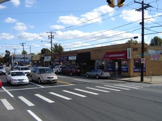
218 Merrick Rd
Nassau County-Suffolk County, NY
31-34
2089-54-125-00-0031-0
NASSAU
Commercialnec
New York
B and X Area of moderate flood hazard, usually the area between the limits of the 100-year and 500-year floods.
31-34
2025
0.18 AC
2026
Southern Nassau
413100
Long Island (New York)
8,000 SF
NEARBY LISTINGS FOR SALE OR LEASE
DEMOGRAPHICS near 218 Merrick Rd
1 mile
3 mile
5 mile
2025 Total Population
27,535
207,879
509,941
2030 Population
27,581
207,575
507,756
Pop Growth 2025-2030
+ 0.17%
(0.15%)
(0.43%)
Average Age
42
41
41
2025 Total Households
9,672
67,395
161,612
HH Growth 2025-2030
+ 0.19%
(0.19%)
(0.47%)
Median Household Inc
$142,439
$133,303
$130,382
Avg Household Size
2.80
3.00
3.00
2025 Avg HH Vehicles
2.00
2.00
2.00
Median Home Value
$722,958
$668,145
$690,344
Median Year Built
1948
1951
1953
Nearby Places
Map Layers
Map Styles
 Street
 Aerial
Layers
 Traffic
 Biking
Places
Listings with unknown addresses are not visible on the map
- Restaurants
- Banks
- Shops
- Fitness
- Groceries
PUBLIC TRANSPORTATION
COMMUTER RAIL
Rockville Centre Station (Babylon Branch - Long Island Rail Road)
Drive
Walk
Distance
Rockville Centre Station (Babylon Branch - Long Island Rail Road)
3 min
1.3 mi
Baldwin Station (Babylon Branch - Long Island Rail Road)
Drive
Walk
Distance
Baldwin Station (Babylon Branch - Long Island Rail Road)
3 min
1.4 mi
AIRPORT
John F Kennedy International
Drive
Walk
Distance
John F Kennedy International
19 min
11.1 mi
LaGuardia
Drive
Walk
Distance
LaGuardia
29 min
18.0 mi
Newark Liberty International
Drive
Walk
Distance
Newark Liberty International
56 min
37.8 mi
Freight Ports
NY - Red Hook Container Terminal
Drive
Walk
Distance
NY - Red Hook Container Terminal
39 min
22.5 mi
SALE & LEASE HISTORY
LISTING DATE
SALE/LEASE

Sep 25, 2016
For Lease
Jul 12, 2022
For Lease
Feb 03, 2025
For Lease
Dec 05, 2016
For Lease
Dec 05, 2016
For Sale
Aug 17, 2018
For Lease
Nearby Properties
Address
Land Use
TOTAL SIZE
Lot Size
Zoning
Address
Land Use
TOTAL SIZE
Lot Size
Zoning
202.54 AC
Address
Land Use
TOTAL SIZE
Lot Size
Zoning
Address
Land Use
TOTAL SIZE
Lot Size
Zoning
5,800 SF
10.48 AC
Address
Land Use
TOTAL SIZE
Lot Size
Zoning
88.30 AC
Address
Land Use
TOTAL SIZE
Lot Size
Zoning
30,700 SF
88.36 AC
Address
Land Use
TOTAL SIZE
Lot Size
Zoning
336,450 SF
139.91 AC
Address
Land Use
TOTAL SIZE
Lot Size
Zoning
133.85 AC
Address
Land Use
TOTAL SIZE
Lot Size
Zoning
11,594 SF
1.69 AC
Address
Land Use
TOTAL SIZE
Lot Size
Zoning
94,204 SF
35.42 AC
Address
Land Use
TOTAL SIZE
Lot Size
Zoning
46,404 SF
38.43 AC
Address
Land Use
TOTAL SIZE
Lot Size
Zoning
140,000 SF
50.78 AC
Address
Land Use
TOTAL SIZE
Lot Size
Zoning
115.42 AC
Address
Land Use
TOTAL SIZE
Lot Size
Zoning
315,667 SF
22.49 AC
Address
Land Use
TOTAL SIZE
Lot Size
Zoning
99,904 SF
20.17 AC
Address
Land Use
TOTAL SIZE
Lot Size
Zoning
293,443 SF
21.86 AC
Address
Land Use
TOTAL SIZE
Lot Size
Zoning
151,757 SF
34.38 AC
Address
Land Use
TOTAL SIZE
Lot Size
Zoning
357,868 SF
24.92 AC
Address
Land Use
TOTAL SIZE
Lot Size
Zoning
377,041 SF
14.43 AC
Address
Land Use
TOTAL SIZE
Lot Size
Zoning
20,670 SF
6.62 AC
Address
Land Use
TOTAL SIZE
Lot Size
Zoning
140,992 SF
12.07 AC
Address
Land Use
TOTAL SIZE
Lot Size
Zoning
74,813 SF
4.56 AC
Address
Land Use
TOTAL SIZE
Lot Size
Zoning
77,439 SF
4.69 AC
Address
Land Use
TOTAL SIZE
Lot Size
Zoning
88,706 SF
33.61 AC
Address
Land Use
TOTAL SIZE
Lot Size
Zoning
176,637 SF
12.30 AC
Address
Land Use
TOTAL SIZE
Lot Size
Zoning
59,715 SF
12.81 AC
Address
Land Use
TOTAL SIZE
Lot Size
Zoning
41,612 SF
3.89 AC
Address
Land Use
TOTAL SIZE
Lot Size
Zoning
82,698 SF
12.03 AC
Address
Land Use
TOTAL SIZE
Lot Size
Zoning
45,854 SF
2.31 AC
Address
Land Use
TOTAL SIZE
Lot Size
Zoning
70,104 SF
12.19 AC
Address
Land Use
TOTAL SIZE
Lot Size
Zoning
197,806 SF
13.36 AC
The World's #1 Commercial Real Estate Marketplace
Connect with us
© 2026 CoStar Group
The information above has been obtained from sources believed reliable. While we do not doubt its accuracy we have not verified it and make no guarantee, warranty or representation about it. It is your responsibility to independently confirm its accuracy and completeness. Any projections, opinions, assumptions, or estimates used are for example only and do not represent the current or future performance of the property. The value of this transaction to you depends on tax and other factors which should be evaluated by your tax, financial, and legal advisors. You and your advisors should conduct a careful, independent investigation of the property to determine to your satisfaction the suitability of the property for your needs.