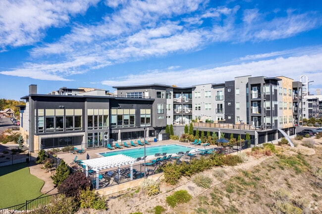
Property Record
2180 N Bryant St, Denver, CO 80211


Current Lease Availabilities
Property Detail
2180 N Bryant St
2321-26-129
RIVER FRONT IN THE TOWN OF HIGHLANDS PTS BLK 2 TO 4 & PTNE/4 S32 3S 68W & VAC ALYS ADJ & VAC FRONTVIEW CRESENT DRDIF REC# 2014114559 RCD 9/22/14 (PARCEL 1) COM NE/4 S32 TH
Commercialofficeresidentialmixeduse
DENVER
C-RX
Colorado
B and X Area of moderate flood hazard, usually the area between the limits of the 100-year and 500-year floods.
6.34 AC
2025
Jefferson Park
2025
Denver
000600
Denver-Aurora-Centennial, CO
411,402 SF
NEARBY LISTINGS FOR SALE OR LEASE
DEMOGRAPHICS near 2180 N Bryant St
1 mile
3 mile
5 mile
2025 Total Population
29,749
245,485
491,425
2030 Population
31,006
253,017
502,634
Pop Growth 2025-2030
+ 4.23%
+ 3.07%
+ 2.28%
Average Age
35
37
38
2025 Total Households
16,413
124,666
230,828
HH Growth 2025-2030
+ 4.18%
+ 3.26%
+ 2.49%
Median Household Inc
$120,751
$99,163
$95,771
Avg Household Size
1.80
1.90
2.00
2025 Avg HH Vehicles
1.00
1.00
2.00
Median Home Value
$816,831
$713,830
$700,058
Median Year Built
2007
1974
1968
Nearby Places
Map Layers
Map Styles
 Street
 Aerial
Layers
 Traffic
 Biking
Places
Listings with unknown addresses are not visible on the map
- Restaurants
- Banks
- Shops
- Fitness
- Groceries
PUBLIC TRANSPORTATION
TRANSIT/SUBWAY
Sports Authority Field At Mile High (C Line - Denver Regional Transportation District Light Rail (TheRide), E Line - Denver Regional Transportation District Light Rail (TheRide), W Line - Denver Regional Transportation District Light Rail (TheRide))
Drive
Walk
Distance
Sports Authority Field At Mile High (C Line - Denver Regional Transportation District Light Rail (TheRide), E Line - Denver Regional Transportation District Light Rail (TheRide), W Line - Denver Regional Transportation District Light Rail (TheRide))
5 min
16 min
0.9 mi
Auraria West Station (Union Station to Jefferson County Government Center-Golden Station - Regional Transportation District, Union Station to RidgeGate Parkway Station - Regional Transportation District)
Drive
Walk
Distance
Auraria West Station (Union Station to Jefferson County Government Center-Golden Station - Regional Transportation District, Union Station to RidgeGate Parkway Station - Regional Transportation District)
5 min
19 min
1.0 mi
Decatur/Federal (W Line - Denver Regional Transportation District Light Rail (TheRide))
Drive
Walk
Distance
Decatur/Federal (W Line - Denver Regional Transportation District Light Rail (TheRide))
4 min
20 min
1.1 mi
COMMUTER RAIL
Union Station: Lodo-Coors Field-16Th Street Mall (C Line - Denver Regional Transportation District Light Rail (TheRide), E Line - Denver Regional Transportation District Light Rail (TheRide), W Line - Denver Regional Transportation District Light Rail (TheRide))
Drive
Walk
Distance
Union Station: Lodo-Coors Field-16Th Street Mall (C Line - Denver Regional Transportation District Light Rail (TheRide), E Line - Denver Regional Transportation District Light Rail (TheRide), W Line - Denver Regional Transportation District Light Rail (TheRide))
4 min
1.4 mi
Denver (California Zephyr - Amtrak)
Drive
Walk
Distance
Denver (California Zephyr - Amtrak)
4 min
1.5 mi
AIRPORT
Denver International
Drive
Walk
Distance
Denver International
33 min
24.9 mi
Freight Ports
Tulsa Port Of Catoosa
Drive
Walk
Distance
Tulsa Port Of Catoosa
730 min
710.4 mi
Nearby Properties
Address
Land Use
TOTAL SIZE
Lot Size
Zoning
Address
Land Use
TOTAL SIZE
Lot Size
Zoning
921,863 SF
2.01 AC
C-MX
Address
Land Use
TOTAL SIZE
Lot Size
Zoning
1,882,179 SF
21.15 AC
D-TD
Address
Land Use
TOTAL SIZE
Lot Size
Zoning
552,279 SF
2.22 AC
C-RX
Address
Land Use
TOTAL SIZE
Lot Size
Zoning
1,721,086 SF
21.34 AC
C-MU-30
Address
Land Use
TOTAL SIZE
Lot Size
Zoning
798,837 SF
1.67 AC
C-MX
Address
Land Use
TOTAL SIZE
Lot Size
Zoning
598,652 SF
1.38 AC
G-TR
Address
Land Use
TOTAL SIZE
Lot Size
Zoning
565,418 SF
4.07 AC
C-RX
Address
Land Use
TOTAL SIZE
Lot Size
Zoning
657,947 SF
5.02 AC
C-RX
Address
Land Use
TOTAL SIZE
Lot Size
Zoning
729,679 SF
C-MX
Address
Land Use
TOTAL SIZE
Lot Size
Zoning
857,233 SF
10.26 AC
CMP-H
Address
Land Use
TOTAL SIZE
Lot Size
Zoning
6,252 SF
1.05 AC
C-MX
Address
Land Use
TOTAL SIZE
Lot Size
Zoning
1,096,923 SF
16.14 AC
CMP-H
Address
Land Use
TOTAL SIZE
Lot Size
Zoning
624,481 SF
1.87 AC
C-MX
Address
Land Use
TOTAL SIZE
Lot Size
Zoning
794,383 SF
0.90 AC
D-TD
Address
Land Use
TOTAL SIZE
Lot Size
Zoning
694,425 SF
1.92 AC
C-MX
Address
Land Use
TOTAL SIZE
Lot Size
Zoning
405,436 SF
2.45 AC
C-MX
Address
Land Use
TOTAL SIZE
Lot Size
Zoning
299,368 SF
0.71 AC
C-MX
Address
Land Use
TOTAL SIZE
Lot Size
Zoning
311,406 SF
1.74 AC
C-MX
Address
Land Use
TOTAL SIZE
Lot Size
Zoning
294,950 SF
6.91 AC
C-RX-12
Address
Land Use
TOTAL SIZE
Lot Size
Zoning
310,267 SF
1.69 AC
C-MX
Address
Land Use
TOTAL SIZE
Lot Size
Zoning
402,700 SF
1.15 AC
C-RX
Address
Land Use
TOTAL SIZE
Lot Size
Zoning
411,031 SF
1.66 AC
I-MX
Address
Land Use
TOTAL SIZE
Lot Size
Zoning
352,226 SF
1.01 AC
ASQ
Address
Land Use
TOTAL SIZE
Lot Size
Zoning
296,778 SF
2.28 AC
U-MS
Address
Land Use
TOTAL SIZE
Lot Size
Zoning
341,972 SF
1.21 AC
G-TR
Address
Land Use
TOTAL SIZE
Lot Size
Zoning
1,048,471 SF
2.44 AC
PUD
Address
Land Use
TOTAL SIZE
Lot Size
Zoning
412,345 SF
0.82 AC
C-MX
Address
Land Use
TOTAL SIZE
Lot Size
Zoning
365,674 SF
2.60 AC
G-MU
Address
Land Use
TOTAL SIZE
Lot Size
Zoning
417,566 SF
2.60 AC
G-MU
The World's #1 Commercial Real Estate Marketplace
Connect with us
© 2026 CoStar Group
The information above has been obtained from sources believed reliable. While we do not doubt its accuracy we have not verified it and make no guarantee, warranty or representation about it. It is your responsibility to independently confirm its accuracy and completeness. Any projections, opinions, assumptions, or estimates used are for example only and do not represent the current or future performance of the property. The value of this transaction to you depends on tax and other factors which should be evaluated by your tax, financial, and legal advisors. You and your advisors should conduct a careful, independent investigation of the property to determine to your satisfaction the suitability of the property for your needs.