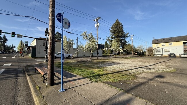
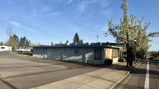
Property Record
220 Molalla Ave, Oregon City, OR 97045

Property Detail
220 Molalla Ave
00590060
45 DARLINGS ADD PT BLK 2
Commercialacreage
Clackamas
MUC1
Oregon
B and X Area of moderate flood hazard, usually the area between the limits of the 100-year and 500-year floods.
0.15 AC
2025
Oregon City
2025
Portland
022502
Portland-Vancouver-Hillsboro, OR-WA
NEARBY LISTINGS FOR SALE OR LEASE
DEMOGRAPHICS near 220 Molalla Ave
1 mile
3 mile
5 mile
2025 Total Population
12,021
70,034
125,017
2030 Population
12,108
70,121
124,810
Pop Growth 2025-2030
+ 0.72%
+ 0.12%
(0.17%)
Average Age
40
42
43
2025 Total Households
4,694
26,216
47,499
HH Growth 2025-2030
+ 0.66%
+ 0.08%
(0.24%)
Median Household Inc
$86,705
$102,732
$104,529
Avg Household Size
2.40
2.60
2.60
2025 Avg HH Vehicles
2.00
2.00
2.00
Median Home Value
$473,129
$628,771
$642,410
Median Year Built
1970
1985
1980
Nearby Places
Map Layers
Map Styles
 Street
 Aerial
Layers
 Traffic
 Biking
Places
Listings with unknown addresses are not visible on the map
- Restaurants
- Banks
- Shops
- Fitness
- Groceries
PUBLIC TRANSPORTATION
COMMUTER RAIL
Oregon City Amtrak (Amtrak Cascades - Amtrak)
Drive
Walk
Distance
Oregon City Amtrak (Amtrak Cascades - Amtrak)
4 min
1.6 mi
AIRPORT
Portland International
Drive
Walk
Distance
Portland International
31 min
19.4 mi
Freight Ports
Port of Portland
Drive
Walk
Distance
Port of Portland
32 min
17.0 mi
SALE & LEASE HISTORY
LISTING DATE
SALE/LEASE

Sep 24, 2025
For Sale
Nearby Properties
Address
Land Use
TOTAL SIZE
Lot Size
Zoning
Address
Land Use
TOTAL SIZE
Lot Size
Zoning
58 AC
MUE
Address
Land Use
TOTAL SIZE
Lot Size
Zoning
15.26 AC
GI
Address
Land Use
TOTAL SIZE
Lot Size
Zoning
9,233 SF
8.27 AC
MUE
Address
Land Use
TOTAL SIZE
Lot Size
Zoning
20.28 AC
R2
Address
Land Use
TOTAL SIZE
Lot Size
Zoning
1,408 SF
7.12 AC
MUC2
Address
Land Use
TOTAL SIZE
Lot Size
Zoning
3.11 AC
GC
Address
Land Use
TOTAL SIZE
Lot Size
Zoning
1,008 SF
10 AC
R3
Address
Land Use
TOTAL SIZE
Lot Size
Zoning
2,482 SF
5.14 AC
MR
Address
Land Use
TOTAL SIZE
Lot Size
Zoning
6 AC
OBC
Address
Land Use
TOTAL SIZE
Lot Size
Zoning
936 SF
10.25 AC
CI
Address
Land Use
TOTAL SIZE
Lot Size
Zoning
11 AC
MUD
Address
Land Use
TOTAL SIZE
Lot Size
Zoning
16.49 AC
MUD
Address
Land Use
TOTAL SIZE
Lot Size
Zoning
9.30 AC
C
Address
Land Use
TOTAL SIZE
Lot Size
Zoning
70.97 AC
OP
Address
Land Use
TOTAL SIZE
Lot Size
Zoning
15.29 AC
R2
Address
Land Use
TOTAL SIZE
Lot Size
Zoning
3.18 AC
C3
Address
Land Use
TOTAL SIZE
Lot Size
Zoning
8.27 AC
MR
Address
Land Use
TOTAL SIZE
Lot Size
Zoning
Address
Land Use
TOTAL SIZE
Lot Size
Zoning
Address
Land Use
TOTAL SIZE
Lot Size
Zoning
9.21 AC
R3
Address
Land Use
TOTAL SIZE
Lot Size
Zoning
6 AC
OP
Address
Land Use
TOTAL SIZE
Lot Size
Zoning
980 SF
6.19 AC
GC
Address
Land Use
TOTAL SIZE
Lot Size
Zoning
Address
Land Use
TOTAL SIZE
Lot Size
Zoning
4 AC
MUE
Address
Land Use
TOTAL SIZE
Lot Size
Zoning
1,202 SF
3 AC
OBC
Address
Land Use
TOTAL SIZE
Lot Size
Zoning
1.67 AC
MUE
Address
Land Use
TOTAL SIZE
Lot Size
Zoning
4.56 AC
MR
Address
Land Use
TOTAL SIZE
Lot Size
Zoning
9.07 AC
GI
Address
Land Use
TOTAL SIZE
Lot Size
Zoning
0.94 AC
MUD
Address
Land Use
TOTAL SIZE
Lot Size
Zoning
4.12 AC
MUC2
The World's #1 Commercial Real Estate Marketplace
Connect with us
© 2026 CoStar Group
The information above has been obtained from sources believed reliable. While we do not doubt its accuracy we have not verified it and make no guarantee, warranty or representation about it. It is your responsibility to independently confirm its accuracy and completeness. Any projections, opinions, assumptions, or estimates used are for example only and do not represent the current or future performance of the property. The value of this transaction to you depends on tax and other factors which should be evaluated by your tax, financial, and legal advisors. You and your advisors should conduct a careful, independent investigation of the property to determine to your satisfaction the suitability of the property for your needs.