Property Record
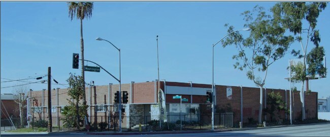
2201 Yates Ave, Commerce, CA 90040


Property Detail
2201 Yates Ave
6336-004-009
SAN ANTONIO RANCHO KNOWN AS WALTER L VAIL'S 2000 ACRE TRACT LOT COM S 26 22'24 W 162.21 FT AND S 63 37'36 E 285FT FROM INTERSECTION OF C/L OF SEE ASSESSOR MAPBOOK FOR MISSING PORTION02 W 40.2 FT TH N 26 22'24 E TO BEG
Warehouse
Los Angeles
CMM2*
California
B and X Area of moderate flood hazard, usually the area between the limits of the 100-year and 500-year floods.
0.72 AC
2024
Montebello
2025
Los Angeles
532303
Los Angeles-Long Beach-Glendale, CA
17,733 SF
NEARBY LISTINGS FOR SALE OR LEASE
DEMOGRAPHICS near 2201 Yates Ave
1 mile
3 mile
5 mile
2025 Total Population
13,627
210,612
629,243
2030 Population
13,348
206,511
617,247
Pop Growth 2025-2030
(2.05%)
(1.95%)
(1.91%)
Average Age
38
39
39
2025 Total Households
3,842
59,317
178,535
HH Growth 2025-2030
(2.32%)
(2.21%)
(2.12%)
Median Household Inc
$73,430
$73,276
$74,630
Avg Household Size
3.50
3.50
3.40
2025 Avg HH Vehicles
2.00
2.00
2.00
Median Home Value
$629,186
$708,239
$732,875
Median Year Built
1955
1955
1956
Nearby Places
Map Layers
Map Styles
 Street
 Aerial
Transit
 Traffic
 Biking
Places
Listings with unknown addresses are not visible on the map
- Restaurants
- Banks
- Shops
- Fitness
- Groceries
PUBLIC TRANSPORTATION
TRANSIT/SUBWAY
Montebello/Commerce (Riverside Line - Southern California Regional Rail Authority (Metrolink))
Drive
Walk
Distance
Montebello/Commerce (Riverside Line - Southern California Regional Rail Authority (Metrolink))
2 min
19 min
1.0 mi
COMMUTER RAIL
Montebello/Commerce (Riverside Line - Southern California Regional Rail Authority (Metrolink))
Drive
Walk
Distance
Montebello/Commerce (Riverside Line - Southern California Regional Rail Authority (Metrolink))
3 min
19 min
1.0 mi
Commerce (91 Line - Southern California Regional Rail Authority (Metrolink), Orange County Line - Southern California Regional Rail Authority (Metrolink))
Drive
Walk
Distance
Commerce (91 Line - Southern California Regional Rail Authority (Metrolink), Orange County Line - Southern California Regional Rail Authority (Metrolink))
5 min
1.6 mi
AIRPORT
Long Beach (Daugherty Field)
Drive
Walk
Distance
Long Beach (Daugherty Field)
27 min
18.6 mi
Los Angeles International
Drive
Walk
Distance
Los Angeles International
33 min
22.5 mi
Bob Hope
Drive
Walk
Distance
Bob Hope
32 min
23.9 mi
SALE & LEASE HISTORY
LISTING DATE
SALE/LEASE

Sep 25, 2016
For Lease
Sep 18, 2023
For Lease
Oct 12, 2016
For Lease
Mar 10, 2023
For Lease
Nearby Properties
Address
Land Use
TOTAL SIZE
Lot Size
Zoning
Address
Land Use
TOTAL SIZE
Lot Size
Zoning
271,020 SF
18.93 AC
CMM2*
Address
Land Use
TOTAL SIZE
Lot Size
Zoning
693,282 SF
30.34 AC
CMM2*
Address
Land Use
TOTAL SIZE
Lot Size
Zoning
397,549 SF
15.73 AC
CMM2*
Address
Land Use
TOTAL SIZE
Lot Size
Zoning
368,164 SF
7.82 AC
CMM2YY
Address
Land Use
TOTAL SIZE
Lot Size
Zoning
557,445 SF
14.08 AC
CMM2YY
Address
Land Use
TOTAL SIZE
Lot Size
Zoning
609,466 SF
19.83 AC
CMM2*
Address
Land Use
TOTAL SIZE
Lot Size
Zoning
621,121 SF
13.07 AC
CMM2*
Address
Land Use
TOTAL SIZE
Lot Size
Zoning
98,118 SF
14.95 AC
Address
Land Use
TOTAL SIZE
Lot Size
Zoning
244,768 SF
10.59 AC
PR1G
Address
Land Use
TOTAL SIZE
Lot Size
Zoning
875,558 SF
24.08 AC
CMM2*
Address
Land Use
TOTAL SIZE
Lot Size
Zoning
841,076 SF
23.77 AC
CMM2*
Address
Land Use
TOTAL SIZE
Lot Size
Zoning
170,222 SF
7.50 AC
PR1G
Address
Land Use
TOTAL SIZE
Lot Size
Zoning
260,714 SF
9.99 AC
VEM*
Address
Land Use
TOTAL SIZE
Lot Size
Zoning
117,004 SF
6.27 AC
CMM2*
Address
Land Use
TOTAL SIZE
Lot Size
Zoning
173,100 SF
7.83 AC
PRIG*
Address
Land Use
TOTAL SIZE
Lot Size
Zoning
168,548 SF
7.53 AC
CMM2*
Address
Land Use
TOTAL SIZE
Lot Size
Zoning
188,940 SF
9 AC
PR1G
Address
Land Use
TOTAL SIZE
Lot Size
Zoning
88,801 SF
10.59 AC
MNC2*
Address
Land Use
TOTAL SIZE
Lot Size
Zoning
513,222 SF
13.35 AC
PR1G
Address
Land Use
TOTAL SIZE
Lot Size
Zoning
500,495 SF
16.23 AC
CMM2*
Address
Land Use
TOTAL SIZE
Lot Size
Zoning
382,648 SF
14.73 AC
CMM2*
Address
Land Use
TOTAL SIZE
Lot Size
Zoning
175,443 SF
7.18 AC
BLCM*
Address
Land Use
TOTAL SIZE
Lot Size
Zoning
159,960 SF
6.22 AC
MNR3*
Address
Land Use
TOTAL SIZE
Lot Size
Zoning
1,094,138 SF
23.73 AC
CMM2YY
Address
Land Use
TOTAL SIZE
Lot Size
Zoning
118,026 SF
5.73 AC
CMM2*
Address
Land Use
TOTAL SIZE
Lot Size
Zoning
244,390 SF
12.99 AC
CMM2
Address
Land Use
TOTAL SIZE
Lot Size
Zoning
826,068 SF
21.11 AC
Address
Land Use
TOTAL SIZE
Lot Size
Zoning
289,422 SF
12.43 AC
CMM2*
Address
Land Use
TOTAL SIZE
Lot Size
Zoning
483,890 SF
12.45 AC
BLM*
Address
Land Use
TOTAL SIZE
Lot Size
Zoning
102,761 SF
4.47 AC
CMM2YY
The World's #1 Commercial Real Estate Marketplace
Connect with us
© 2026 CoStar Group
The information above has been obtained from sources believed reliable. While we do not doubt its accuracy we have not verified it and make no guarantee, warranty or representation about it. It is your responsibility to independently confirm its accuracy and completeness. Any projections, opinions, assumptions, or estimates used are for example only and do not represent the current or future performance of the property. The value of this transaction to you depends on tax and other factors which should be evaluated by your tax, financial, and legal advisors. You and your advisors should conduct a careful, independent investigation of the property to determine to your satisfaction the suitability of the property for your needs.