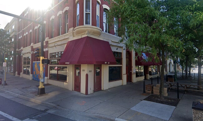
Property Record
221 Cedar Ave S, Minneapolis, MN 55454
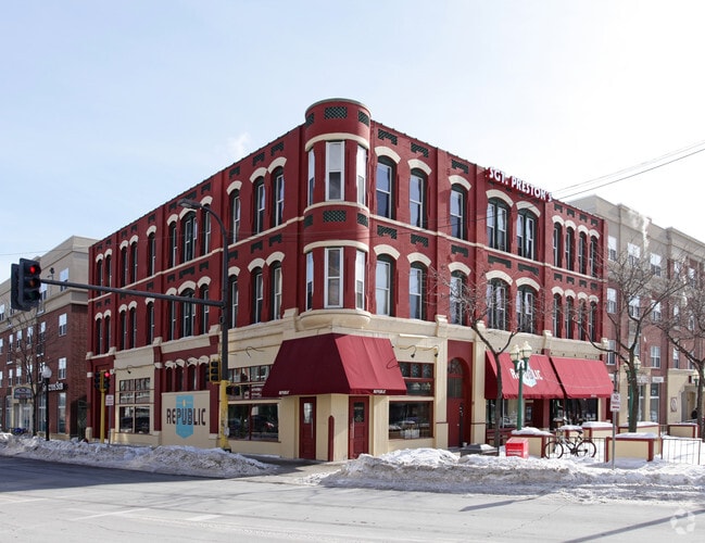
This Property Is For Sale
Current Lease Availabilities
NEARBY LISTINGS FOR SALE OR LEASE
Property Detail
221 Cedar Ave S
Minneapolis-St. Paul-Bloomington, MN-WI
Town Of Minneapolis
25-029-24-23-0075
LOT 005 BLOCK 168 A TOWN OF MINNEAPOLIS N 66.45 FT OF W 10 FT OF LOT 4 AND N 66.45 FT OF LOT 5 66.45 X 76
Apartment
Hennepin
X
Minnesota
27053C0376F
5
2024
0.12 AC
2024
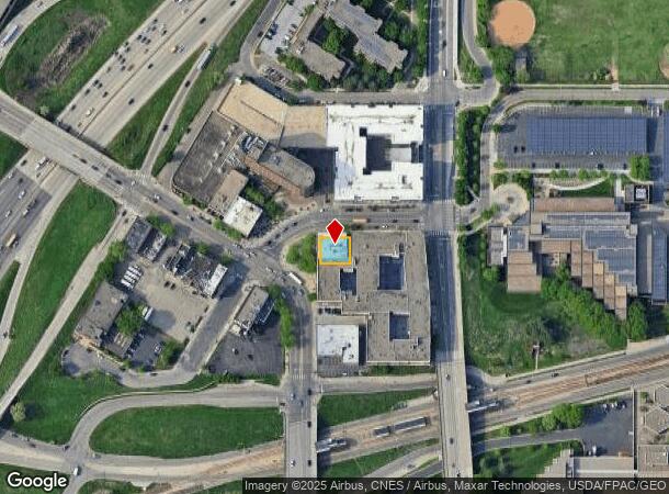
Cedar-Riverside
104802
Minneapolis/St Paul
15,048 SF
DEMOGRAPHICS near 221 Cedar Ave S
1 Mile
3 Mile
5 Mile
2024 Total Population
47,223
250,760
488,195
2029 Population
46,931
247,513
480,439
Pop Growth 2024-2029
(0.62%)
(1.29%)
(1.59%)
Average Age
33
35
37
2024 Total Households
19,601
115,779
215,918
HH Growth 2024-2029
(0.58%)
(1.20%)
(1.55%)
Median Household Inc
$40,749
$60,922
$69,823
Avg Household Size
1.90
2.00
2.10
2024 Avg HH Vehicles
1.00
1.00
1.00
Median Home Value
$456,983
$328,518
$332,453
Median Year Built
1986
1967
1955
Nearby Places
Map Layers
Map Styles
 Street
 Aerial
- Restaurants
- Banks
- Shops
- Fitness
- Groceries
PUBLIC TRANSPORTATION
TRANSIT/SUBWAY
Cedar/Riverside Station (Hiawatha Line - Minneapolis-Saint Paul Metro Transit Light Rail)
DRIVE
WALK
Distance
Cedar/Riverside Station (Hiawatha Line - Minneapolis-Saint Paul Metro Transit Light Rail)
2 min
10 min
0.5 mi
Franklin Avenue Station (Hiawatha Line - Minneapolis-Saint Paul Metro Transit Light Rail)
DRIVE
WALK
Distance
Franklin Avenue Station (Hiawatha Line - Minneapolis-Saint Paul Metro Transit Light Rail)
4 min
15 min
0.8 mi
Downtown East/Metrodome Station (Hiawatha Line - Minneapolis-Saint Paul Metro Transit Light Rail)
DRIVE
WALK
Distance
Downtown East/Metrodome Station (Hiawatha Line - Minneapolis-Saint Paul Metro Transit Light Rail)
2 min
15 min
0.8 mi
COMMUTER RAIL
Target Field Station (Northstar Corridor - Northstar Commuter Rail)
DRIVE
WALK
Distance
Target Field Station (Northstar Corridor - Northstar Commuter Rail)
6 min
1.9 mi
DRIVE
WALK
Distance
15 min
9.2 mi
AIRPORT
Minneapolis-St Paul International/Wold-Chamberlain
DRIVE
WALK
Distance
Minneapolis-St Paul International/Wold-Chamberlain
20 min
10.0 mi
Nearby Properties
Address
Land Use
TOTAL SIZE
Lot Size
Zoning
Address
Land Use
TOTAL SIZE
Lot Size
Zoning
1,462,182 SF
1 AC
B4-2
Address
Land Use
TOTAL SIZE
Lot Size
Zoning
2,094,377 SF
2.10 AC
B4-2
Address
Land Use
TOTAL SIZE
Lot Size
Zoning
1,821,999 SF
2.51 AC
B4-2
Address
Land Use
TOTAL SIZE
Lot Size
Zoning
Address
Land Use
TOTAL SIZE
Lot Size
Zoning
1,934,403 SF
1.67 AC
B4-2
Address
Land Use
TOTAL SIZE
Lot Size
Zoning
1,021,060 SF
1.71 AC
B4S-2
Address
Land Use
TOTAL SIZE
Lot Size
Zoning
2,282,334 SF
3.25 AC
B4-2
Address
Land Use
TOTAL SIZE
Lot Size
Zoning
1,054,492 SF
1.70 AC
B4-1
Address
Land Use
TOTAL SIZE
Lot Size
Zoning
495,632 SF
1.72 AC
C1
Address
Land Use
TOTAL SIZE
Lot Size
Zoning
1,208,190 SF
1.20 AC
B4-2
Address
Land Use
TOTAL SIZE
Lot Size
Zoning
621,608 SF
1.03 AC
B4-2
Address
Land Use
TOTAL SIZE
Lot Size
Zoning
458,470 SF
1.18 AC
OR3
Address
Land Use
TOTAL SIZE
Lot Size
Zoning
907,129 SF
1.65 AC
B4-1
Address
Land Use
TOTAL SIZE
Lot Size
Zoning
442,731 SF
0.97 AC
B4S-2
Address
Land Use
TOTAL SIZE
Lot Size
Zoning
1,044,454 SF
1.08 AC
B4-2
Address
Land Use
TOTAL SIZE
Lot Size
Zoning
1,261,574 SF
2.52 AC
B4-2
Address
Land Use
TOTAL SIZE
Lot Size
Zoning
695,624 SF
3.67 AC
C2
Address
Land Use
TOTAL SIZE
Lot Size
Zoning
2.67 AC
C3A
Address
Land Use
TOTAL SIZE
Lot Size
Zoning
615,172 SF
1.98 AC
I1
Address
Land Use
TOTAL SIZE
Lot Size
Zoning
722,423 SF
1.33 AC
B4-2
Address
Land Use
TOTAL SIZE
Lot Size
Zoning
1,424,796 SF
1.13 AC
B4-1
Address
Land Use
TOTAL SIZE
Lot Size
Zoning
577,656 SF
2.92 AC
C3A
Address
Land Use
TOTAL SIZE
Lot Size
Zoning
557,654 SF
3.15 AC
C2
Address
Land Use
TOTAL SIZE
Lot Size
Zoning
478,616 SF
2.28 AC
C2
Address
Land Use
TOTAL SIZE
Lot Size
Zoning
513,403 SF
0.73 AC
C2
Address
Land Use
TOTAL SIZE
Lot Size
Zoning
1,235,416 SF
1.12 AC
B4-2
Address
Land Use
TOTAL SIZE
Lot Size
Zoning
323,404 SF
2.54 AC
B4S-2
Address
Land Use
TOTAL SIZE
Lot Size
Zoning
561,603 SF
1 AC
B4N
Address
Land Use
TOTAL SIZE
Lot Size
Zoning
403,792 SF
2.51 AC
B4N
Address
Land Use
TOTAL SIZE
Lot Size
Zoning
618,841 SF
1.53 AC
B4N
The World's #1 Commercial Real Estate Marketplace
Connect with us
© 2026 CoStar Group
The information above has been obtained from sources believed reliable. While we do not doubt its accuracy we have not verified it and make no guarantee, warranty or representation about it. It is your responsibility to independently confirm its accuracy and completeness. Any projections, opinions, assumptions, or estimates used are for example only and do not represent the current or future performance of the property. The value of this transaction to you depends on tax and other factors which should be evaluated by your tax, financial, and legal advisors. You and your advisors should conduct a careful, independent investigation of the property to determine to your satisfaction the suitability of the property for your needs.