Property Record
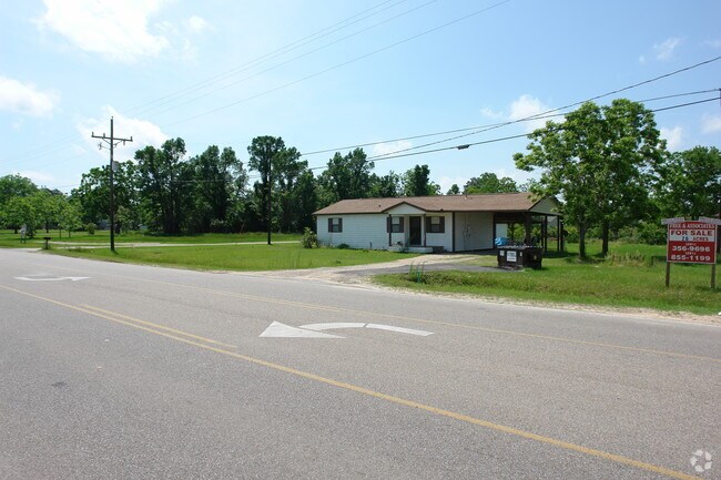
22240 Farris Green Rd, Porter, TX 77365


Property Detail
22240 Farris Green Rd
0104-00-05321
A0104 A0104 - BEARDSLEE WM, TRACT 53-C-1(AKA HOUSTON COMMUNITY BANK-PORTER P#2008094301), ACRES 1.357
Commercialnec
Montgomery
5
Texas
A Areas with a 1% annual chance of flooding and a 26% chance of flooding over the life of a 30-year mortgage.
1.36 AC
2024
Kingwood/Humble
2025
Houston
692502
Houston-Pasadena-The Woodlands, TX
3,150 SF
NEARBY LISTINGS FOR SALE OR LEASE
DEMOGRAPHICS near 22240 Farris Green Rd
1 mile
3 mile
5 mile
2025 Total Population
4,939
56,200
132,083
2030 Population
5,794
65,075
150,131
Pop Growth 2025-2030
+ 17.31%
+ 15.79%
+ 13.66%
Average Age
35
37
38
2025 Total Households
1,689
19,900
46,729
HH Growth 2025-2030
+ 18.06%
+ 16.39%
+ 14.14%
Median Household Inc
$42,619
$82,640
$93,021
Avg Household Size
2.90
2.80
2.80
2025 Avg HH Vehicles
2.00
2.00
2.00
Median Home Value
$284,313
$280,047
$299,947
Median Year Built
2002
2005
2001
Nearby Places
Map Layers
Map Styles
 Street
 Aerial
Layers
 Traffic
 Biking
Places
Listings with unknown addresses are not visible on the map
- Restaurants
- Banks
- Shops
- Fitness
- Groceries
PUBLIC TRANSPORTATION
AIRPORT
George Bush Intcntl/Houston
Drive
Walk
Distance
George Bush Intcntl/Houston
22 min
16.1 mi
William P Hobby
Drive
Walk
Distance
William P Hobby
55 min
37.7 mi
Nearby Properties
Address
Land Use
TOTAL SIZE
Lot Size
Zoning
Address
Land Use
TOTAL SIZE
Lot Size
Zoning
275,500 SF
13.58 AC
Address
Land Use
TOTAL SIZE
Lot Size
Zoning
288,199 SF
15.50 AC
Address
Land Use
TOTAL SIZE
Lot Size
Zoning
430,982 SF
21.50 AC
Address
Land Use
TOTAL SIZE
Lot Size
Zoning
298,715 SF
16.28 AC
Address
Land Use
TOTAL SIZE
Lot Size
Zoning
307,727 SF
14.93 AC
5
Address
Land Use
TOTAL SIZE
Lot Size
Zoning
343,814 SF
12.83 AC
Address
Land Use
TOTAL SIZE
Lot Size
Zoning
444,537 SF
55.21 AC
5
Address
Land Use
TOTAL SIZE
Lot Size
Zoning
274,809 SF
11.89 AC
Address
Land Use
TOTAL SIZE
Lot Size
Zoning
29,782 SF
28.69 AC
Address
Land Use
TOTAL SIZE
Lot Size
Zoning
282,880 SF
12.34 AC
Address
Land Use
TOTAL SIZE
Lot Size
Zoning
154,584 SF
46.76 AC
Address
Land Use
TOTAL SIZE
Lot Size
Zoning
356,000 SF
67.95 AC
Address
Land Use
TOTAL SIZE
Lot Size
Zoning
235,072 SF
26.44 AC
5
Address
Land Use
TOTAL SIZE
Lot Size
Zoning
161,302 SF
60.09 AC
5
Address
Land Use
TOTAL SIZE
Lot Size
Zoning
128,976 SF
16.99 AC
Address
Land Use
TOTAL SIZE
Lot Size
Zoning
215,554 SF
20.89 AC
5
Address
Land Use
TOTAL SIZE
Lot Size
Zoning
76,292 SF
32.01 AC
5
Address
Land Use
TOTAL SIZE
Lot Size
Zoning
165,381 SF
16.60 AC
Address
Land Use
TOTAL SIZE
Lot Size
Zoning
62,172 SF
6.02 AC
Address
Land Use
TOTAL SIZE
Lot Size
Zoning
190,424 SF
23 AC
Address
Land Use
TOTAL SIZE
Lot Size
Zoning
224,810 SF
21.64 AC
5
Address
Land Use
TOTAL SIZE
Lot Size
Zoning
38,994 SF
4.82 AC
5
Address
Land Use
TOTAL SIZE
Lot Size
Zoning
103,640 SF
13.92 AC
Address
Land Use
TOTAL SIZE
Lot Size
Zoning
121,871 SF
12.59 AC
Address
Land Use
TOTAL SIZE
Lot Size
Zoning
128,079 SF
5.30 AC
Address
Land Use
TOTAL SIZE
Lot Size
Zoning
13,238 SF
35 AC
Address
Land Use
TOTAL SIZE
Lot Size
Zoning
139,838 SF
38.71 AC
Address
Land Use
TOTAL SIZE
Lot Size
Zoning
154,800 SF
3.10 AC
Address
Land Use
TOTAL SIZE
Lot Size
Zoning
82,740 SF
5.25 AC
5
Address
Land Use
TOTAL SIZE
Lot Size
Zoning
131,028 SF
9.46 AC
The World's #1 Commercial Real Estate Marketplace
Connect with us
© 2026 CoStar Group
The information above has been obtained from sources believed reliable. While we do not doubt its accuracy we have not verified it and make no guarantee, warranty or representation about it. It is your responsibility to independently confirm its accuracy and completeness. Any projections, opinions, assumptions, or estimates used are for example only and do not represent the current or future performance of the property. The value of this transaction to you depends on tax and other factors which should be evaluated by your tax, financial, and legal advisors. You and your advisors should conduct a careful, independent investigation of the property to determine to your satisfaction the suitability of the property for your needs.