Property Record
2224A Polymer Dr, Chattanooga, TN 37421
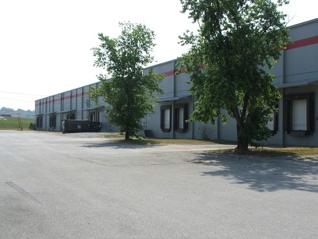

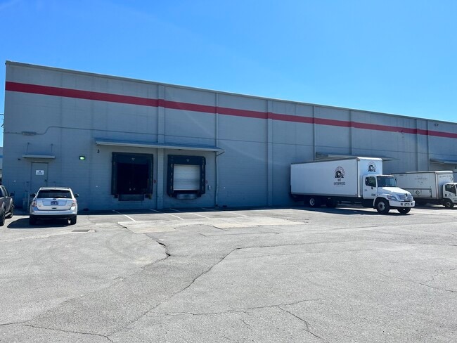
Property Detail
2224A Polymer Dr
138O-A-003
SE 1/4 SEC 5 NE 1/4 SEC 8 SW 1/4 SEC 4 TWP 2 R 3
Warehouse
Hamilton
M1
Tennessee
B and X Area of moderate flood hazard, usually the area between the limits of the 100-year and 500-year floods.
6.30 AC
2025
Outlying Chattanooga
2025
Chattanooga
011445
Chattanooga, TN-GA
122,275 SF
NEARBY LISTINGS FOR SALE OR LEASE
DEMOGRAPHICS near 2224A Polymer Dr
1 mile
3 mile
5 mile
2025 Total Population
2,367
42,465
118,018
2030 Population
2,478
44,572
124,323
Pop Growth 2025-2030
+ 4.69%
+ 4.96%
+ 5.34%
Average Age
40
42
41
2025 Total Households
1,075
18,694
49,927
HH Growth 2025-2030
+ 4.93%
+ 5.12%
+ 5.49%
Median Household Inc
$56,032
$62,486
$63,900
Avg Household Size
2.10
2.20
2.30
2025 Avg HH Vehicles
1.00
2.00
2.00
Median Home Value
$261,309
$255,488
$272,468
Median Year Built
1985
1975
1975
Nearby Places
Map Layers
Map Styles
 Street
 Aerial
Layers
 Traffic
 Biking
Places
Listings with unknown addresses are not visible on the map
- Restaurants
- Banks
- Shops
- Fitness
- Groceries
PUBLIC TRANSPORTATION
AIRPORT
Lovell Field
Drive
Walk
Distance
Lovell Field
10 min
4.5 mi
Freight Ports
Georgia Ports - Savannah
Drive
Walk
Distance
Georgia Ports - Savannah
405 min
362.5 mi
SALE & LEASE HISTORY
LISTING DATE
SALE/LEASE

Oct 28, 2020
For Lease
Mar 14, 2017
For Lease
Jul 20, 2022
For Lease
Apr 10, 2023
For Lease
Nearby Properties
Address
Land Use
TOTAL SIZE
Lot Size
Zoning
Address
Land Use
TOTAL SIZE
Lot Size
Zoning
831.19 AC
M1
Address
Land Use
TOTAL SIZE
Lot Size
Zoning
523,520 SF
12.03 AC
M1
Address
Land Use
TOTAL SIZE
Lot Size
Zoning
440,611 SF
27.46 AC
C2
Address
Land Use
TOTAL SIZE
Lot Size
Zoning
292,309 SF
45.28 AC
M1
Address
Land Use
TOTAL SIZE
Lot Size
Zoning
1,015,740 SF
83.82 AC
M1
Address
Land Use
TOTAL SIZE
Lot Size
Zoning
117,007 SF
23.87 AC
R4
Address
Land Use
TOTAL SIZE
Lot Size
Zoning
242,788 SF
27 AC
Address
Land Use
TOTAL SIZE
Lot Size
Zoning
402,862 SF
26.14 AC
R1
Address
Land Use
TOTAL SIZE
Lot Size
Zoning
43,488 SF
27.72 AC
R3
Address
Land Use
TOTAL SIZE
Lot Size
Zoning
23,078 SF
14.41 AC
R4
Address
Land Use
TOTAL SIZE
Lot Size
Zoning
333,768 SF
15.38 AC
C4
Address
Land Use
TOTAL SIZE
Lot Size
Zoning
43,576 SF
6.66 AC
C2
Address
Land Use
TOTAL SIZE
Lot Size
Zoning
25,462 SF
16.20 AC
R1
Address
Land Use
TOTAL SIZE
Lot Size
Zoning
3,472 SF
14.01 AC
Address
Land Use
TOTAL SIZE
Lot Size
Zoning
20,964 SF
17.72 AC
R1
Address
Land Use
TOTAL SIZE
Lot Size
Zoning
97,000 SF
18.78 AC
Address
Land Use
TOTAL SIZE
Lot Size
Zoning
25,165 SF
21.90 AC
Address
Land Use
TOTAL SIZE
Lot Size
Zoning
99,202 SF
17.32 AC
Address
Land Use
TOTAL SIZE
Lot Size
Zoning
129,710 SF
4.55 AC
R1
Address
Land Use
TOTAL SIZE
Lot Size
Zoning
291,314 SF
29.69 AC
M1
Address
Land Use
TOTAL SIZE
Lot Size
Zoning
82,000 SF
22.45 AC
M1
Address
Land Use
TOTAL SIZE
Lot Size
Zoning
201,276 SF
15.30 AC
R3
Address
Land Use
TOTAL SIZE
Lot Size
Zoning
50,506 SF
5.14 AC
MD
Address
Land Use
TOTAL SIZE
Lot Size
Zoning
236,880 SF
18.90 AC
R2
Address
Land Use
TOTAL SIZE
Lot Size
Zoning
6,912 SF
19.97 AC
Address
Land Use
TOTAL SIZE
Lot Size
Zoning
110,710 SF
6.69 AC
M1
Address
Land Use
TOTAL SIZE
Lot Size
Zoning
238,806 SF
24.84 AC
Address
Land Use
TOTAL SIZE
Lot Size
Zoning
73.82 AC
Address
Land Use
TOTAL SIZE
Lot Size
Zoning
8,032 SF
19.80 AC
Address
Land Use
TOTAL SIZE
Lot Size
Zoning
17,800 SF
14.30 AC
R2
The World's #1 Commercial Real Estate Marketplace
Connect with us
© 2026 CoStar Group
The information above has been obtained from sources believed reliable. While we do not doubt its accuracy we have not verified it and make no guarantee, warranty or representation about it. It is your responsibility to independently confirm its accuracy and completeness. Any projections, opinions, assumptions, or estimates used are for example only and do not represent the current or future performance of the property. The value of this transaction to you depends on tax and other factors which should be evaluated by your tax, financial, and legal advisors. You and your advisors should conduct a careful, independent investigation of the property to determine to your satisfaction the suitability of the property for your needs.