Property Record
224 W Main St, Sterling, CO 80751
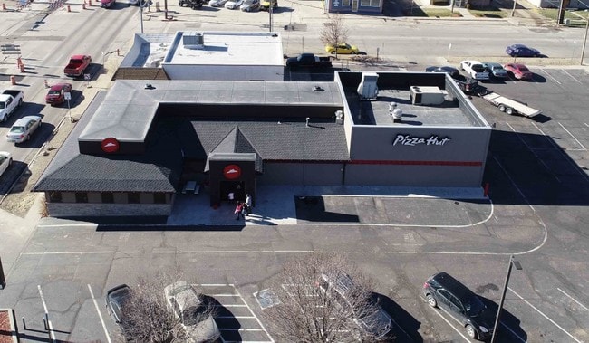

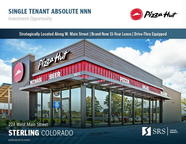

Property Detail
224 W Main St
Sterling, CO
2 PACKARDS ADDN STERLING STERLING; N 50' AND N 70' OF THE S 140' OF LOT 9 & LOTS 10-11 BLK
38052529336013
Logan
Restaurantdrivein
Colorado
AH Areas with a 1% annual chance of shallow flooding, usually in the form of a pond, withan average depth ranging from 1 to 3 feet. These areas have a 26% chance of flooding over the life of a 30-year mortgage.
9-11
2025
0.57 AC
2025
Colorado East Area
966102
Other Market Areas
3,384 SF
NEARBY LISTINGS FOR SALE OR LEASE
DEMOGRAPHICS near 224 W Main St
1 mile
3 mile
5 mile
2025 Total Population
7,526
13,753
14,654
2030 Population
7,458
13,618
14,507
Pop Growth 2025-2030
(0.90%)
(0.98%)
(1.00%)
Average Age
40
41
41
2025 Total Households
3,332
5,667
6,028
HH Growth 2025-2030
(1.44%)
(1.39%)
(1.41%)
Median Household Inc
$46,333
$53,279
$55,345
Avg Household Size
2.20
2.20
2.20
2025 Avg HH Vehicles
2.00
2.00
2.00
Median Home Value
$215,282
$238,503
$243,765
Median Year Built
1955
1962
1962
Nearby Places
Map Layers
Map Styles
 Street
 Aerial
Layers
 Traffic
 Biking
Places
Listings with unknown addresses are not visible on the map
- Restaurants
- Banks
- Shops
- Fitness
- Groceries
SALE & LEASE HISTORY
LISTING DATE
SALE/LEASE

Feb 21, 2025
For Sale
Dec 13, 2018
For Sale
Nearby Properties
Address
Land Use
TOTAL SIZE
Lot Size
Zoning
Address
Land Use
TOTAL SIZE
Lot Size
Zoning
262,955 SF
26 AC
Address
Land Use
TOTAL SIZE
Lot Size
Zoning
160,000 SF
84 AC
Address
Land Use
TOTAL SIZE
Lot Size
Zoning
36,812 SF
8.45 AC
Address
Land Use
TOTAL SIZE
Lot Size
Zoning
93,227 SF
29.25 AC
Address
Land Use
TOTAL SIZE
Lot Size
Zoning
22,554 SF
2.76 AC
Address
Land Use
TOTAL SIZE
Lot Size
Zoning
57,641 SF
11.40 AC
Address
Land Use
TOTAL SIZE
Lot Size
Zoning
942 SF
39 AC
Address
Land Use
TOTAL SIZE
Lot Size
Zoning
40,212 SF
1.19 AC
Address
Land Use
TOTAL SIZE
Lot Size
Zoning
135,095 SF
35.79 AC
Address
Land Use
TOTAL SIZE
Lot Size
Zoning
45,162 SF
8.62 AC
Address
Land Use
TOTAL SIZE
Lot Size
Zoning
18,379 SF
2.50 AC
Address
Land Use
TOTAL SIZE
Lot Size
Zoning
50,800 SF
92.78 AC
Address
Land Use
TOTAL SIZE
Lot Size
Zoning
55,203 SF
242 AC
Address
Land Use
TOTAL SIZE
Lot Size
Zoning
20,672 SF
4.17 AC
Address
Land Use
TOTAL SIZE
Lot Size
Zoning
36,586 SF
10 AC
Address
Land Use
TOTAL SIZE
Lot Size
Zoning
44,104 SF
53.03 AC
Address
Land Use
TOTAL SIZE
Lot Size
Zoning
26,424 SF
26.99 AC
Address
Land Use
TOTAL SIZE
Lot Size
Zoning
12,350 SF
0.96 AC
Address
Land Use
TOTAL SIZE
Lot Size
Zoning
18,110 SF
0.14 AC
Address
Land Use
TOTAL SIZE
Lot Size
Zoning
15,212 SF
5.56 AC
Address
Land Use
TOTAL SIZE
Lot Size
Zoning
19,880 SF
3 AC
Address
Land Use
TOTAL SIZE
Lot Size
Zoning
11,001 SF
3.67 AC
Address
Land Use
TOTAL SIZE
Lot Size
Zoning
34,634 SF
10 AC
Address
Land Use
TOTAL SIZE
Lot Size
Zoning
12,818 SF
4 AC
Address
Land Use
TOTAL SIZE
Lot Size
Zoning
179,474 SF
22.61 AC
Address
Land Use
TOTAL SIZE
Lot Size
Zoning
27,920 SF
14.63 AC
Address
Land Use
TOTAL SIZE
Lot Size
Zoning
19,124 SF
2.16 AC
Address
Land Use
TOTAL SIZE
Lot Size
Zoning
19,115 SF
1.65 AC
Address
Land Use
TOTAL SIZE
Lot Size
Zoning
14,324 SF
5 AC
Address
Land Use
TOTAL SIZE
Lot Size
Zoning
38,562 SF
2.03 AC
The World's #1 Commercial Real Estate Marketplace
Connect with us
© 2026 CoStar Group
The information above has been obtained from sources believed reliable. While we do not doubt its accuracy we have not verified it and make no guarantee, warranty or representation about it. It is your responsibility to independently confirm its accuracy and completeness. Any projections, opinions, assumptions, or estimates used are for example only and do not represent the current or future performance of the property. The value of this transaction to you depends on tax and other factors which should be evaluated by your tax, financial, and legal advisors. You and your advisors should conduct a careful, independent investigation of the property to determine to your satisfaction the suitability of the property for your needs.