Property Record
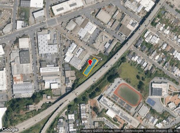
2245 Shafter Ave, San Francisco, CA 94124


This Property Is For Sale
NEARBY LISTINGS FOR SALE OR LEASE
Property Detail
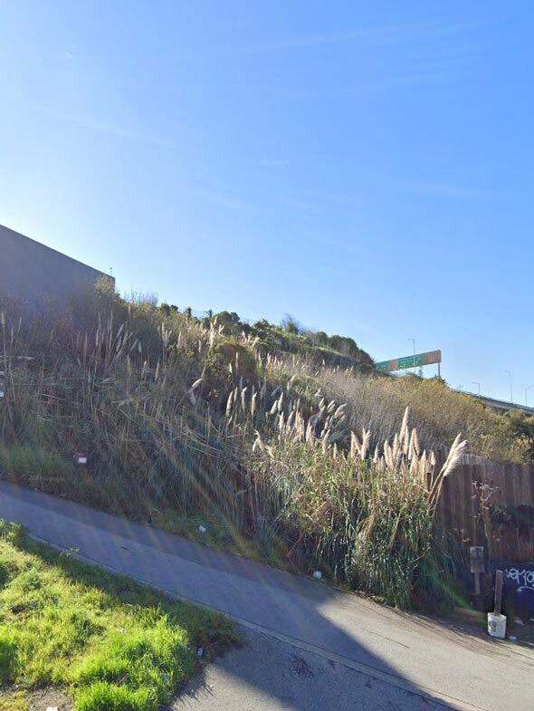
2245 Shafter Ave
San Francisco-Redwood City-South San Francisco, CA
San Francisco
5350-060
California
Vacantlandnec
60
2024
0.23 AC
2025
Mission/Potrero
023001
San Francisco
DEMOGRAPHICS near 2245 Shafter Ave
1 Mile
3 Mile
5 Mile
2024 Total Population
44,161
336,162
765,745
2029 Population
40,169
309,960
708,828
Pop Growth 2024-2029
(9.04%)
(7.79%)
(7.43%)
Average Age
43
42
42
2024 Total Households
13,983
130,586
321,495
HH Growth 2024-2029
(9.46%)
(8.05%)
(7.77%)
Median Household Inc
$114,865
$135,583
$124,988
Avg Household Size
2.90
2.40
2.20
2024 Avg HH Vehicles
2.00
1.00
1.00
Median Home Value
$1,070,696
$1,083,173
$1,090,040
Median Year Built
1948
1954
1949
Nearby Places
Map Layers
Map Styles
 Street
 Aerial
- Restaurants
- Banks
- Shops
- Fitness
- Groceries
PUBLIC TRANSPORTATION
TRANSIT/SUBWAY
Oakdale/Palou Station (T Third Street - San Francisco Municipal Railway (MUNI Metro), THIRD - San Francisco Municipal Railway (MUNI Metro))
DRIVE
WALK
Distance
Oakdale/Palou Station (T Third Street - San Francisco Municipal Railway (MUNI Metro), THIRD - San Francisco Municipal Railway (MUNI Metro))
2 min
18 min
1.0 mi
COMMUTER RAIL
22Nd Street Caltrain Station Southbound (Express - Caltrain (Caltrain), Limited - Caltrain (Caltrain), Local Weekday - Caltrain (Caltrain), Local Weekend - Caltrain (Caltrain))
DRIVE
WALK
Distance
22Nd Street Caltrain Station Southbound (Express - Caltrain (Caltrain), Limited - Caltrain (Caltrain), Local Weekday - Caltrain (Caltrain), Local Weekend - Caltrain (Caltrain))
7 min
3.1 mi
22Nd Street (Caltrain - Caltrain (Caltrain))
DRIVE
WALK
Distance
22Nd Street (Caltrain - Caltrain (Caltrain))
7 min
3.2 mi
AIRPORT
San Francisco International
DRIVE
WALK
Distance
San Francisco International
17 min
10.6 mi
Metro Oakland International
DRIVE
WALK
Distance
Metro Oakland International
34 min
22.2 mi
Freight Ports
Port of San Francisco
DRIVE
WALK
Distance
Port of San Francisco
11 min
5.1 mi
Nearby Properties
Address
Land Use
TOTAL SIZE
Lot Size
Zoning
Address
Land Use
TOTAL SIZE
Lot Size
Zoning
750,370 SF
3.25 AC
MBR3
Address
Land Use
TOTAL SIZE
Lot Size
Zoning
248,303 SF
4.35 AC
Address
Land Use
TOTAL SIZE
Lot Size
Zoning
717,234 SF
3.47 AC
UMU
Address
Land Use
TOTAL SIZE
Lot Size
Zoning
10.92 AC
Address
Land Use
TOTAL SIZE
Lot Size
Zoning
885,581 SF
5.20 AC
M2
Address
Land Use
TOTAL SIZE
Lot Size
Zoning
1.52 AC
C3G
Address
Land Use
TOTAL SIZE
Lot Size
Zoning
2.74 AC
Address
Land Use
TOTAL SIZE
Lot Size
Zoning
313,306 SF
1.23 AC
WMUG
Address
Land Use
TOTAL SIZE
Lot Size
Zoning
314,826 SF
1.85 AC
MB-RA
Address
Land Use
TOTAL SIZE
Lot Size
Zoning
10.92 AC
Address
Land Use
TOTAL SIZE
Lot Size
Zoning
393,918 SF
3.36 AC
WMUG
Address
Land Use
TOTAL SIZE
Lot Size
Zoning
24.37 AC
Address
Land Use
TOTAL SIZE
Lot Size
Zoning
241,659 SF
3.76 AC
Address
Land Use
TOTAL SIZE
Lot Size
Zoning
230,853 SF
3.76 AC
Address
Land Use
TOTAL SIZE
Lot Size
Zoning
302,084 SF
0.88 AC
MBO
Address
Land Use
TOTAL SIZE
Lot Size
Zoning
674,317 SF
3.36 AC
UMU
Address
Land Use
TOTAL SIZE
Lot Size
Zoning
319,119 SF
0.76 AC
Address
Land Use
TOTAL SIZE
Lot Size
Zoning
222,000 SF
1 AC
MB-RA
Address
Land Use
TOTAL SIZE
Lot Size
Zoning
10.92 AC
Address
Land Use
TOTAL SIZE
Lot Size
Zoning
2.93 AC
Address
Land Use
TOTAL SIZE
Lot Size
Zoning
342,727 SF
1.36 AC
C3G
Address
Land Use
TOTAL SIZE
Lot Size
Zoning
291,522 SF
6.66 AC
CM
Address
Land Use
TOTAL SIZE
Lot Size
Zoning
250,884 SF
1.66 AC
MB-RA
Address
Land Use
TOTAL SIZE
Lot Size
Zoning
375,030 SF
0.96 AC
Address
Land Use
TOTAL SIZE
Lot Size
Zoning
248,974 SF
0.88 AC
MBO
Address
Land Use
TOTAL SIZE
Lot Size
Zoning
345,000 SF
1.74 AC
WMUG
Address
Land Use
TOTAL SIZE
Lot Size
Zoning
0.75 AC
SLI
Address
Land Use
TOTAL SIZE
Lot Size
Zoning
2.22 AC
M1
Address
Land Use
TOTAL SIZE
Lot Size
Zoning
332,221 SF
1.17 AC
Address
Land Use
TOTAL SIZE
Lot Size
Zoning
2.06 AC
The World's #1 Commercial Real Estate Marketplace
Connect with us
© 2026 CoStar Group
The information above has been obtained from sources believed reliable. While we do not doubt its accuracy we have not verified it and make no guarantee, warranty or representation about it. It is your responsibility to independently confirm its accuracy and completeness. Any projections, opinions, assumptions, or estimates used are for example only and do not represent the current or future performance of the property. The value of this transaction to you depends on tax and other factors which should be evaluated by your tax, financial, and legal advisors. You and your advisors should conduct a careful, independent investigation of the property to determine to your satisfaction the suitability of the property for your needs.