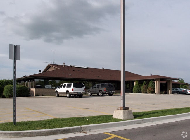
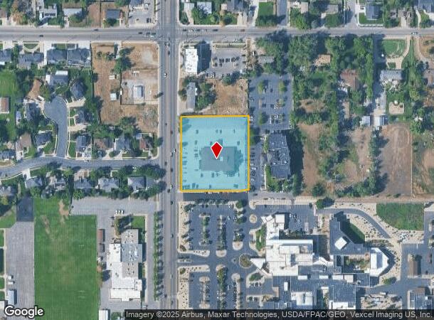
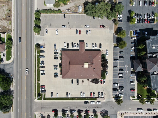
Property Record
226 N 1100 E, American Fork, UT 84003
NEARBY LISTINGS FOR SALE OR LEASE
Property Detail
226 N 1100 E
Provo-Orem-Lehi, UT
COM S 860.35 FT & E 1192.04 FT FR W 1/4 COR. SEC. 18, T5S, R2E, SLB&M.; S 89 DEG 55 43 E 284.37 FT; S 0 DEG 6 31 W 307.06 FT; ALONG A CURVE TO L (CHORD BEARS: S 81 DEG 43 36 W 17.13 FT, RADIUS = 180 FT) ARC LENGTH = 17.14 FEET; ALONG A CURVE TO R (CH
14-017-0202
Utah
Medicalbuilding
Utah
2024
2.04 AC
2025
Utah County
010225
Salt Lake City
23,823 SF
DEMOGRAPHICS near 226 N 1100 E
1 Mile
3 Mile
5 Mile
2024 Total Population
14,519
87,144
154,918
2029 Population
16,892
101,918
180,667
Pop Growth 2024-2029
+ 16.34%
+ 16.95%
+ 16.62%
Average Age
33
33
33
2024 Total Households
4,237
25,430
43,405
HH Growth 2024-2029
+ 16.78%
+ 17.37%
+ 17.05%
Median Household Inc
$86,219
$92,609
$100,405
Avg Household Size
3.40
3.40
3.50
2024 Avg HH Vehicles
2.00
2.00
3.00
Median Home Value
$471,968
$469,080
$499,979
Median Year Built
2000
2000
1999
Nearby Places
Map Layers
Map Styles
 Street
 Aerial
- Restaurants
- Banks
- Shops
- Fitness
- Groceries
PUBLIC TRANSPORTATION
COMMUTER RAIL
DRIVE
WALK
Distance
9 min
3.8 mi
DRIVE
WALK
Distance
12 min
7.3 mi
AIRPORT
Provo Municipal
DRIVE
WALK
Distance
Provo Municipal
23 min
15.2 mi
Salt Lake City International
DRIVE
WALK
Distance
Salt Lake City International
47 min
39.1 mi
SALE & LEASE HISTORY
LISTING DATE
SALE/LEASE

Jan 28, 2023
For Sale
Nearby Properties
Address
Land Use
TOTAL SIZE
Lot Size
Zoning
Address
Land Use
TOTAL SIZE
Lot Size
Zoning
587,192 SF
48.27 AC
Address
Land Use
TOTAL SIZE
Lot Size
Zoning
296,420 SF
19.66 AC
Address
Land Use
TOTAL SIZE
Lot Size
Zoning
287,823 SF
8.96 AC
Address
Land Use
TOTAL SIZE
Lot Size
Zoning
201,081 SF
17.96 AC
Address
Land Use
TOTAL SIZE
Lot Size
Zoning
400,684 SF
10.39 AC
Address
Land Use
TOTAL SIZE
Lot Size
Zoning
322,826 SF
9.53 AC
Address
Land Use
TOTAL SIZE
Lot Size
Zoning
21,510 SF
6.66 AC
Address
Land Use
TOTAL SIZE
Lot Size
Zoning
291,932 SF
8.10 AC
Address
Land Use
TOTAL SIZE
Lot Size
Zoning
194,977 SF
8.18 AC
Address
Land Use
TOTAL SIZE
Lot Size
Zoning
230,702 SF
11.85 AC
Address
Land Use
TOTAL SIZE
Lot Size
Zoning
305,553 SF
13.08 AC
Address
Land Use
TOTAL SIZE
Lot Size
Zoning
171,905 SF
6.62 AC
Address
Land Use
TOTAL SIZE
Lot Size
Zoning
327,092 SF
14.61 AC
Address
Land Use
TOTAL SIZE
Lot Size
Zoning
144,310 SF
6.85 AC
Address
Land Use
TOTAL SIZE
Lot Size
Zoning
146,939 SF
36.63 AC
Address
Land Use
TOTAL SIZE
Lot Size
Zoning
144,456 SF
5.55 AC
Address
Land Use
TOTAL SIZE
Lot Size
Zoning
333,724 SF
13.12 AC
Address
Land Use
TOTAL SIZE
Lot Size
Zoning
268,989 SF
12.78 AC
Address
Land Use
TOTAL SIZE
Lot Size
Zoning
8.99 AC
Address
Land Use
TOTAL SIZE
Lot Size
Zoning
Address
Land Use
TOTAL SIZE
Lot Size
Zoning
154,800 SF
9.14 AC
Address
Land Use
TOTAL SIZE
Lot Size
Zoning
227,030 SF
21.91 AC
Address
Land Use
TOTAL SIZE
Lot Size
Zoning
269,768 SF
14.94 AC
Address
Land Use
TOTAL SIZE
Lot Size
Zoning
194,852 SF
10.03 AC
Address
Land Use
TOTAL SIZE
Lot Size
Zoning
213,863 SF
11.71 AC
Address
Land Use
TOTAL SIZE
Lot Size
Zoning
141,635 SF
10.58 AC
Address
Land Use
TOTAL SIZE
Lot Size
Zoning
212,466 SF
25.89 AC
Address
Land Use
TOTAL SIZE
Lot Size
Zoning
182,338 SF
7.97 AC
Address
Land Use
TOTAL SIZE
Lot Size
Zoning
153,790 SF
12.07 AC
Address
Land Use
TOTAL SIZE
Lot Size
Zoning
200,016 SF
8.82 AC
The World's #1 Commercial Real Estate Marketplace
Connect with us
© 2026 CoStar Group
The information above has been obtained from sources believed reliable. While we do not doubt its accuracy we have not verified it and make no guarantee, warranty or representation about it. It is your responsibility to independently confirm its accuracy and completeness. Any projections, opinions, assumptions, or estimates used are for example only and do not represent the current or future performance of the property. The value of this transaction to you depends on tax and other factors which should be evaluated by your tax, financial, and legal advisors. You and your advisors should conduct a careful, independent investigation of the property to determine to your satisfaction the suitability of the property for your needs.