Property Record
230 North St, Danvers, MA 01923


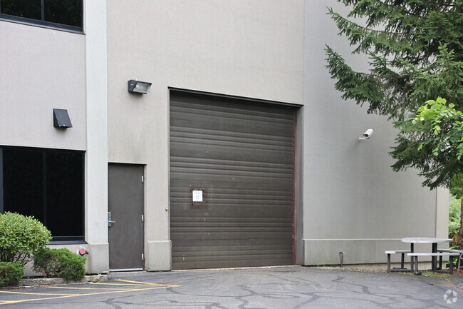
Property Detail
230 North St
008 003D
Essex
Officebuilding
Massachusetts
I1
3a
A Areas with a 1% annual chance of flooding and a 26% chance of flooding over the life of a 30-year mortgage.
2.44 AC
2025
Danvers/Beverly
2025
Boston
211402
Boston-Cambridge-Newton, MA-NH
23,300 SF
NEARBY LISTINGS FOR SALE OR LEASE
DEMOGRAPHICS near 230 North St
1 mile
3 mile
5 mile
2025 Total Population
4,640
33,531
107,387
2030 Population
4,824
34,513
110,419
Pop Growth 2025-2030
+ 3.97%
+ 2.93%
+ 2.82%
Average Age
45
43
44
2025 Total Households
1,576
12,480
41,571
HH Growth 2025-2030
+ 4.51%
+ 2.94%
+ 2.81%
Median Household Inc
$123,591
$126,490
$119,604
Avg Household Size
2.40
2.50
2.50
2025 Avg HH Vehicles
2.00
2.00
2.00
Median Home Value
$695,467
$727,244
$713,173
Median Year Built
1983
1969
1967
Nearby Places
Map Layers
Map Styles
 Street
 Aerial
Layers
 Traffic
 Biking
Places
Listings with unknown addresses are not visible on the map
- Restaurants
- Banks
- Shops
- Fitness
- Groceries
PUBLIC TRANSPORTATION
COMMUTER RAIL
Hamilton/Wenham (Newburyport/Rockport Line - Massachusetts Bay Transportation Authority Commuter Rail (Purple Line))
Drive
Walk
Distance
Hamilton/Wenham (Newburyport/Rockport Line - Massachusetts Bay Transportation Authority Commuter Rail (Purple Line))
14 min
6.0 mi
North Beverly (Newburyport/Rockport Line - Massachusetts Bay Transportation Authority Commuter Rail (Purple Line))
Drive
Walk
Distance
North Beverly (Newburyport/Rockport Line - Massachusetts Bay Transportation Authority Commuter Rail (Purple Line))
13 min
6.2 mi
AIRPORT
General Edward Lawrence Logan International
Drive
Walk
Distance
General Edward Lawrence Logan International
32 min
19.6 mi
Portsmouth International at Pease
Drive
Walk
Distance
Portsmouth International at Pease
50 min
38.2 mi
Manchester Boston Regional
Drive
Walk
Distance
Manchester Boston Regional
71 min
43.6 mi
Freight Ports
Port of Boston
Drive
Walk
Distance
Port of Boston
35 min
22.5 mi
SALE & LEASE HISTORY
LISTING DATE
SALE/LEASE

Mar 29, 2021
For Sale
Jun 25, 2025
For Lease
Feb 26, 2019
For Lease
Apr 13, 2022
For Lease
Nearby Properties
Address
Land Use
TOTAL SIZE
Lot Size
Zoning
Address
Land Use
TOTAL SIZE
Lot Size
Zoning
747,237 SF
36.70 AC
HW
Address
Land Use
TOTAL SIZE
Lot Size
Zoning
374,769 SF
71.70 AC
Address
Land Use
TOTAL SIZE
Lot Size
Zoning
252,965 SF
56.44 AC
R3
Address
Land Use
TOTAL SIZE
Lot Size
Zoning
198.74 AC
R3
Address
Land Use
TOTAL SIZE
Lot Size
Zoning
13.04 AC
HC
Address
Land Use
TOTAL SIZE
Lot Size
Zoning
172.50 AC
R3
Address
Land Use
TOTAL SIZE
Lot Size
Zoning
101,389 SF
20 AC
I
Address
Land Use
TOTAL SIZE
Lot Size
Zoning
65.79 AC
I1
Address
Land Use
TOTAL SIZE
Lot Size
Zoning
40.20 AC
R1B
Address
Land Use
TOTAL SIZE
Lot Size
Zoning
54,302 SF
83.70 AC
R3
Address
Land Use
TOTAL SIZE
Lot Size
Zoning
93,789 SF
8.22 AC
HW
Address
Land Use
TOTAL SIZE
Lot Size
Zoning
111.24 AC
R3
Address
Land Use
TOTAL SIZE
Lot Size
Zoning
37,553 SF
238.29 AC
IR
Address
Land Use
TOTAL SIZE
Lot Size
Zoning
177,782 SF
12.21 AC
I2
Address
Land Use
TOTAL SIZE
Lot Size
Zoning
15.32 AC
HC
Address
Land Use
TOTAL SIZE
Lot Size
Zoning
71.68 AC
R3
Address
Land Use
TOTAL SIZE
Lot Size
Zoning
12.57 AC
IH
Address
Land Use
TOTAL SIZE
Lot Size
Zoning
24.54 AC
M1
Address
Land Use
TOTAL SIZE
Lot Size
Zoning
139,582 SF
31.13 AC
R1
Address
Land Use
TOTAL SIZE
Lot Size
Zoning
36,156 SF
754.25 AC
R1A
Address
Land Use
TOTAL SIZE
Lot Size
Zoning
81,746 SF
10.50 AC
R1A
Address
Land Use
TOTAL SIZE
Lot Size
Zoning
24.87 AC
R3
Address
Land Use
TOTAL SIZE
Lot Size
Zoning
181,659 SF
11.57 AC
R114
Address
Land Use
TOTAL SIZE
Lot Size
Zoning
83,916 SF
15 AC
R3
Address
Land Use
TOTAL SIZE
Lot Size
Zoning
30.70 AC
R2
Address
Land Use
TOTAL SIZE
Lot Size
Zoning
175,699 SF
22.91 AC
R3
Address
Land Use
TOTAL SIZE
Lot Size
Zoning
115,348 SF
16.40 AC
HCD
Address
Land Use
TOTAL SIZE
Lot Size
Zoning
127,748 SF
13.64 AC
HC
Address
Land Use
TOTAL SIZE
Lot Size
Zoning
114,680 SF
13.73 AC
HC
Address
Land Use
TOTAL SIZE
Lot Size
Zoning
8.60 AC
I1
The World's #1 Commercial Real Estate Marketplace
Connect with us
© 2026 CoStar Group
The information above has been obtained from sources believed reliable. While we do not doubt its accuracy we have not verified it and make no guarantee, warranty or representation about it. It is your responsibility to independently confirm its accuracy and completeness. Any projections, opinions, assumptions, or estimates used are for example only and do not represent the current or future performance of the property. The value of this transaction to you depends on tax and other factors which should be evaluated by your tax, financial, and legal advisors. You and your advisors should conduct a careful, independent investigation of the property to determine to your satisfaction the suitability of the property for your needs.