Property Record
231 E Baltimore St, Baltimore, MD 21202


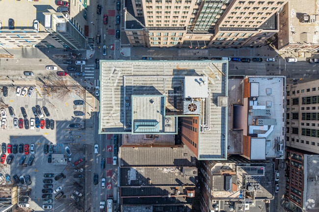

Property Detail
231 E Baltimore St
0650-013
0.179 ACRES
Officebuilding
Baltimore City
C-5TO
Maryland
B and X Area of moderate flood hazard, usually the area between the limits of the 100-year and 500-year floods.
13
2024
0.18 AC
2025
CBD Baltimore
040100
Baltimore
107,940 SF
Baltimore-Columbia-Towson, MD
NEARBY LISTINGS FOR SALE OR LEASE
DEMOGRAPHICS near 231 E Baltimore St
1 mile
3 mile
5 mile
2025 Total Population
40,195
259,652
507,221
2030 Population
39,990
261,186
503,784
Pop Growth 2025-2030
(0.51%)
+ 0.59%
(0.68%)
Average Age
37
38
38
2025 Total Households
23,542
118,419
215,299
HH Growth 2025-2030
(0.56%)
+ 0.26%
(0.84%)
Median Household Inc
$68,886
$59,010
$59,696
Avg Household Size
1.60
2.10
2.20
2025 Avg HH Vehicles
1.00
1.00
1.00
Median Home Value
$353,340
$264,751
$240,486
Median Year Built
1964
1948
1948
Nearby Places
Map Layers
Map Styles
 Street
 Aerial
Transit
 Traffic
 Biking
Places
Listings with unknown addresses are not visible on the map
- Restaurants
- Banks
- Shops
- Fitness
- Groceries
PUBLIC TRANSPORTATION
TRANSIT/SUBWAY
Charles Center (Metro Subway - Maryland Transit Administration Metro Subway (Baltimore Metro))
Drive
Walk
Distance
Charles Center (Metro Subway - Maryland Transit Administration Metro Subway (Baltimore Metro))
1 min
5 min
0.2 mi
Shot Tower/Market Place (Metro Subway - Maryland Transit Administration Metro Subway (Baltimore Metro))
Drive
Walk
Distance
Shot Tower/Market Place (Metro Subway - Maryland Transit Administration Metro Subway (Baltimore Metro))
1 min
6 min
0.3 mi
University Center/Baltimore Street (Hunt Valley & BWI Marshall - Maryland Transit Administration Light Rail (Baltimore Light Rail), Penn Station & Camden Yards - Maryland Transit Administration Light Rail (Baltimore Light Rail), Timonium & Cromwell - Maryland Transit Administration Light Rail (Baltimore Light Rail))
Drive
Walk
Distance
University Center/Baltimore Street (Hunt Valley & BWI Marshall - Maryland Transit Administration Light Rail (Baltimore Light Rail), Penn Station & Camden Yards - Maryland Transit Administration Light Rail (Baltimore Light Rail), Timonium & Cromwell - Maryland Transit Administration Light Rail (Baltimore Light Rail))
2 min
10 min
0.5 mi
Lexington Market (Hunt Valley & BWI Marshall - Maryland Transit Administration Light Rail (Baltimore Light Rail), Penn Station & Camden Yards - Maryland Transit Administration Light Rail (Baltimore Light Rail), Timonium & Cromwell - Maryland Transit Administration Light Rail (Baltimore Light Rail))
Drive
Walk
Distance
Lexington Market (Hunt Valley & BWI Marshall - Maryland Transit Administration Light Rail (Baltimore Light Rail), Penn Station & Camden Yards - Maryland Transit Administration Light Rail (Baltimore Light Rail), Timonium & Cromwell - Maryland Transit Administration Light Rail (Baltimore Light Rail))
2 min
12 min
0.6 mi
Convention Center (Hunt Valley & BWI Marshall - Maryland Transit Administration Light Rail (Baltimore Light Rail), Penn Station & Camden Yards - Maryland Transit Administration Light Rail (Baltimore Light Rail), Timonium & Cromwell - Maryland Transit Administration Light Rail (Baltimore Light Rail))
Drive
Walk
Distance
Convention Center (Hunt Valley & BWI Marshall - Maryland Transit Administration Light Rail (Baltimore Light Rail), Penn Station & Camden Yards - Maryland Transit Administration Light Rail (Baltimore Light Rail), Timonium & Cromwell - Maryland Transit Administration Light Rail (Baltimore Light Rail))
2 min
13 min
0.7 mi
COMMUTER RAIL
Drive
Walk
Distance
3 min
16 min
0.8 mi
Penn Station (Penn Line - Maryland Area Regional Commuter Trains (The MARC))
Drive
Walk
Distance
Penn Station (Penn Line - Maryland Area Regional Commuter Trains (The MARC))
5 min
1.5 mi
AIRPORT
Baltimore/Washington International Thurgood Marshall
Drive
Walk
Distance
Baltimore/Washington International Thurgood Marshall
19 min
10.5 mi
Ronald Reagan Washington Ntl
Drive
Walk
Distance
Ronald Reagan Washington Ntl
65 min
42.8 mi
Freight Ports
Port of Baltimore
Drive
Walk
Distance
Port of Baltimore
2 min
0.5 mi
SALE & LEASE HISTORY
LISTING DATE
SALE/LEASE

Sep 26, 2016
For Lease
Sep 24, 2016
For Lease
Oct 07, 2016
For Sale
Nov 14, 2024
For Sale
May 15, 2019
For Lease
Jun 27, 2017
For Lease
Jul 21, 2023
For Sale
Feb 28, 2025
For Sale
Apr 17, 2024
For Sale
Nearby Properties
Address
Land Use
TOTAL SIZE
Lot Size
Zoning
Address
Land Use
TOTAL SIZE
Lot Size
Zoning
1,595,200 SF
20.36 AC
H
Address
Land Use
TOTAL SIZE
Lot Size
Zoning
1,871,691 SF
6.77 AC
C-5DC
Address
Land Use
TOTAL SIZE
Lot Size
Zoning
1,632,000 SF
106.32 AC
EC-2
Address
Land Use
TOTAL SIZE
Lot Size
Zoning
712,573 SF
1.32 AC
C-5DC
Address
Land Use
TOTAL SIZE
Lot Size
Zoning
20.26 AC
C-5DC
Address
Land Use
TOTAL SIZE
Lot Size
Zoning
308,887 SF
3.98 AC
C-5DC
Address
Land Use
TOTAL SIZE
Lot Size
Zoning
21.27 AC
C-5DC
Address
Land Use
TOTAL SIZE
Lot Size
Zoning
739,000 SF
2.79 AC
C-5DC
Address
Land Use
TOTAL SIZE
Lot Size
Zoning
3.89 AC
C-5DC
Address
Land Use
TOTAL SIZE
Lot Size
Zoning
830,720 SF
1.90 AC
I-MU
Address
Land Use
TOTAL SIZE
Lot Size
Zoning
400,000 SF
13.98 AC
0B051
Address
Land Use
TOTAL SIZE
Lot Size
Zoning
256,816 SF
1.27 AC
EC-2
Address
Land Use
TOTAL SIZE
Lot Size
Zoning
654,224 SF
14.98 AC
C-5DC
Address
Land Use
TOTAL SIZE
Lot Size
Zoning
833,702 SF
1.74 AC
C-5DC
Address
Land Use
TOTAL SIZE
Lot Size
Zoning
911,487 SF
5.27 AC
C-5DC
Address
Land Use
TOTAL SIZE
Lot Size
Zoning
381,152 SF
3.46 AC
C-5DC
Address
Land Use
TOTAL SIZE
Lot Size
Zoning
2.61 AC
C-5DE
Address
Land Use
TOTAL SIZE
Lot Size
Zoning
236,614 SF
1.20 AC
BSC
Address
Land Use
TOTAL SIZE
Lot Size
Zoning
241,576 SF
6.13 AC
H
Address
Land Use
TOTAL SIZE
Lot Size
Zoning
199,435 SF
1.19 AC
BSC
Address
Land Use
TOTAL SIZE
Lot Size
Zoning
289,515 SF
1.10 AC
BSC
Address
Land Use
TOTAL SIZE
Lot Size
Zoning
10,386 SF
15.01 AC
C-5IH
Address
Land Use
TOTAL SIZE
Lot Size
Zoning
334,715 SF
1.77 AC
H
Address
Land Use
TOTAL SIZE
Lot Size
Zoning
656,306 SF
1.10 AC
C-5DC
Address
Land Use
TOTAL SIZE
Lot Size
Zoning
579,351 SF
0.96 AC
C-5DC
Address
Land Use
TOTAL SIZE
Lot Size
Zoning
189,700 SF
0.71 AC
TOD-4
Address
Land Use
TOTAL SIZE
Lot Size
Zoning
538,988 SF
8.40 AC
I-MU
Address
Land Use
TOTAL SIZE
Lot Size
Zoning
642,817 SF
1.91 AC
PC-2
Address
Land Use
TOTAL SIZE
Lot Size
Zoning
831,350 SF
5.56 AC
C-2
Address
Land Use
TOTAL SIZE
Lot Size
Zoning
625,217 SF
2.12 AC
C-5DC
The World's #1 Commercial Real Estate Marketplace
Connect with us
© 2026 CoStar Group
The information above has been obtained from sources believed reliable. While we do not doubt its accuracy we have not verified it and make no guarantee, warranty or representation about it. It is your responsibility to independently confirm its accuracy and completeness. Any projections, opinions, assumptions, or estimates used are for example only and do not represent the current or future performance of the property. The value of this transaction to you depends on tax and other factors which should be evaluated by your tax, financial, and legal advisors. You and your advisors should conduct a careful, independent investigation of the property to determine to your satisfaction the suitability of the property for your needs.